From Allos to Colmars via the Autapie ridge

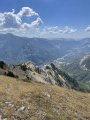
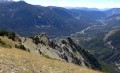
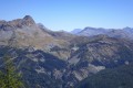
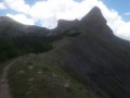
An easy hike starting from the Gros Tapi chairlift terminus. A ridge walk offering constantly stunning and unforgettable panoramic views of the Haut Verdon mountain ranges. An easy route with a final descent to Colmars through the forest on signposted paths. Best undertaken in summer whilst the chairlifts are operating.

Details

334896
Creation:
Last update:
Last review:
  • Walking
    Activity: Walking
  • ↔
    Distance: 7.35 mi
  • ◔
    Average duration: 3h 55 
  • ▲
    Difficulty: Moderate

  • ⚐
    Back to start: No
  • ↗
    Ascent: + 659 ft
  • ↘
    Descent: - 4,324 ft

  • ▲
    Highest point: 7,959 ft
  • ▼
    Lowest point: 4,055 ft

Photos

Description of the walk

Moderator’s update as at 21/07/2020: Please note! A review of this hike indicates that the Gros Tapi chairlift is undergoing maintenance during the 2020 summer season.

The walk starts at the top station of the Gros Tapi chairlift.

(S) Follow the track southwards.

(1) At the summit of the Autapie, the highest point of the walk, continue along the ridge towards the south (yellowPR® markings).

(2) Ignore thePR®-marked path on the left (Autapie forest hut). Carry on straight south towards La Gardette. The yellow markings are rather sparse, but the route is straightforward, staying on the ridge all the way to the La Gardette viewpoint overlooking the southern Verdon, Villars-Colmars, Beauvezer, etc.

(3) Head north again and discover (if you wish) some superb picnic spots with views. Then head north-east towards a clearly defined ridge where you’ll find a path. You’ll now be off the marked trail.

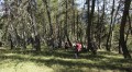
(4) In a lovely forest of tall larch trees, head downwards by sight, keeping fairly close to the ridge line, until you find the yellowPR® marked trail coming from the Autapie hut.

(5) Turn right and follow the path, which soon leads out onto the south-east face (viewpoint).

(6) You’ll reach a signposted junction. Take the path on the right, markedGRP® Yellow and Red (Tour du Haut Verdon Nord). Follow it to the next junction.

(7) Signposted junction. Leave theGRP® and take the yellowPR® path immediately to the left (towards La Chapelle). The path, which is very steep towards the end, leads onto a tarmac road.

(8) Take the road leading downhill and follow it until you reach Colmars (E).

Waypoints

  1. S : mi 0 - alt. 7,749 ft - Top station of the Gros Tapi chairlift
  2. 1 : mi 1.06 - alt. 7,943 ft - Summit of the Autapie.
  3. 2 : mi 2.18 - alt. 7,313 ft - Crossroads: path to the Autapie Forest Hut
  4. 3 : mi 2.83 - alt. 7,287 ft - La Gardette viewpoint
  5. 4 : mi 3.04 - alt. 7,247 ft - Off-trail route through the forest
  6. 5 : mi 3.56 - alt. 6,476 ft - From the Autapie Forest Hut
  7. 6 : mi 5.11 - alt. 5,262 ft - Junction with the GRP Tour du Haut Verdon
  8. 7 : mi 5.81 - alt. 5,167 ft - Junction with the PR La Chapelle Les Espiniers trail
  9. 8 : mi 6.86 - alt. 4,140 ft - Follow the road to Colmars
  10. E : mi 7.35 - alt. 4,078 ft - Colmars. Southern ramparts after the - Verdon (rivière)

Notes

Please note: The labels on IGN maps are not up to date with regard to the marked trails. Please refer to the description above for the colours of the trail markings.

For further information: Allos Tourist Office Tel. 04 92 83 02 81. Enquiries regarding the operating periods and days of the chairlifts.

The first chairlift departure (Clot Bertrand) is at 9.30 am (€6), as is the Allos cable car to Le Seignus d’Allos (€2). If you have two vehicles (one in Colmars for the return journey to Allos), it is best to park at Le Seignus. If you only have one car, you should park at the Allos car park and take the cable car up to Le Seignus. The return journey from Colmars to Allos is provided by a free shuttle bus (Tel. 04 92 83 95 81, last departure around 5.00 pm).

There are no water sources along the ridge route.

Only set out on this route in good weather and never if a thunderstorm is forecast.

(2) Take the path leading to the Autapie forest hut to leave the ridge if necessary (e.g. due to changing weather conditions).

(6) In the event of an emergency or delay, it is possible to return to Colmars by taking the slightly shorter path on the left.

Worth a visit

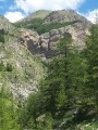
The mountain scenery and the larch and pine forests are the main attractions of this hike.

Always be cautious and plan ahead when you're outdoors. Visorando and the author of this route cannot be held responsible for any accidents occurring on this route.

The GR® and PR® markings are the intellectual property of the Fédération Française de Randonnée Pédestre.

Reviews and comments

4.3 / 5
Based on 3 reviews

Reliability of the description
4.3 / 5
Ease of following the route
4.3 / 5
Route interest
4.3 / 5
marysepiou
marysepiou
• Edited:

Overall rating : 4 / 5

Date of your route : Aug 13, 2023
Reliability of the description : ★★★★☆ Good
Ease of following the route : ★★★★☆ Good
Route interest : ★★★★☆ Good
Very busy route : No

It’s a lovely walk, provided the Gros Tapy lift is running. This year it was running every weekend in July and August… Hallelujah!!! So we made the most of it…
The path is very well signposted; however, once we reached the Gardette viewpoint, we retraced our steps as far as the ‘Colmars 9km’ sign. In fact, the turn-off that takes you on a shortcut, as indicated in the route description, was nowhere to be found.
But there’s also a major downside regarding the estimated time, which is far too short. We set off from Gros Tapy at around 10.40 am and had to catch the 4.15 pm bus from Colmars for our return journey. A 45-minute picnic, a few photos… And just like that, our hike turned into a ‘Nordic walk’ for the entire descent through the woods!!! That wasn’t the plan, but it was the only way to make sure we didn’t miss our connection… Anyway, by 4.10 pm we were at the bus stop… completely exhausted… Total distance recorded by our GPS = 16.5 km.

Machine-translated

GeorgesA
GeorgesA

Overall rating : 4 / 5

Date of your route : Jul 31, 2022
Reliability of the description : ★★★★☆ Good
Ease of following the route : ★★★★☆ Good
Route interest : ★★★★☆ Good
Very busy route : No

The final stretch through the forest seems to go on forever; at the Gardette viewpoint, it’s better to retrace your steps back to the junction signposted ‘Direction Colmars’ than to try to cut across to rejoin the path coming from the Cabane de l’Autapie.

Machine-translated

grandin
grandin ★

Thanks for the info; I’ve added it to the walk description

Machine-translated

mifmoufia
mifmoufia

Hiking isn’t possible this summer: the Gros Tapi chairlift is undergoing maintenance during the summer months.

Machine-translated

Redlinda
Redlinda

Overall rating : 5 / 5

Date of your route : Aug 26, 2016
Reliability of the description : ★★★★★ Very good
Ease of following the route : ★★★★★ Very good
Route interest : ★★★★★ Very good

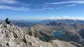
A superb ridge walk with stunning, endless views. The peaceful chairlift ride sets the scene for the walk that follows. (A quick note on getting off at Gros Tapi – the platform isn’t very big, so make sure you get off quickly!) To make the most of it, bring a good map of the area (or a good guidebook) to help you identify all the peaks, mountain ranges and ridges around you. The descent through a beautiful forest isn’t difficult, but it is long. In theory, you can complete this walk within the time given in the description, but as we were taking photos, chatting amongst ourselves and stopping frequently to admire the views, our small group needed a bit longer. Apart from that, the description is spot on.

Machine-translated

Other walks in the area

For more walks, use our search engine .

The GPS track and description are the property of this route's author. Please do not copy them without permission.