


Les refuges de la Cayolle et de la Cantonnière sont accessibles par voie routière, et celui du Lac d'Allos est à une demi-heure du parking payant de la Laus , cela vous permet de de commencer par n'importe laquelle des trois étapes.
Pour les réservations, voici les sites des trois refuges :
Refuge de la Cantonnière
Refuge de la Cayolle
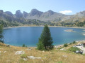
Refuge du lac d'Allos
Autour des Garrets

Randonnée de 3 jours en montagne allant de refuge en refuge.
Les étapes sont relativement courtes (3 à 5 heures) ce qui la rend accessible à des personnes moyennement entrainées.
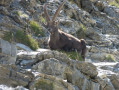
La faune (marmottes, chamois, bouquetins et rapaces) est assez facilement observable sur les hauteurs.
Details
Creation:
Last update:
Last review:
–
–
-
 Activity: Walking
 -
 Distance: 14.67 mi
 -
 Average duration: 3 days
 -
 Difficulty: Moderate
 -
-
 Back to start: No
 -
 Ascent: + 4,055 ft
 -
 Descent: - 4,108 ft
 -
-
 Highest point: 8,642 ft
 -
 Lowest point: 6,063 ft
-
 Country:
France
Country:
France
-
 Areas: Alps, Mercantour
 -
 City:
Entraunes (06470)
City:
Entraunes (06470) -
 Start: N 44.244852° / E 6.757066°
 -
 End: N 44.243016° / E 6.755112°
 -


 Hour-by-hour weather
Photos
Stages of the route
This route needs several days, find the details below:
Notes
This route passes through multiple protected areas, which may be subject to special regulations:
Other walks in the area
Pointe Côte de l'Âne
 Visorando Member
 9.93 mi
+3,340 ft
-3,337 ft
7h 30
9.93 mi
+3,340 ft
-3,337 ft
7h 30
 Difficult
Departure from Entraunes (Alpes-Maritimes)
Difficult
Departure from Entraunes (Alpes-Maritimes)
Enjoy the Roche Trouée tour with its mineral universe where erosion has left a unique landscape, then climb to reach Pointe Côte de l'Âne, where you will be rewarded with a beautiful panorama.
Tour de la Roche Trouée
 5.94 mi
+1,637 ft
-1,637 ft
4h 10
Moderate
Departure from Entraunes (Alpes-Maritimes)
5.94 mi
+1,637 ft
-1,637 ft
4h 10
Moderate
Departure from Entraunes (Alpes-Maritimes)
A tour that plunges you into a mineral desert with peaks that are strange to say the least.
The Estrop Lakes
 9.63 mi
+2,549 ft
-2,536 ft
6h 40
Moderate
Departure from Entraunes (Alpes-Maritimes)
9.63 mi
+2,549 ft
-2,536 ft
6h 40
Moderate
Departure from Entraunes (Alpes-Maritimes)
The Col de Gialorgues is a crossing point between the upper Var and upper Tinée regions, offering views of a glacial valley with the Lacs de l'Estrop lakes in a cirque.
Mont Pelat from the Col de la Cayolle
 10.09 mi
+3,993 ft
-3,983 ft
8h 05
Difficult
Departure from Uvernet-Fours (Alpes-de-Haute-Provence)
10.09 mi
+3,993 ft
-3,983 ft
8h 05
Difficult
Departure from Uvernet-Fours (Alpes-de-Haute-Provence)
A very accessible 3,000-metre peak with magnificent views of Lac d'Allos and a 360° panorama. The hike is superb, with lakes, marmots and chamois along the route.
Col de la petite Cayolle - Petite Cayolle and Garrets lakes
 6.15 mi
+1,686 ft
-1,660 ft
4h 20
Moderate
Departure from Uvernet-Fours (Alpes-de-Haute-Provence)
6.15 mi
+1,686 ft
-1,660 ft
4h 20
Moderate
Departure from Uvernet-Fours (Alpes-de-Haute-Provence)
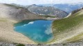
A beautiful day's hike. Varied landscapes, snowfields, scree, lakes, marmots, chamois, everything you need to have a good time.
Please note that you will be hiking in the heart of the Mercantour National Park. Be sure to comply with the regulations in force.
Col de la Cayolle – Lac d’Allos Mountain Hut
4.49 mi
+1,204 ft
-1,312 ft
3h 05
Moderate
Departure from Uvernet-Fours (Alpes-de-Haute-Provence)
A climb to a pass, followed by a descent of roughly the same length, with two beautiful lakes to admire. This walk also gives you the chance to compare the two sides of the mountain, which are quite different.
Mont Cimet via the southern ridge
 8.10 mi
+3,451 ft
-3,448 ft
6h 45
Difficult
Departure from Uvernet-Fours (Alpes-de-Haute-Provence)
8.10 mi
+3,451 ft
-3,448 ft
6h 45
Difficult
Departure from Uvernet-Fours (Alpes-de-Haute-Provence)
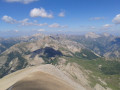
A superb hike in the Mercantour National Park, with a beautiful ridge leading to a summit over 3,000 metres high. Le Cimet, neighbouring Le Pelat and about thirty metres lower, offers a magnificent panorama on a clear day. The hike starts from the Vieux Brec bridge on the Col de la Cayolle road.
Col des Esbéliousses from the Pont du Vieux Brec
 4.41 mi
+1,483 ft
-1,476 ft
3h 20
Moderate
Departure from Uvernet-Fours (Alpes-de-Haute-Provence)
4.41 mi
+1,483 ft
-1,476 ft
3h 20
Moderate
Departure from Uvernet-Fours (Alpes-de-Haute-Provence)
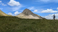
This hike in the Grande Cayolle, which is part of the heart of the Mercantour massif, is not difficult. It offers varied landscapes ranging from forest to mountain pastures, then to the mineral world of the north face of Mont Pelat and the surrounding ridges.
For more walks, use our search engine .
The GPS track and description are the property of this route's author. Please do not copy them without permission.

