Country:

 City:
City:


From Guillaumes, head towards Nice via the D2202 and, at the end of the straight stretch of road, park in the car park on the right before the Pont des Roberts on the banks of the River Var. Cross the road to reach the starting point at Marker 13.
(S) Set off southwards along a small road on the left bank of the Var. After about 50 metres, take the stony path which climbs to the left and winds its way up through the trees, initially with a few hairpin bends before becoming more straight. Cross the Ruisseau de Tirebœuf via a footbridge and continue climbing until you reach Marker 112.
(1) Continue along the path on the right (south) which, after a short descent, levels out.
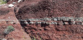
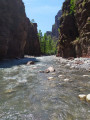
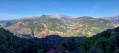
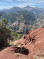
You then enter the Gorges de Daluis Regional Nature Reserve; you can admire the beauty of these red rocks (pelites) throughout the route, particularly at the Belvédère des Roches Rouges, which overlooks the valley dominated by Mont Saint-Honorat opposite.
Carry on amongst the thyme, savory and boxwood until you reach Marker 115.
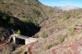
(2) Carry on straight ahead and descend to the footbridge at Clue d’Amen (the starting point for the canyon descent).
(3) Turn back to Marker 115.
(2) Take the path on the right (north-east) towards the hamlet of Amen, which you can see above. The climb is quite steep, the yellow markings are sporadic, but there are plenty of cairns. If approaching from the east, do not pass Markers 113 and 114. A final climb with hairpin bends leads to the hamlet of Amen.
(4) Turn left and head for Place de l’Abbé Olive, situated between the chapel and the old school.
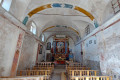
Through the railings, you can admire the decoration of Notre-Dame des Neiges. There is a water trough where you can fill your water bottles.
Walk round the chapel and head uphill to an information board about the history of the site, near an old oven.
(5) Return to the previous junction in the centre of the hamlet.
(4) Continue eastwards: an unnumbered signpost indicates the direction of La Baisse du Barrot. The path is narrow and descends gradually to the hamlet of La Collette.
The only house, which has been roughly restored, is a shepherd’s hut.
(6) N.B.: You are now entering an area where you may encounter a flock of sheep and guard dogs almost right up to the finish.
Continue east-northeast. The path is sometimes obscured by sheep tracks, but numerous cairns make it easier to follow. The path becomes steeper as you approach the third and final hamlet, Le Lavigné.
(7) The path passes to the left of the chapel. The climb becomes steeper until you emerge from the trees. The yellow markings are clearly visible. This takes you to the Baisse de Barrot, Marker 130.
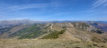
(8) Continue north-east and, off the path across the grassy slopes, reach the summit of the Cime du Pra (a stunning 360° panorama over the Var Valley and the Mercantour peaks).
(9) Carry on north-east and take the shortest route down to rejoin the path along the ridge leading to the top station of the Pra Brûlé ski lift (elevation 1986).
(10) Continue descending, first eastwards then northwards, along a track to the Col du Raton, at Marker 126.
(11) Take the track that climbs north-north-east towards Valberg. Pass under the Barzès chairlift line and reach La Bréchette, marker 25.
(12) Continue along the track on the left (north-east). Go round Lac des Anguillers on the left and reach the pass of the same name, Marker 24.
(13) Follow the track on the left (north-east). Head downhill, pass Marker 22 and reach a fork at an elevation of 1807.
(14) Leave the track and turn left onto the nature trail (known as the Sentier Planétaire), which is closed to mountain bikes. Pass the Sainte-Marie shelter. At a Fork in the road, keep left and stay on the nature trail. Reach a crossroads on the shore of Lac du Sénateur.
(15) Head north along the grassy ski run rather than the footpath. Join the footpath directly below the ski lift lines, continue north-north-east and rejoin it as it passes beneath two chairlifts. A path through the woodland leads to a road junction at the finish. Turn right onto Avenue de Valberg to quickly reach the central square (E).

 Visorando Member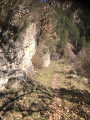
 Moderate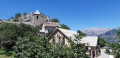
 Difficult