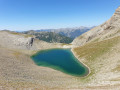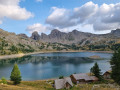
Lac d’Allos Mountain Hut – La Cantonnière Mountain Hut

The final stage, which is longer than the other two, takes you back to the starting point.

This walk is part of a multi-day hike: Around Les Garrets

Details

n°35079006
Creation:
Last update:
Last review:
  • Walking
    Activity: Walking
  • ↔
    Distance: 6.84 mi
  • ◔
    Average duration: 4h 15 
  • ▲
    Difficulty: Moderate

  • ⚐
    Back to start: No
  • ↗
    Ascent: + 1,253 ft
  • ↘
    Descent: - 2,493 ft

  • ▲
    Highest point: 8,537 ft
  • ▼
    Lowest point: 6,063 ft
  • ⚐ Country: France
  • ⚐
    Areas: Alps, Mercantour
  • ⚐ City: Allos (04260)
  • ⚑
    Start: N 44.237721° / E 6.707044°
  • ⚑
    End: N 44.243016° / E 6.755112°
  • ❏
    IGN map(s): Ref. 3540ET, 3540OT, 3540OTR
  • Hour-by-hour weather

Photos

Description of the walk

(S) Resume the route from the previous day, following the red and whiteGR® markings. You will reach the Mont Pelat crossroads.

(1) Keep to the right on the previous day’s route to reach the Pas de Lausson junction.

(2) Leave theGR® and continue to the right, following the yellow markings. Carry on climbing to reach the Pas de Lausson and the junction at marker 296.

(3) Head towards Estenc and begin the descent down the other side of the pass. Reach the junction marked with signpost 295.

(4) Take the path on the left, and after a long traverse to the right and then to the left, reach the junction marked 294, which you took on thefirst day.

(5) Turn right towards Estenc, following the winding path through alternating forest and meadows along the route taken onthe first day. Reach the junction marked with signpost 293.

(6) Pass once again near the Gîte Forestier du Garret and continue the descent.

(7) At a junction near the stream, turn right; the path winds once before returning to the stream and a second junction, where you should also turn right. Pass marker 292, then, about fifty metres before reaching the bridge on the road, take a small, less clearly marked path to the left, descend to the stream, wade across it, then follow the path which passes under the bridge and then follows the stream.

(8) Turn right and cross a wooden bridge to reach the car park at the hairpin bend. Then follow the road to the Cantonnière mountain hut (E).

Waypoints

  1. S : mi 0 - alt. 7,329 ft - Refuge du Lac d'Allos
  2. 1 : mi 0.9 - alt. 7,428 ft - Junction
  3. 2 : mi 1.4 - alt. 7,723 ft - Junction
  4. 3 : mi 2.66 - alt. 8,537 ft - Pas du Lausson
  5. 4 : mi 3.14 - alt. 8,146 ft - Marker 295
  6. 5 : mi 4.56 - alt. 7,552 ft - Marker 294
  7. 6 : mi 5.86 - alt. 6,745 ft - Garret Forest Lodge
  8. 7 : mi 6.22 - alt. 6,535 ft - Crossroads near the stream
  9. 8 : mi 6.6 - alt. 6,155 ft - Wooden bridge
  10. E : mi 6.84 - alt. 6,063 ft - Refuge de la Cantonnière

Notes

This route passes through multiple protected areas, which may be subject to special regulations:

Worth a visit

One kilometre downstream from the Cantonnière refuge (E), you can visit Lake Estenc and the source of the Var.

Always be cautious and plan ahead when you're outdoors. Visorando and the author of this route cannot be held responsible for any accidents occurring on this route.

The GR® and PR® markings are the intellectual property of the Fédération Française de Randonnée Pédestre.

Reviews and comments

5 / 5
Based on 1 review

Reliability of the description
5 / 5
Ease of following the route
5 / 5
Route interest
5 / 5
User 956347

Overall rating : 5 / 5

Date of your route : Oct 27, 2025
Reliability of the description : ★★★★★ Very good
Ease of following the route : ★★★★★ Very good
Route interest : ★★★★★ Very good
Very busy route : Yes

The arrival at the lake is magnificent.
Very easy to reach from the Laus car park.
Access fee: €10.

Machine-translated

Other walks in the area

For more walks, use our search engine .

The GPS track and description are the property of this route's author. Please do not copy them without permission.