Country:

 City:
City:


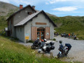
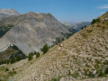
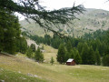
You can park opposite the Refuge de la Cantonnière and leave your car there; you can collect it again after these three days’ hiking.
Set off from the Refuge de la Cantonnière, where you can spend the night so you can set off early in the morning and enjoy the cool air.
(S) Follow the D2202 uphill for 400 m and, at the first bend, take the path that crosses the Ruisseau du Garret. Continue straight on after the footbridge and, after crossing a field, cross the D2202 twice (markers 285 and 286) to head up into a beautiful larch forest.
(1) Follow the Ruisseau de Sanguinière. Ignore the path branching off to the right and continue straight on towards the Cabanes de Sanguinière. You will then reach a junction above a footbridge (marker 287).
(2) Turn left at the junction towards the Col de la Boucharde. At marker 290, turn right onto a good path which climbs northwards along the right bank of the Ravin de la Boucharde, which you follow up to the pass of the same name.
(3) From the Col de la Boucharde at 2,539 metres (Marker 291), head north towards the Tête du Grand Clot and descend, initially along the left bank of the Ravin de l’Eschillon and subsequently below the Tête du Grand Clot via a series of hairpin bends. Cross the Bachelard via a lovely footbridge and join the D902.
(4) Cross the D902 with care and follow it westwards for 300 metres until you come to a path on the left.
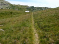
(5) Take this fairly steep path, which climbs through woodland and fields of flowers before running alongside the D902. The path passes through some very beautiful mountain pastures. You’ll come to a junction with an unmarked path.
(6) Ignore the path branching off to the right towards the Col de la Petite Cayolle and cross the mountain pastures heading south until you rejoin the D902. You will then arrive at the Refuge de la Cayolle (E).

 Visorando Member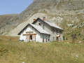
 Difficult