Country:

 City:
City:


Start from Val d’Allos le Seignus; drive to the Seignus Haut car park.
(S) From the car park, continue along the road to easily reach the start of the trail. Begin your walk towards the Meyriès trail via a lovely forest track that will take you through the mountain ranges of the Val d’Allos Haut-Verdon. You’ll come to a Fork in the road.
(1) Carry on straight ahead, then head down to the left onto the path. Follow it to the Meyriès hut.
(2) Keep going in the same direction, then follow theGR® de Pays – Tour du Haut Verdon. Shortly after passing through the Ravin du Tapi, you’ll reach the peatland and Fourier plateau.
(3) Continue due south until you reach the heights of Chaumie Haut at a crossroads.
(4) Head down towards the village and turn right to reach the alternative route.
(5) There are two options:
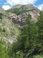
1) Turn right to reach the lovely Chaumie Waterfall (via a detour). Please note that the path to the waterfall is very narrow and quite steep.
2) The option shown on the map: carry on straight ahead until you reach a chapel. Then take the road on the right and follow the first path leading down to the left. After about 150 m, you’ll arrive at Chaumie Bas at a junction.
(6) First turn left then right, then right, then left. Carry on straight ahead towards the south until you reach Pont Haut.
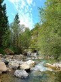
(7) Pass the bridge on your left and take the path on the right until you reach the start of the alternative route via the Canal de l’Adroit.
(8) Carry on straight ahead until you are opposite Fort de Savoie.
(9) Carry on to Colmars and join a narrow lane (Montée du Docteur Jacques Guidoni). Follow it to the end, to the ‘Stop’ sign before the D908. Then turn right onto the D908 and continue to the Porte des Gracis car park, situated next to the tourist information office (E).


 Visorando Member
 Difficult
 Tourist office
 Average