


Refine your search for walks in Tourouzelle
Tourouzelle walks


 La Bade Pine Forest and Sainte-Cécile Chapel in Tourouzelle
 Visorando Member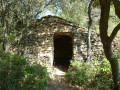
 7.39 mi
 +443 ft
 -423 ft
 3h 45
3h 45
 Moderate
 Departure from Tourouzelle (Aude)
A walk through vineyards, heath and fragrant pine trees, allowing you to discover numerous drystone shelters and old sheepfolds built of dry stone, bearing witness to the activities of the villagers of yesteryear on the hillsides. At the end of the route, the Chapel of Sainte-Cécile, set in a very pretty spot, offers a pleasant place to rest.
La Mota Doça in Oupia
 Tourist office5.29 mi
+846 ft
-833 ft
3h 10
Moderate
Departure from Oupia (Hérault)
Tourist office5.29 mi
+846 ft
-833 ft
3h 10
Moderate
Departure from Oupia (Hérault)
[PLEASE NOTE: due to the fire in July 2026 in the Oupia area, the walking route is closed until further notice]
This beautiful walk combines nature, history and modern technology. Enjoy the exceptional panoramic views over the wine-growing plain.Ideal for nature lovers and those looking to get away from it all for a few hours in peaceful surroundings.
Stroll around the spillway at La Redorte
2.30 mi
+43 ft
-43 ft
1h 05
 Easy
Departure from La Redorte (Aude)
Easy
Departure from La Redorte (Aude)
This very short walk for the whole family takes in a boat harbour, a spillway, a canal bridge, a boatman's stop, an aqueduct, a beautiful dairy farm and a small lake where you can fish for trout. A wealth of discoveries!
The Obieu Valley from Conhilac-Corbières
 2.20 mi
+351 ft
-348 ft
1h 20
Easy
Departure from Conilhac-Corbières (Aude)
2.20 mi
+351 ft
-348 ft
1h 20
Easy
Departure from Conilhac-Corbières (Aude)
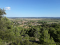
If you have an hour or two to spare in Conhilac-Corbières – at the end of the day, for example – this quick walk offers a lovely view over the Obieu valley, which is in fact the route from Toulouse to the Mediterranean for the motorway, the train and so on, with the Pyrenees in the background. The walk takes you past a field of wind turbines, giving you the chance to see for yourself the impact of this type of development.
The two locks at Puichéric
4.17 mi
+26 ft
-26 ft
1h 55
Easy
Departure from Puichéric (Aude)
More of a stroll than a hike, this outing is ideal for families looking to get some fresh air.
Although the banks of the canal have lost some of their charm (many plane trees have been lost), there are still two locks to discover, including the Aiguille lock with its unusual sculptor.
The Répudre Canal Bridge at the start of Paraza
 8.08 mi
+472 ft
-489 ft
4h 10
Moderate
Departure from Paraza (Aude)
8.08 mi
+472 ft
-489 ft
4h 10
Moderate
Departure from Paraza (Aude)
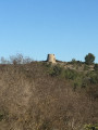
The Pont-Canal du Répudre bridge is the highlight of this circular route starting from Paraza towards the Minervois vineyards and the Jardin de Bacchus, near the Pouzols-Minervois cooperative winery. Before that, the passage through Sainte-Valière brings a hint of Saint-Jacques with a section of the Camin Romieu. Due to its location on the route, this Languedoc village is an essential stop for pilgrims looking for an enriching break on the Voie des Piémonts.
Around Mas de Lignières in Casseras
 6.31 mi
+965 ft
-938 ft
3h 45
Moderate
Departure from Cesseras (Hérault)
6.31 mi
+965 ft
-938 ft
3h 45
Moderate
Departure from Cesseras (Hérault)
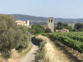
This beautiful walk allows naturist campers and hikers to explore the area around the Mas de Lignières campsite. The walk is done fully clothed and takes you through the vineyards and pine forest north of Cesseras. For non-naturists, there is a car park, marked on the map but not on the road, at thefirst crossing point, which can be used as a starting and finishing point.
Circular route from the watchtower via Moux
7.58 mi
+2,064 ft
-2,083 ft
5h 15
Moderate
Departure from Moux (Aude)
A challenging hike, with no major difficulties, apart from the total lack of signposting or, frequently, numerous signs that contradict this route. The route follows deeply rutted paths, with loose gravel underfoot. The start crosses a pine forest devastated by fire, but after that it’s pure joy through dense vegetation, consisting of pines, holm oaks, boxwoods, junipers, kade trees, and the full range of Mediterranean plants – a feast of scents. Avoid doing this in summer or after a storm.
La Montagne D'Alaric - Roc De L'Aigle
 10.28 mi
+2,264 ft
-2,267 ft
6h 40
Moderate
Departure from Moux (Aude)
10.28 mi
+2,264 ft
-2,267 ft
6h 40
Moderate
Departure from Moux (Aude)
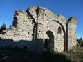
At the gates of Carcassonne, the Montagne d'Alaric offers a superb viewpoint over the Pyrenees and the Aude plain. The ruins of the priories of Saint-Pierre d'Alaric and Saint-Michel de Nahuze, as well as those of the Métairie de Vidal, encourage us to reflect on the history of this mountain and the life that must have once animated it. Finally, the return journey through the vineyards of the Corbières region is an invitation to end this day's walk with a well-deserved wine tasting.
Around the Ruisseau de Coupiat canyon
 9.36 mi
+1,312 ft
-1,329 ft
5h 25
Moderate
Departure from Minerve (Hérault)
9.36 mi
+1,312 ft
-1,329 ft
5h 25
Moderate
Departure from Minerve (Hérault)
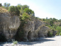
Far less well-known than the Brian, its close neighbour, the Ruisseau de Coupiac has also carved out impressive gorges that are well worth discovering. After a rather gruelling climb up onto the causse, the route offers beautiful views of the Minervois, the Corbières and the Pyrenees. The descent along the canyon leads to the small village of La Caunette, where a stop for a break will be most welcome. Finally, the return journey along the dry bed of the Cesse offers a unique experience.
Minerve circular tour via the Cesse and Brian gorges
 10.16 mi
+1,929 ft
-1,939 ft
6h 20
Moderate
Departure from Minerve (Hérault)
10.16 mi
+1,929 ft
-1,939 ft
6h 20
Moderate
Departure from Minerve (Hérault)
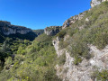
This day-long route takes you around the very pretty medieval village of Minerve, allowing you to explore the Cesse and Brian gorges as well as some of the Minervois vineyards. This route, walked in May 2025, follows only safe paths, many of which are signposted (several other paths running along the cliffs above the gorges are now dangerous and often off-limits). As an added bonus, when water levels are low, you can visit the spectacular and immense natural arch/cave in Minerve through which the River Cesse flows.
Minerve, La Cesse and Brian
 5.41 mi
+1,158 ft
-1,178 ft
3h 30
Moderate
Departure from Minerve (Hérault)
5.41 mi
+1,158 ft
-1,178 ft
3h 30
Moderate
Departure from Minerve (Hérault)
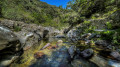
This route around Minerve has it all! The natural bridges over the Cesse, the heath, the footbridges over the Gorges du Brian and, of course, the cobbled streets of the town.
⚠️ After rainfall, we advise you to check the conditions for crossing the River Brian (7): the ford between the town and the catapult can sometimes be covered in water or become slippery (see practical information).
This hike may be closed depending on the fire risk level. Please check the map.
The Megaliths of Minerve
 7.87 mi
+1,473 ft
-1,457 ft
4h 55
Moderate
Departure from La Caunette (Hérault)
7.87 mi
+1,473 ft
-1,457 ft
4h 55
Moderate
Departure from La Caunette (Hérault)
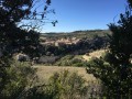
This hike, at the start of La Caunette, will take you above Minerva and will let you discover the megaliths scattered along the route. You'll criss-cross vines, scrubland composed of gorse, thyme, brush, evergreen oak trees and the odd wood.
Causse circuit starting from La Caunette
 9.16 mi
+1,263 ft
-1,273 ft
5h 20
Moderate
Departure from La Caunette (Hérault)
9.16 mi
+1,263 ft
-1,273 ft
5h 20
Moderate
Departure from La Caunette (Hérault)
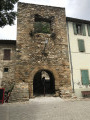
This beautiful hike offers stunning views of the Coupiat, Fendaille and Trémenal gorges. The route is fully signposted, presents no major difficulties and can be shortened at various points if necessary.
Pont de Daniel and Pont du Moulin via Minerve
 4.91 mi
+1,109 ft
-1,135 ft
3h 15
Moderate
Departure from Minerve (Hérault)
4.91 mi
+1,109 ft
-1,135 ft
3h 15
Moderate
Departure from Minerve (Hérault)
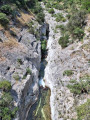
A short hike around the town of Minerve along trails that are rarely used. They offer magnificent views, but be careful if you are afraid of heights on the edges of the Brian Canyon.
Short circular loop on the heights of Bize-Minervois.
 2.97 mi
+371 ft
-341 ft
1h 40
Easy
Departure from Bize-Minervois (Aude)
2.97 mi
+371 ft
-341 ft
1h 40
Easy
Departure from Bize-Minervois (Aude)
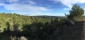
A circular loop that takes you alternately through vineyards, heath and undergrowth. All dotted with some beautiful views of the Pyrenees and the Mivervois plain.
Ventajou
 13.56 mi
+2,001 ft
-1,998 ft
8h 00
13.56 mi
+2,001 ft
-1,998 ft
8h 00
 Difficult
Departure from Félines-Minervois (Hérault)
Difficult
Departure from Félines-Minervois (Hérault)
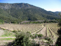
Starting from Félines-Minervois, this hike leads primarily to the ruins of Ventajou, which offer a magnificent view of the Corbières and the Pyrenees. But there are many other places of interest along the route: the pretty hamlet of Auberadou, the Planette dolmen, the stone apiaries and the old marble quarries of Planette, Castillou and Escaliers, a cistern carved into the rock, not to mention the Cubitus Cave, which is worth a short detour. Finally, a walk through a magnificent pine forest filled with wonderful scents will bring this journey to a harmonious conclusion.
Montpenery and La Roche Trouée
 3.57 mi
+367 ft
-361 ft
2h 00
Easy
Departure from Boutenac (Aude)
3.57 mi
+367 ft
-361 ft
2h 00
Easy
Departure from Boutenac (Aude)
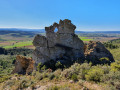
A lovely walk with the scent of the heath in the air. The walk starts at the recently rebuilt Boutenac washhouse, takes you past the church – which has also been renovated – and the remains of the tower. After a visit to the old village, head towards Mount Penery to enjoy a 360° view very close to the Roche Trouée, but be careful not to take any unnecessary risks: if you ask locals for directions, say ‘le Trou de la Lunette’.
Roque Sestière and Saint-Siméon from Boutenac
 5.17 mi
+669 ft
-666 ft
3h 00
Easy
Departure from Boutenac (Aude)
5.17 mi
+669 ft
-666 ft
3h 00
Easy
Departure from Boutenac (Aude)
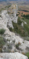
This sunny and windy trip will take you to the heart of the Boutenac National Forest, better known for its wine than for its hikes. In a setting that smells of pine and rosemary, discover the cave and the Chapel of Saint-Siméon, with a fresco depicting its history, its life and its work. Then head to the rocky barrier of Roque Sestière, the highest point of the Boutenac massif, a landmark for birds of prey and an area where the Cers wind has left no chance for vegetation.
Alaric loop via Combe du Gravier
 5.23 mi
+1,539 ft
-1,539 ft
3h 45
Moderate
Departure from Douzens (Aude)
5.23 mi
+1,539 ft
-1,539 ft
3h 45
Moderate
Departure from Douzens (Aude)
This is a great walk in the heart of the Alaric massif, where you can explore deep valleys and forests of holm oaks and Austrian black pines. Legend has it that the Visigoth king Alaric, passing through the region, gave the mountain its name, and some say that his treasure is hidden here.
A trip to the summit offers views of the entire Aude plain, the Corbières, the Eastern Pyrenees and the Mediterranean Sea if the weather is clear enough.
Alaric between valleys, ridges and splendid views
 11.00 mi
+2,543 ft
-2,572 ft
7h 15
Moderate
Departure from Douzens (Aude)
11.00 mi
+2,543 ft
-2,572 ft
7h 15
Moderate
Departure from Douzens (Aude)
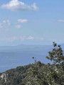
A beautiful circular route around Alaric, along ridges and valleys from north to south, offering views of the Montagne Noire, the Aude valley from Carcassonne to Lezignan, and the Corbières Massif with the Pyrenees in the background, surrounded by vegetation including thyme, rosemary, boxwood, pine and lavender. Very quiet paths.
Panoramic view between heath and pine forest in Saint-Frichoux
 4.54 mi
+180 ft
-177 ft
2h 15
Easy
Departure from Saint-Frichoux (Aude)
4.54 mi
+180 ft
-177 ft
2h 15
Easy
Departure from Saint-Frichoux (Aude)
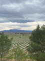
A lovely 8.5 km walk through heath and pine forest, or along one of the canals of the former, now-dry Marseillette pond.
From Bize-Minervois to Montouliers
 8.53 mi
+1,158 ft
-1,122 ft
4h 55
Moderate
Departure from Bize-Minervois (Aude)
8.53 mi
+1,158 ft
-1,122 ft
4h 55
Moderate
Departure from Bize-Minervois (Aude)
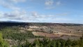
This route offers magnificent views. Depart from Bize-Minervois via the D5 departmental road, known as "La Minervoise".
Route on tracks through heath, then through pine forests.
Bize-Minervois and the Pech tour
 4.39 mi
+591 ft
-568 ft
2h 30
Easy
Departure from Bize-Minervois (Aude)
4.39 mi
+591 ft
-568 ft
2h 30
Easy
Departure from Bize-Minervois (Aude)
An easy, gentle walk. Long path along the hillside and return via the ridge.
Le Roc Tremblaïre
 8.58 mi
+1,204 ft
-1,184 ft
5h 00
Moderate
Departure from Bize-Minervois (Aude)
8.58 mi
+1,204 ft
-1,184 ft
5h 00
Moderate
Departure from Bize-Minervois (Aude)
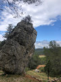
Between Aude and Hérault, this route alternates between flat and steep paths, crossing hills and plateaus between Bize-Minervois and Montouliers. On a balcony overlooking the Cesse valley, via the Travers de Verdeyre, let's set off to discover the Roc Tremblaïre before stopping at Montouliers for a break near its famous Roman fountain. The return journey, following a section ofthe GR®78combined with a Saint-Jacques slip road, allows you to overlook the Argeliers plain before arriving at Bize-Minervois.
Loop on the heights of Vialanove
 7.79 mi
+725 ft
-715 ft
4h 15
Moderate
Departure from Aigues-Vives (Hérault) (Hérault)
7.79 mi
+725 ft
-715 ft
4h 15
Moderate
Departure from Aigues-Vives (Hérault) (Hérault)
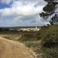
A short circuit starting from the hamlet of Paguignan will take you through vineyards and woods, passing successively through the hamlets of Cailhol and Vialanove. On the return circuit, there is a protected cave where bats nest.
Please note! We recommend using the Visorando app for navigation, and above all, downloading the map before you leave home, as the area will remain a white zone until at least the end of 2022...
The Brahunal Balcony
4.20 mi
+476 ft
-472 ft
2h 20
Moderate
Departure from Aigues-Vives (Hérault) (Hérault)
Between 55 and 45 million years ago, a warm, shallow sea flooded the older terrain forming the Montagne Noire, covering it with limestone rich in foraminifera (microscopic organisms encased in a calcareous shell). This limestone forms the Causses du Minervois. Rivers flowing down from the Montagne Noire cross these plateaus and carve out narrow valleys: the canyons. This network of canyons is home to numerous karstic caves and caves harbouring ancient traces of human presence and rare animal species. Bats, which inhabit the Grotte de l’Aldène in the Cesse Gorges, the peregrine falcon, the Montagu’s harrier and the red-backed shrike all contribute to the biodiversity of this site. This walk remains on the limestone plateau, amongst vineyards and valleys, and offers an exceptional view of the Brahunal Gorges, a stream that joins the Cessière. See warning in the practical information tab
Circulate the Muscat vineyards of Saint-Jean-de-Minervois
 8.43 mi
+850 ft
-846 ft
4h 35
Moderate
Departure from Aigues-Vives (Hérault) (Hérault)
8.43 mi
+850 ft
-846 ft
4h 35
Moderate
Departure from Aigues-Vives (Hérault) (Hérault)
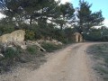
Discover the famous Muscat vineyards of Saint-Jean-de-Minervois. This circuit moves out of the hamlet of Paguignan leading onto the plateau of Saint John and then descends to the Cesse Valley to join Agel and its Castle, which is listed as a Historical Monument. The route then continues in the direction of Cassidy and then reaches the starting point.
On the heights of Paguignan and La Cessière
4.27 mi
+354 ft
-358 ft
2h 15
Easy
Departure from Aigues-Vives (Hérault) (Hérault)
A short, easy walk. It is partly marked in blue and, in places, in yellow and red.
Warning! In summer, temperatures (in the shade) can exceed 35°C and the route is largely exposed.
Remember to take plenty of water and apply sun cream.
Also, from 15 August onwards, check that a driven hunt is not taking place.
From Cailhol to Saint-Jean-de-Minervois via Paguignan
4.77 mi
+443 ft
-417 ft
2h 35
Moderate
Departure from Aigues-Vives (Hérault) (Hérault)
A circular route through the heath that will take you from Paguignan towards the road to Saint-Jean-de-Minervois, passing through the Muscat vineyards.
Rieussec Route
 9.45 mi
+1,519 ft
-1,486 ft
5h 40
Moderate
Departure from Vélieux (Hérault)
9.45 mi
+1,519 ft
-1,486 ft
5h 40
Moderate
Departure from Vélieux (Hérault)
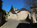
A walk through the Avants-Monts region towards the small village of Rieussec, along the road linking Narbonne to Saint-Pons-de-Thomières, making use of a section ofthe GR® 77 starting from Vélieux and a stretch of the Grande Traversée de l’Hérault to return to this village in the Haut-Languedoc Regional Nature Park
Around the Cesse
 9.57 mi
+1,545 ft
-1,549 ft
5h 45
Moderate
Departure from La Livinière (Hérault)
9.57 mi
+1,545 ft
-1,549 ft
5h 45
Moderate
Departure from La Livinière (Hérault)
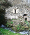
This small river, which flows into the Aude after 50 km, is the focus of this circular route starting from Cantignergues, a hamlet in La Livinière, in the commune of Hérault, to its source near the village of Ferrals-les-Montagne, a village in the Haut-Languedoc Regional Nature Park. A picnic area (with tables and barbecue) has been set up near the stone "gatehouse" where the waters of the Cesse emerge, disappearing during periods of drought at the foot of the Cathar citadel of Minerve.
From the Marseillette lock to Naudy
 2.84 mi
+82 ft
-82 ft
1h 25
Easy
Departure from Marseillette (Aude)
2.84 mi
+82 ft
-82 ft
1h 25
Easy
Departure from Marseillette (Aude)
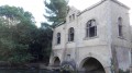
Discover part of the dried-up Marseillette lake, where orchards, vineyards and rice fields are cultivated, and its freshwater supply.
Chante Coucou Cultural Trail in Comigne
 1.79 mi
+230 ft
-230 ft
1h 00
Easy
Departure from Comigne (Aude)
1.79 mi
+230 ft
-230 ft
1h 00
Easy
Departure from Comigne (Aude)
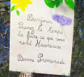
Amidst vineyards and pine forests, discover works of art all along the trail.
From the Plateau de la Matte to medieval Ventajou
 5.86 mi
+942 ft
-942 ft
3h 30
Easy
Departure from Félines-Minervois (Hérault)
5.86 mi
+942 ft
-942 ft
3h 30
Easy
Departure from Félines-Minervois (Hérault)
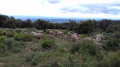
A magnificent hike in the hills above Féline-Minervois. Our footsteps echo on the marble that lies just below the surface of the heath. Sumptuous views of the Minervois. And medieval ruins to admire.
The Moulin de Biot and the marble quarries via Ventajou
 8.25 mi
+1,660 ft
-1,657 ft
5h 15
Moderate
Departure from Félines-Minervois (Hérault)
8.25 mi
+1,660 ft
-1,657 ft
5h 15
Moderate
Departure from Félines-Minervois (Hérault)
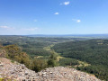
This hike, partly off the marked trails, allows you to see the hamlet of Biot, its quarry and its mill. As you pass the marble quarries (you will cross four during the hike), you will understand the titanic work carried out by our ancestors during the last century. The hike ends with a long, safe cliff-top path offering spectacular views of the Minervois plain and, beyond, the Corbières massif. In good weather, you can see the Pyrenees in the distance.
Towards the Ruisseau du Cros and Font dal Rainard
 8.42 mi
+1,703 ft
-1,667 ft
5h 20
Moderate
Departure from Félines-Minervois (Hérault)
8.42 mi
+1,703 ft
-1,667 ft
5h 20
Moderate
Departure from Félines-Minervois (Hérault)
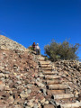
This hike offers a variety of landscapes and trails in the Félines-Minervois marble quarry area. The passage along trails that we have recently opened up allows you to discover places that are little known or unknown.
Circular walk starting from L’Abeuradou
 9.42 mi
+2,231 ft
-2,218 ft
6h 15
Difficult
Departure from Félines-Minervois (Hérault)
9.42 mi
+2,231 ft
-2,218 ft
6h 15
Difficult
Departure from Félines-Minervois (Hérault)
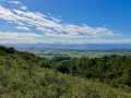
A lovely walk in this area, well known for its two PR® trails in Caunes-Minervois and Félines-Minervois: the Marble Quarries Route. To create this circular route, off the beaten track, we spent several days ‘working’ to find the best route, clearing certain sections overgrown with vegetation and marking the paths we created with Yellow Circles. In the marble quarries, you can really appreciate the titanic effort put in by the workers at the start of the 20th century. Information boards explain how the various quarries we come across used to operate.
Circular Signal de l'Alaric via the Congoust Gorges and Gabart plain
 10.88 mi
+1,575 ft
-1,581 ft
6h 20
Moderate
Departure from Montlaur (Aude)
10.88 mi
+1,575 ft
-1,581 ft
6h 20
Moderate
Departure from Montlaur (Aude)
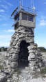
This is a challenging hike on beautiful trails to reach the Signal de l'Alaric, the highest point of the eponymous mountain range, where the view is breathtaking – literally for hikers who do the circular loop in the opposite direction.The descent that follows is challenging, over rocky terrain, with the last kilometre at a gradient of over 20% and permanent views of the Pyrenees and Corbières mountain ranges.The end, which is more relaxing but mostly on tarmac, simply completes the circular. The final variant, which is a little longer, reduces the amount of tarmac.
The Alaric ridges from the Col du Fer à Cheval
5.70 mi
+866 ft
-846 ft
3h 20
Moderate
Departure from Montlaur (Aude)
A circular route around the central part of the Alaric massif with beautiful panoramic views of the Corbières and the Pyrenees from the high points. The circular route starts on tarmac, then runs alongside the Corbières vineyards and finally follows the GR®36 trail along the limestone ridges. Feast your eyes!
The marble circuit in Caunes-Minervois
 7.68 mi
+1,686 ft
-1,696 ft
5h 00
Moderate
Departure from Caunes-Minervois (Aude)
7.68 mi
+1,686 ft
-1,696 ft
5h 00
Moderate
Departure from Caunes-Minervois (Aude)
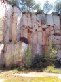
From Notre-Dame du Cros (Caunes-Minervois), a route takes you to former marble quarries, with a picnic stop at the renovated Ventajou refuge, near the ruins of the castle of the old village that has disappeared. On the way back, you pass by the Moulin de Biot, a former witness to a technique of using wind energy for sawing marble.
Warning from the author of the route in the "practical information" tab (2/11/2021)
Around Barroubio
 10.35 mi
+1,453 ft
-1,453 ft
6h 00
Moderate
Departure from Saint-Jean-de-Minervois (Hérault)
10.35 mi
+1,453 ft
-1,453 ft
6h 00
Moderate
Departure from Saint-Jean-de-Minervois (Hérault)
A loop starting from Saint-Jean-de-Minervois will take you across several streams and to the Church of Saint-Jean de Dieuvaille or the Church of the Trou. Along the way, you will alternate between old paths through the woods and Muscat vineyards. The route is dotted with beautiful views of the Barroubio cliffs. Depending on the season, you may see wild irises, broom, gorse, thyme and holm oaks.
Around Montlaur
 8.18 mi
+1,296 ft
-1,276 ft
4h 55
Moderate
Departure from Montlaur (Aude)
8.18 mi
+1,296 ft
-1,276 ft
4h 55
Moderate
Departure from Montlaur (Aude)
Starting from the small village of Montlaur, in the heart of the Corbières region, this circular trail is fragrant with the scent of pine trees and heath. The return journey takes you through vineyards, in a very Mediterranean atmosphere. There is a little tarmac at the end of the route, but this should not spoil the enjoyment of the walk.
Fontfroide Massif
 7.00 mi
+482 ft
-463 ft
3h 40
Moderate
Departure from Narbonne (Aude)
7.00 mi
+482 ft
-463 ft
3h 40
Moderate
Departure from Narbonne (Aude)
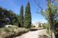
A loop from the magnificent Abbaye de Fontfroide in the massif of the same name. There are 360° views of the Corbières, the Pyrenees and the Aude coastline.
With no major difficulties, the route only takes in the DFCI paths of this highly protected massif.
Fontfroide Abbey: from La Croix to the Chemin de l’Aragnon
 5.40 mi
+781 ft
-764 ft
3h 10
Easy
Departure from Narbonne (Aude)
5.40 mi
+781 ft
-764 ft
3h 10
Easy
Departure from Narbonne (Aude)
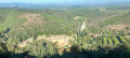
A circular route, not too difficult, starting from Fontfroide Abbey offering lovely views. The route is varied as it follows paths that are sometimes stony, tracks, and also a section of the Via Domitia.
All in all, a short hike that is a bit of a workout in places but remains enjoyable.
The Saint-Peyre Chapel and the Pierre Trouée
 4.84 mi
+499 ft
-472 ft
2h 40
Easy
Departure from Assignan (Hérault)
4.84 mi
+499 ft
-472 ft
2h 40
Easy
Departure from Assignan (Hérault)
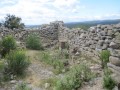
A walk that leads to the ruins of the Saint-Peyre Chapel and then to a curious stone with a hole in it hidden in the heath.
(Moderator's note) Please note that there are reported difficulties at the end of the route. See the three comments left since February 2022.