


Refine your search for walks in Tinée (rivière)
Tinée (rivière) walks


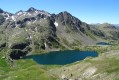
 The Lacs de Vens from Le Pra
 Visorando Member
 9.74 mi
 +3,481 ft
 -3,478 ft
 7h 30
 Difficult
 Departure from Saint-Étienne-de-Tinée (Alpes-Maritimes)
A magnificent hike in the Haute-Tinée offering varied panoramas and one of the most beautiful series of lakes in the Mercantour!
The climb from Le Pra is gradual and easy, with the Cime de la Bonnette behind you. You then pass under the strange Aiguilles de Tortisse before arriving at the Col du Fer (view of Mont Viso).
After the Collet de Tortisse, you arrive at the arch, where you can enjoy a splendid panorama of the Lacs de Vens and the peaks of the Trou de l'Âne!
The Mont Ténibre circular from Saint-Étienne-de-Tinée
 12.42 mi
+6,496 ft
-6,476 ft
8 hrs
 Very difficult
Departure from Saint-Étienne-de-Tinée (Alpes-Maritimes)
A long and demanding circular in the Mercantour National Park that will first take you to Lac de Rabuons, the largest lake in the Alpes-Maritimes, which is worth the detour in itself, before climbing Mont Ténibre, the highest peak in the Tinée at 3,031 metres.
You are in the Mercantour National Park, where there are regulations to be observed, with fines of up to €1,500 for non-compliance. See practical information.
Read the reviews before committing.
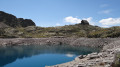
Saint-Étienne-de-Tinée - Rabuons Refuge
 4.55 mi
+4,951 ft
-423 ft
6h 25
Difficult
Departure from Saint-Étienne-de-Tinée (Alpes-Maritimes)
This first stage will take you to the Rabuons mountain hut, on the shores of the largest lake in the Alpes-Maritimes.The landscape is very rocky. You’ll come across plenty of Italians, as just across the border there are several mountain huts offering lovely routes via the nearby Pas de l’Ischiator.
⚠️ Allow around 4 hours for an average hiker in good physical condition to complete this walk.
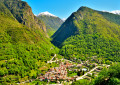
Louch Waterfall Circular Route from Isola village
 2.93 mi
+883 ft
-896 ft
2h 05
 Moderate
Departure from Isola (Alpes-Maritimes)
This is a must-do short hike if you are visiting Isola. Clearly visible from the village, the waterfall is nearly 90 metres high and offers canyoning opportunities for enthusiasts. The path is well marked and properly maintained.
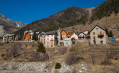
Along the Mollières valley
 10.75 mi
+3,002 ft
-3,002 ft
7h 35
Moderate
Departure from Alpes-Maritimes
A very beautiful hike starting from the Tinée Valley to discover the lost hamlet of Mollières. It is a bit long but has a very gradual climb, making it easily accessible.
Temporary ban in 2023, see notices.
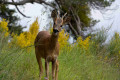
Tour of Mont Falourde from Massoins
 9.80 mi
+3,307 ft
-3,307 ft
7h 25
Difficult
Departure from Massoins (Alpes-Maritimes)
A beautiful, challenging hike between the Var and Tinée rivers.
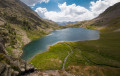
Circular Vens loop via the Vens torrent, return via Tortisse
 12.11 mi
+3,898 ft
-3,875 ft
9h 00
Difficult
Departure from Saint-Étienne-de-Tinée (Alpes-Maritimes)
This is a variation on the traditional hikes to the magnificent lakes of Vens. Although the last section on tarmac between Le Pra and the car park at the start is not the most attractive, this circular route takes you through both the Vens and Tortisse valleys, with a more pleasant climb along the torrent and a breathtaking descent from the Col de Fer.
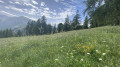
Sélasse route
 3.81 mi
+2,221 ft
-2,234 ft
3h 40
Moderate
Departure from Saint-Étienne-de-Tinée (Alpes-Maritimes)
A hike to discover the Ténibres valley from both sides as well as the architecture of the region.
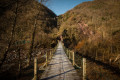
The Ilonse circular route via Abéliéra
 10.53 mi
+3,379 ft
-3,379 ft
7h 45
Difficult
Departure from Saint-Sauveur-sur-Tinée (Alpes-Maritimes)
A very pretty circular route in the Tinée Valley featuring an abandoned hamlet, magnificent climbs through the woods and breathtaking views of several villages in the area.
Col and Cime d'Anelle
 5.96 mi
+2,277 ft
-2,251 ft
4h 45
Moderate
Departure from Saint-Étienne-de-Tinée (Alpes-Maritimes)
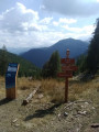
This morning route is an alternative to the Bois d'Anelle loop, passing via the Cime d'Anelle. The first section climbs through the Ublan countryside, then crosses the woods in the shade of the fir trees.
Lower Claï from the Vens car park
9.16 mi
+3,540 ft
-3,540 ft
7h 20
Difficult
Departure from Saint-Étienne-de-Tinée (Alpes-Maritimes)
A little-known viewpoint above the Lakes of Vens and Babarottes. A 360° panorama stretching from Mont Ténibre to Mont Mounier, as well as the Tête de l’Enchastraye and the Cime de Pal...
Rabuons Mountain Hut – Saint-Étienne de Tinée
4.93 mi
+164 ft
-4,642 ft
2h 25
Moderate
Departure from Saint-Étienne-de-Tinée (Alpes-Maritimes)
The final day is less demanding than the previous one, consisting entirely of a descent. It’s a chance to walk the ‘Chemin de l’Énergie’ one last time before a long descent to Saint-Étienne-de-Tinée.
Saint-Etienne-de-Tinée - Lacs de Vens - Small Pass of Tortisse
 7.52 mi
+5,942 ft
-1,342 ft
7 hrs
Very difficult
Departure from Saint-Étienne-de-Tinée (Alpes-Maritimes)
First stage of a two-day hike in the Haute-Tinée.
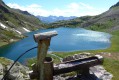
Ascent to the magnificent Lacs de Vens and the small pass of Tortisse via the Claï valley and Lac des Babarottes.
Plenty of marmots and chamois around the Lacs de Vens and below the small pass of Tortisse.
Western circular of La Tour-sur-Tinée
 4.63 mi
+1,526 ft
-1,532 ft
3h 25
Very difficult
Departure from La Tour (Alpes-Maritimes)
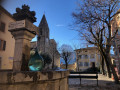
A very beautiful hike with a variety of trails and vegetation, enhanced by a village classified as a historical monument to discover. Take into account the practical information mentioned in the description regarding the period and the off-trail section.
⚠️ GPS or app essential for this hike! Avoid the winter period, as the rocks near the rivers are slippery.
Route from Rabuons to Vens via Mont Ténibre
 21.65 mi
+9,636 ft
-9,639 ft
3 days
Difficult
Departure from Saint-Étienne-de-Tinée (Alpes-Maritimes)
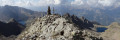
A magnificent three-day route taking you to one of the 3,000-metre peaks in the Alpes-Maritimes. You’ll have the chance to spend a night on the shores of the largest lake in the Alpes-Maritimes at the small Rabuons refuge. The following day, the ascent of Mont Ténibre will offer you a superb panorama of Italy, as well as the Mercantour range stretching as far as the peaks of the Auron ski resort. You’ll leave your rucksack behind for a second night by the shores of another lake – less rugged and more pastoral – at the Vens refuge.
GTA, Great Alpine Crossing via the GR®5 and GR®55. From Lake Geneva to Nice.
 342.76 mi
+99,633 ft
-100,915 ft
21 days
Very difficult
Departure from Saint-Gingolph (Haute-Savoie)
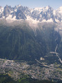
The Grande Traversée des Alpes (GTA) mainly follows the GR®5, with a few possible variations such as the crossing of the Haute Vanoise via the GR®55 and the Via Alpina, which this route takes instead of the GR®5 route via the Col de l’Iseran. It crosses the French Alps from north to south, from Saint-Gingolph to Nice. The guide includes web links to the many accommodation options along the route or nearby: mountain huts, lodges, campsites, cabins and shelters, excluding hotels. Although this guidebook details the GTA as a three-week trek, it can be adapted to suit your own pace, with stages of varying lengths, either completed in one go or in sections over several years. This journey, fuelled by the joy of freedom in unspoilt natural surroundings, will remain a superb and unforgettable experience, offering, moreover, the opportunity to meet many people with whom you can share this same passion for the mountains.
Lakes Varicles and Ténibre
 8.35 mi
+4,656 ft
-4,669 ft
7h 55
Difficult
Departure from Saint-Étienne-de-Tinée (Alpes-Maritimes)
Two high-altitude lakes, amongst the many above Saint-Étienne-de-Tinée, less well-known and less frequented than Lac du Rabuons, but offering a beautiful viewpoint over the Auron valley and beyond.
Lacs de Vens
 16.76 mi
+7,900 ft
-7,963 ft
2 days
Difficult
Departure from Saint-Étienne-de-Tinée (Alpes-Maritimes)
A two-day hike starting from Saint-Étienne-de-Tinée.
Day one: ascent to the Lacs de Vens via the Vallon de Claï and the Lac des Babarottes, followed by a round trip to the Aiguilles de Tortisse.
Day two: ascent to the Cime du Fer, then return to Saint-Etienne-de-Tinée via the Vallon de Tortisse, Lac des Babarottes and the Chemin de l’Energie.
Fort Charvet from the Courbaisse
 6.09 mi
+1,791 ft
-1,791 ft
4h 20
Moderate
Departure from Tournefort (Alpes-Maritimes)
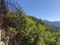
Forgotten on its rocky ridge, the main attraction of this hike is a visit to Fort Charvet. But it is also an opportunity to imagine, for a few minutes, what it was like for the soldiers who were tasked with observing the Var and Tinée valleys at the end of the 18th century in order to protect against a possible Piedmontese invasion. Let us not forget that this area has been French since 1860.
From Saint-Sauveur-sur-Tinée to Roure via the canal
 5.13 mi
+2,028 ft
-2,041 ft
4h 10
Moderate
Departure from Saint-Sauveur-sur-Tinée (Alpes-Maritimes)
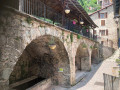
This route begins in woodland where wild strawberries grow, followed by an unusual, little-used canal, before joining the GR®5. The beautiful village of Roure is well worth a visit: original wash house, fountains, a wealth of renowned local heritage.
From Bousiéyas to Roya
 19.22 mi
+5,515 ft
-6,716 ft
13h 40
Very difficult
Departure from Saint-Dalmas-le-Selvage (Alpes-Maritimes)
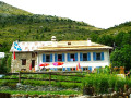
This seventeenth stage continues the crossing of the Mercantour massif. From Bousiéyas, the GR®5 climbs gently along the forest track, crosses the Tinée valley and reaches the small lake of Lauzarouotte. The path then crosses the Issias valley and reaches the Col de la Colombière. Winding its way down, it plunges straight into the Vallon de la Combe and, hugging the hillside, reaches the Rochepin chalet before returning to the bottom of the Vallon de la Combe and reaching Saint-Dalmas-le-Selvage. The GR®5 follows the Route d’Anelle, crossing a few torrents before reaching the Col d’Anelle. It descends to Saint-Étienne-de-Tinée, which it passes through, before entering the Tinée Valley. At the hamlet of Drogon, it winds its way up the valley side in a series of hairpin bends to the resort of Auron, then passes through woodland to reach the Col du Blainon before descending the sunny side of the Vallon de la Roya and arriving at the “Ma Vieille École” lodge.
Larche - Saint-Dalmas-le-Selvage
17.35 mi
+5,102 ft
-5,633 ft
12h 25
Difficult
Departure from Larche (Alpes-de-Haute-Provence)
Étape de la traversée des Alpes par le GR®5 de Larche à Saint Dalmas le Selvage. Passage dans le Parc National du Mercantour sauvage et authentique puis transition entre la Haute Tinée et le Vallon de Jalorgues avec un passage sur la plus haute route d'Europe vers le Col de la Bonnette.