


Refine your search for walks in Tenneville
Tenneville walks


 Around the Basseille Stream
 Visorando Member
 10.57 mi
 +1,043 ft
 -1,027 ft
 5h 45
5h 45
 Moderate
 Departure from Tenneville (Province de Luxembourg)
The Ruisseau de Basseille has its source in the Fagne de la Borne near the Saint-Hubert Aerodrome and flows into the western Ourthe near Ortheuville. This walk follows its course more or less closely for about 6 km.
Ardennes circular starting from Champlon
 10.52 mi
+961 ft
-935 ft
5h 40
Moderate
Departure from Tenneville (Province de Luxembourg)
10.52 mi
+961 ft
-935 ft
5h 40
Moderate
Departure from Tenneville (Province de Luxembourg)
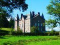
The hike takes you on a journey of discovery through the countryside and forests on the heights of the Deux Ourthes Natural Park. The balanced alternation between panoramic views and deciduous and coniferous forests provides all the ingredients for a beautiful and enjoyable outing in nature.
Passing through La Basseille
 5.27 mi
+673 ft
-673 ft
3h 00
5.27 mi
+673 ft
-673 ft
3h 00
 Easy
Departure from Tenneville (Province de Luxembourg)
Easy
Departure from Tenneville (Province de Luxembourg)
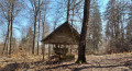
Set off to explore the River La Basseille, a tributary of the Ourthe which rises in Saint-Hubert. The river, whose banks form a Nature Reserve, flows exclusively through the Forest of Freyr for around 10 km.
Please note: there are two sections that are more difficult to follow; a GPX track is recommended.
Chapelle de la Bonne Dame and Cheslin Viewpoint
 6.15 mi
+725 ft
-705 ft
3h 30
Moderate
Departure from Sainte-Ode (Province de Luxembourg)
6.15 mi
+725 ft
-705 ft
3h 30
Moderate
Departure from Sainte-Ode (Province de Luxembourg)
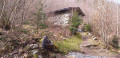
From the beautiful village of Lavacherie, set off to explore the Chapelle de la Bonne Dame and the Cheslin viewpoint. On your way back, pass by the Golet campsite and through the village streets, where magnificent houses built from local stone come into view.
Between Laval and the western Ourthe, starting from Lavacherie
 9.36 mi
+837 ft
-817 ft
5h 00
Moderate
Departure from Sainte-Ode (Province de Luxembourg)
9.36 mi
+837 ft
-817 ft
5h 00
Moderate
Departure from Sainte-Ode (Province de Luxembourg)
The valleys of the western Ourthe, its tributary the Laval, and the Orti Nature Reserve are particularly interesting at the start. After Wachirock, a succession of lovely countryside scenes unfolds, with panoramic views across this beautiful, rolling region. The stretch between Tillet and Amberloup offers a particularly relaxing atmosphere. The return journey along the outskirts of Tonny, through the countryside, in the undergrowth or along the edges of woodland, provides a very pleasant finale to this easy walk.Keen observers will probably spot the odd remnant of a work of art near the nature reserve, the gigantic white building of the holiday centre overlooking Amberloup, and the Château du Celly in the direction of the Cheslin Rocks. Happy spotting! Well worth a go in any season!
Cheslin loop
 10.40 mi
+1,198 ft
-1,201 ft
5h 50
Moderate
Departure from Sainte-Ode (Province de Luxembourg)
10.40 mi
+1,198 ft
-1,201 ft
5h 50
Moderate
Departure from Sainte-Ode (Province de Luxembourg)
This beautiful hike in Sainte-Ode takes you on a journey of discovery through the valleys of the Ourthe, Baseille and Laval streams, alternating between forest and pretty panoramic views of this region of the Ardennes, with a return trip through the Orti Nature Reserve.
A circular nature-filled loop starting from Cens
 11.38 mi
+1,070 ft
-1,073 ft
6h 10
Moderate
Departure from Tenneville (Province de Luxembourg)
11.38 mi
+1,070 ft
-1,073 ft
6h 10
Moderate
Departure from Tenneville (Province de Luxembourg)
Here is a circular walking route within the Two Ourthes Nature Park, offering a lovely mix of countryside and woodland (alternating between coniferous and deciduous trees) with magnificent views of the Ardennes hills between La Roche-en-Ardenne and the Pays de Bastogne. The section along the River Ourthe is wonderfully wild, and progress is slower here than on the wide country lanes to the north of the route. It is likely that this route would be impassable without getting your feet wet in the event of heavy flooding.
Circular Ardennes loop south of La Roche-en-Ardenne
 11.95 mi
+1,358 ft
-1,375 ft
6h 40
Moderate
Departure from La Roche-en-Ardenne (Province de Luxembourg)
11.95 mi
+1,358 ft
-1,375 ft
6h 40
Moderate
Departure from La Roche-en-Ardenne (Province de Luxembourg)
This circular route goes around a few villages south of La Roche-en-Ardenne, encroaching slightly on the territory of Tenneville.Although mainly forested, the route offers some beautiful panoramic views of the surrounding countryside and hills.
Circular route via Lavacherie
 13.01 mi
+866 ft
-846 ft
6h 45
13.01 mi
+866 ft
-846 ft
6h 45
 Difficult
Departure from Sainte-Ode (Province de Luxembourg)
Difficult
Departure from Sainte-Ode (Province de Luxembourg)
As a result, the walk is more rural than wooded, offering more panoramic views of this beautiful region. Whilst the natural scenery is lovely, don’t expect too many architectural or artistic highlights: there are a few works of art along the old country lane between Amberloup and Lavacherie, the Saint-Hubert Chapel in Bonnerue and the Church of Saint-Ouen in Tillet with its separate bell tower, but that’s about it.
The Art Trail of the Orti Nature Reserve
 2.59 mi
+92 ft
-105 ft
1h 15
Easy
Departure from Sainte-Ode (Province de Luxembourg)
2.59 mi
+92 ft
-105 ft
1h 15
Easy
Departure from Sainte-Ode (Province de Luxembourg)
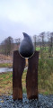
The walk begins in an orchard with heritage fruit varieties and an apiary, before following a sunken path that descends to the bottom of the Laval Valley. Beavers, ponds, artistic installations... so many discoveries await you.
In the Laval and Western Ourthe valleys
 6.15 mi
+453 ft
-430 ft
3h 15
Moderate
Departure from Sainte-Ode (Province de Luxembourg)
6.15 mi
+453 ft
-430 ft
3h 15
Moderate
Departure from Sainte-Ode (Province de Luxembourg)
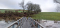
A few sculptures, a bit of nature reserve with the occasional sign of beavers here and there, and a bit of countryside: that’s what this walk has to offer.
Circular in the Heart of the Ardennes starting from La Roche
 11.00 mi
+945 ft
-945 ft
5h 55
Moderate
Departure from La Roche-en-Ardenne (Province de Luxembourg)
11.00 mi
+945 ft
-945 ft
5h 55
Moderate
Departure from La Roche-en-Ardenne (Province de Luxembourg)
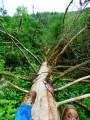
Starting from the Ronchamps pond, the walk begins by winding through the countryside before heading into the forest.Make sure you’re wearing suitable footwear, as the route follows a stream along a path overgrown with tall grass at the start and flooded with water towards the end. This valley is magnificent and wonderfully wild!The first climb of the route leads out into the countryside with a lovely view to the north over the hills of the Ourthe Valley.A short detour (off the route) to the centre of Beausaint allows you to admire its castle.From Beausaint to Vecmont, it’s (almost) straight ahead and through the countryside. There’s a small chapel and a picnic table between Ronchampay and Vecmont.Shortly after Vecmont, there is (unfortunately) a short kilometre of minor road before entering the woods, which the route leaves only briefly to cross the N89 again and finally return to the starting point.
Circular route within the future Nassonia National Park starting from Sapin Fî
 14.03 mi
+1,312 ft
-1,306 ft
7h 35
Difficult
Departure from Saint-Hubert (Belgique) (Province de Luxembourg)
14.03 mi
+1,312 ft
-1,306 ft
7h 35
Difficult
Departure from Saint-Hubert (Belgique) (Province de Luxembourg)
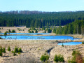
This circular walk follows the wide forest tracks through part of the future Nassonia National Park and the Deux-Ourthes Nature Park.Starting from the Sapin Fî car park, the walk first heads towards the Rouge Poncé birch forest and its boardwalks, then towards the Wallonia Log Park before branching off towards Mochamps, the Fagnes de Priesse observation tower and the Croix des Russes.After a long descent into the Rabani valley, the walk crosses the Masblette, the iconic river of Fourneau-Saint-Michel, via a small footbridge following the destruction of the two-arched stone bridge during the floods of summer 2021.On the return journey, the route climbs slowly but surely, following the Palogne stream back up to Sapin Fî.
The Sentier de la Girolle from Beauplateau
 11.25 mi
+853 ft
-866 ft
5h 55
Moderate
Departure from Sainte-Ode (Province de Luxembourg)
11.25 mi
+853 ft
-866 ft
5h 55
Moderate
Departure from Sainte-Ode (Province de Luxembourg)
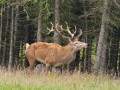
With beautiful panoramic views over the delightfully undulating countryside, this walk starting from the hamlet of Beauplateau is sure to delight many. Cow pastures dominate the landscape: there are few crops and no real woodland sections, although you do skirt round the odd copse here and there… and are sometimes in for a lovely surprise. Those who dislike tarmac, however, might want to give this a miss, even though the many small country roads taken aren’t particularly busy. The church at Tillet, with its freestanding bell tower, is well worth a visit.
Beauplateau and l’Agaric via the Côte de la Chapelle
 9.98 mi
+840 ft
-843 ft
5h 20
Moderate
Departure from Sainte-Ode (Province de Luxembourg)
9.98 mi
+840 ft
-843 ft
5h 20
Moderate
Departure from Sainte-Ode (Province de Luxembourg)
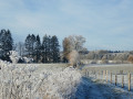
The Agaric walk, adapted here, offers a wide variety of landscapes along the route: sometimes wooded with scrub, sometimes with deciduous trees, and often open, with beautiful panoramic views of the neighbouring rolling countryside.
Around the hamlet of Beauplateau
 8.89 mi
+794 ft
-768 ft
4h 45
Moderate
Departure from Sainte-Ode (Province de Luxembourg)
8.89 mi
+794 ft
-768 ft
4h 45
Moderate
Departure from Sainte-Ode (Province de Luxembourg)
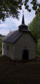
Starting from the hamlet of Beauplateau and the former convent built in 1880, set off to discover the Chapel of Notre-Dame de Lorette via covered and uncovered trails, roads and dirt tracks.
Around the Tram and Laval
 11.49 mi
+951 ft
-928 ft
6h 05
Moderate
Departure from Sainte-Ode (Province de Luxembourg)
11.49 mi
+951 ft
-928 ft
6h 05
Moderate
Departure from Sainte-Ode (Province de Luxembourg)
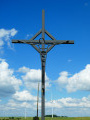
Le Laval is the name given to the stream that originates upstream of Magerotte and flows into the Western Ourthe at Sainte-Ode after passing through Magery, Houmont, Rechrival, Laval (near Laval Castle), Fosset and Sprimont.‘Le Tram’ is the former local railway line that linked Marche to Bastogne: you’ll only really see the route itself near the ‘Espace de jeux’ in Chenogne. A number of signposted walks have been marked out in the region based on this railway line.This highly scenic walk takes you through the rolling Ardennes countryside, with its meadows and farmland. There is only 1.5 km of woodland on this route, towards the end between Chenogne and the gigantic commemorative cross erected ‘in the middle of nowhere’.