


The River Lomme between Arville and Smuid


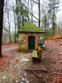
Starting from Arville cemetery, the walk heads due north at first, then turns west to reach the Chapelle du Cheny du Mont.
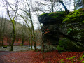
The second stop is the Rocher de Marie Gobaille, named after a legendary witch. It is from this point that the route begins to follow the course of the River Lomme upstream.
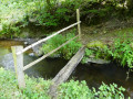
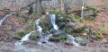
The third stop is the Sainte-Adeline Canal, running alongside the River Lomme, with its small hydroelectric power station and, further on, the old mill at Pont-à-Smuid.
This is followed by a short detour to the other side of the Brussels–Luxembourg railway line to follow the route of an old local track, and a return to the starting point after crossing both the River Lomme and the railway line once more and skirting the motocross route near the Ferme du Val-de-Poix.
The entire route runs through woodland from the second kilometre onwards.
Details
–
-
 Activity: Walking
 -
 Distance: 9.90 mi
 -
 Average duration: 5h 20
 -
 Difficulty: Moderate
 -
-
 Back to start: Yes
 -
 Ascent: + 938 ft
 -
 Descent: - 925 ft
 -
-
 Highest point: 1,385 ft
 -
 Lowest point: 938 ft
-
 Country:
Belgium
Country:
Belgium
-
 Area: Massif des Ardennes
 -
 City:
Saint-Hubert (Belgique)
City:
Saint-Hubert (Belgique) -
 Start/End: N 50.029795° / E 5.316551°
 -


 Hour-by-hour weather


Photos
Waypoints
- S/E : mi 0 - alt. 1,204 ft - Arville Cemetery
- 1 : mi 1.36 - alt. 1,339 ft - Chapel of Cheny du Mont
- 2 : mi 2.62 - alt. 945 ft - Marie Gobaille Rock and the River Lomme
- 3 : mi 2.85 - alt. 955 ft - Sainte-Adeline Canal
- 4 : mi 3.13 - alt. 951 ft - Micro hydroelectric power station
- 5 : mi 3.87 - alt. 994 ft - Old mill
- 6 : mi 5.83 - alt. 1,240 ft - Former local track
- 7 : mi 8.63 - alt. 1,158 ft - Motocross route
- S/E : mi 9.9 - alt. 1,204 ft - Arville Cemetery
Other walks in the area
In the woods of Arville
 Visorando Member
 9.45 mi
+823 ft
-827 ft
5h 05
Moderate
9.45 mi
+823 ft
-827 ft
5h 05
Moderate
 Departure from Saint-Hubert (Belgique) (Province de Luxembourg)
Circular forest loop between Poix-Saint-Hubert and Hatrival
 6.93 mi
+860 ft
-843 ft
3h 55
Moderate
Departure from Saint-Hubert (Belgique) (Province de Luxembourg)
6.93 mi
+860 ft
-843 ft
3h 55
Moderate
Departure from Saint-Hubert (Belgique) (Province de Luxembourg)
Family walk in Poix-Saint-Hubert
 4.62 mi
+528 ft
-512 ft
2h 35
4.62 mi
+528 ft
-512 ft
2h 35
 Easy
Departure from Saint-Hubert (Belgique) (Province de Luxembourg)
Easy
Departure from Saint-Hubert (Belgique) (Province de Luxembourg)
Walk in Val de Poix
 5.78 mi
+554 ft
-541 ft
3h 10
Easy
Departure from Saint-Hubert (Belgique) (Province de Luxembourg)
5.78 mi
+554 ft
-541 ft
3h 10
Easy
Departure from Saint-Hubert (Belgique) (Province de Luxembourg)
In the woods of Poix Saint-Hubert
 5.71 mi
+741 ft
-738 ft
3h 15
Moderate
Departure from Saint-Hubert (Belgique) (Province de Luxembourg)
5.71 mi
+741 ft
-738 ft
3h 15
Moderate
Departure from Saint-Hubert (Belgique) (Province de Luxembourg)
Ardennes getaway in Hatrival
 11.60 mi
+955 ft
-938 ft
6h 10
Moderate
Departure from Saint-Hubert (Belgique) (Province de Luxembourg)
11.60 mi
+955 ft
-938 ft
6h 10
Moderate
Departure from Saint-Hubert (Belgique) (Province de Luxembourg)
For more walks, use our search engine .
The GPS track and description are the property of this route's author. Please do not copy them without permission.

