


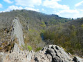
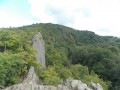
The walk follows the River Ourthe for roughly the first half of the route, passing by the Cresse des Chevaux, that enormous vertical rock face which can be admired from very close up and is also visible from the François Remy viewpoint, a few hundred metres further on.
Walkers looking for a bit more of a thrill can hold onto the chain to descend the path along the rock face, passing beneath the François Remy viewpoint and rejoining the route a little further on at a bend in the path towards Tiebiewe.
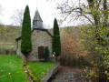
The route leaves the river and heads up the hill to the chapels of Ollomont and Notre-Dame de Halle, offering a short stretch through the countryside before re-entering the forest towards Bérismenil.
The return route is mainly through the countryside as far as Les Crestelles, a paragliding launch site offering a lovely view over the village of Maboge.
La Cresse des Chevaux


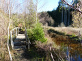
This walk is quite challenging, not so much because of its length or total elevation gain, but rather due to the number of obstacles encountered along the Ourthe: mud, water, rocks that are difficult to cross and fallen trees often force walkers to stray from the ‘official’ paths and wind their way both horizontally and vertically. Challenging, then, but well worth the trip. The more adventurous may want to take a short detour to the Cheslé site.
Details
–
-
 Activity: Walking
 -
 Distance: 10.23 mi
 -
 Average duration: 6h 00
 -
 Difficulty: Difficult
 -
-
 Back to start: Yes
 -
 Ascent: + 1,532 ft
 -
 Descent: - 1,532 ft
 -
-
 Highest point: 1,440 ft
 -
 Lowest point: 817 ft
-
 Country:
Belgium
Country:
Belgium
-
 Area: Massif des Ardennes
 -
 City:
La Roche-en-Ardenne
City:
La Roche-en-Ardenne -
 Start/End: N 50.173913° / E 5.632754°
 -


 Hour-by-hour weather
Photos
Description of the walk
Waypoints
- S/E : mi 0 - alt. 896 ft - Car park for access to Le Cheslé
- 1 : mi 1.06 - alt. 846 ft - Access path to Le Cheslé - Ourthe (rivière) - Belgique
- 2 : mi 2.02 - alt. 850 ft - Access path to Le Cheslé
- 3 : mi 4.11 - alt. 883 ft - Horsetail
- 4 : mi 4.32 - alt. 1,089 ft - Access to the Hérou site (car park, tower, restaurant)
- 5 : mi 4.38 - alt. 1,050 ft - François Remy viewpoint
- 6 : mi 4.86 - alt. 902 ft - Tîebièwé
- 7 : mi 5.45 - alt. 899 ft - Bend - Ourthe (rivière) - Belgique
- 8 : mi 5.92 - alt. 1,227 ft - Ollomont Chapel
- 9 : mi 6.1 - alt. 1,299 ft - Notre-Dame de Halle Chapel in Nadrin
- 10 : mi 8.36 - alt. 1,437 ft - Entrance to Bérismenil
- 11 : mi 9.35 - alt. 1,394 ft - WW2 Airmen’s Memorial
- 12 : mi 9.51 - alt. 1,355 ft - Crestelles viewpoint
- S/E : mi 10.23 - alt. 896 ft - Car park for access to Le Cheslé
Notes
Picnic tables at (1), just before (8), just after (9) and at (12).
Worth a visit
Completely off the route:
- The Nisramont dam and the confluence of the two Ourthes
- La Roche-en-Ardenne
- Houffalize
Other walks in the area
Borzée, or a beaver’s paradise
 Visorando Member
 10.21 mi
+1,490 ft
-1,463 ft
6h 00
10.21 mi
+1,490 ft
-1,463 ft
6h 00
 Moderate
 Departure from La Roche-en-Ardenne (Province de Luxembourg)
Mer and Belle Meuse starting from Bérismenil
 9.75 mi
+1,175 ft
-1,145 ft
5h 30
Moderate
Departure from La Roche-en-Ardenne (Province de Luxembourg)
9.75 mi
+1,175 ft
-1,145 ft
5h 30
Moderate
Departure from La Roche-en-Ardenne (Province de Luxembourg)
From Cheslé to Hérou
 6.28 mi
+981 ft
-981 ft
3h 45
Difficult
Departure from Houffalize (Province de Luxembourg)
6.28 mi
+981 ft
-981 ft
3h 45
Difficult
Departure from Houffalize (Province de Luxembourg)
Forest loop in the heart of the Ardennes via Samrée
 10.45 mi
+1,706 ft
-1,690 ft
6h 15
Moderate
Departure from La Roche-en-Ardenne (Province de Luxembourg)
10.45 mi
+1,706 ft
-1,690 ft
6h 15
Moderate
Departure from La Roche-en-Ardenne (Province de Luxembourg)
An Ardennes getaway in the heart of the forest at Borzée
 10.66 mi
+1,358 ft
-1,385 ft
6h 05
Moderate
Departure from La Roche-en-Ardenne (Province de Luxembourg)
10.66 mi
+1,358 ft
-1,385 ft
6h 05
Moderate
Departure from La Roche-en-Ardenne (Province de Luxembourg)
The two Ourthes rivers and the Nisramont Dam
4.71 mi
+850 ft
-846 ft
2h 55
Moderate
Departure from La Roche-en-Ardenne (Province de Luxembourg)
Around the Aisne tourist tramway between Dochamps and Lamorménil
 11.05 mi
+1,119 ft
-1,129 ft
6h 05
Moderate
Departure from Manhay (Province de Luxembourg)
11.05 mi
+1,119 ft
-1,129 ft
6h 05
Moderate
Departure from Manhay (Province de Luxembourg)
Circular loop at the source of the Aisne
 10.00 mi
+715 ft
-715 ft
5h 15
Moderate
Departure from Manhay (Province de Luxembourg)
10.00 mi
+715 ft
-715 ft
5h 15
Moderate
Departure from Manhay (Province de Luxembourg)
For more walks, use our search engine .
The GPS track and description are the property of this route's author. Please do not copy them without permission.

