Chapelle de la Bonne Dame and Cheslin Viewpoint

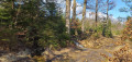
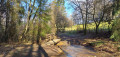
From the beautiful village of Lavacherie, set off to explore the Chapelle de la Bonne Dame and the Cheslin viewpoint. On your way back, pass by the Golet campsite and through the village streets, where magnificent houses built from local stone come into view.

Details

6550390
Creation:
Last update:
Last review:
  • Walking
    Activity: Walking
  • ↔
    Distance: 6.15 mi
  • ◔
    Average duration: 3h 30 
  • ▲
    Difficulty: Moderate

  • ⚐
    Back to start: Yes
  • ↗
    Ascent: + 725 ft
  • ↘
    Descent: - 705 ft

  • ▲
    Highest point: 1,752 ft
  • ▼
    Lowest point: 1,171 ft

Photos

Description of the walk

Car park with 3 spaces near the Pro Patria Monument on Place de l’Église.

GR®57signposting

(S/E) With your back to the rear of the church, head east along Rue de Bastogne. Walk straight on for about 800 m. As you do so, you’ll pass the Saint-Roch Chapel, then cross the La Mâle Racine stream, above the Ourthe Occidentale. You’ll reach a junction; the Moulin de la Gottale is visible on your right.

(1) Turn left onto Rue de Hiémont. At the bend, carry on straight ahead along the path which is closed to motorbikes – there is a sign at the entrance to the path. Follow the forest track until you reach the road.

(2) Turn left. Look out for beaver tracks on the verge (March 2021). Ignore the dirt track at the next bend in the road. Signposting ends here.

No signposting

Stay on the road and cross over the Ourthe Occidentale. At the junction with the N829, turn right. You’ll come to a forest track branching off to the left.

Blue Rectangle Signposting

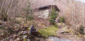
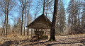
(3) Head up the path towards La Bonne Dame. At the multi-way junction, take the central path straight ahead. Discover the waterfall and the chapel.

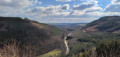
(4) Take the path leading uphill, right next to the chapel. At the crossroads, carry on straight ahead along the uphill path. At thesecond crossroads, continue straight ahead again along the uphill path. Emerge into the open and climb up to the Cheslin Viewpoint.

(5) At the top, head towards the magnificent viewpoint overlooking the valley and Lavacherie. Retrace your steps, leaving the path you came from on your left and heading straight on. Ignore the next path on your left. At the crossroads, carry on straight ahead. The signposting ends here.

No signposting

(6) Take the path on the right. At the T-junction, carry on straight ahead. Continue straight on for about 1 km 100, crossing three streams that cut across the forest track from time to time, until you reach an open junction.

(7) Carry on straight ahead and then head down to the right. At the road, turn left. At the next junction, on your left, is the Golet campsite. Take the forest track leading uphill to the left of the campsite.

Blue Rectangle signposting

(8) At the multi-way junction, carry on straight ahead. At the next junction, turn right. At the T-junction, turn left. Walk until you see a gate. Just before the gate, turn right. Walk downhill for about 250 m; a stream also follows this path – don’t let it distract you. Look out for a fork in the road that isn’t shown on the IGN map.

(9) Turn slightly left. The stream continues along the other path. Walk downhill; you’ll have a clear view of Amberloup in the distance. You’ll reach a wide forest track; cross it and carry on straight ahead. The path turns right and widens. A stream crosses the path. At the crossroads, carry on straight ahead. Lift the gate to open it and pull the latch.

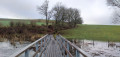
(10) On your left, take the footbridge over the Ruisseau de Bockaissart. The path becomes a road. At the junction with a huge oak tree and its wayside shrine, carry on straight ahead. At the N829, turn right, walk past the church and return to your car park (S/E).


Waypoints

  1. S/E : mi 0 - alt. 1,250 ft - Car park with 3 spaces at Place de l’Eglise
  2. 1 : mi 0.48 - alt. 1,194 ft - Moulin de Gottale junction
  3. 2 : mi 1.22 - alt. 1,191 ft - Route
  4. 3 : mi 1.49 - alt. 1,214 ft - Path to La Bonne Dame
  5. 4 : mi 1.96 - alt. 1,325 ft - Path near the Chapel
  6. 5 : mi 2.26 - alt. 1,486 ft - Le Cheslin viewpoint
  7. 6 : mi 2.32 - alt. 1,503 ft - Fork in the road after the crossroads
  8. 7 : mi 3.21 - alt. 1,509 ft - Crossroads with a clear view
  9. 8 : mi 3.87 - alt. 1,519 ft - Multiple junctions
  10. 9 : mi 4.68 - alt. 1,680 ft - Abandoned fork in the road ru
  11. 10 : mi 5.5 - alt. 1,398 ft - Barrier
  12. S/E : mi 6.15 - alt. 1,250 ft - Car park with 3 spaces at Place de l’Eglise

Notes

Car park also available on Rue Le Jardin.

There is no drinking water along the route without filtration.

There are still two climbs on this route, but they are long and steady.

Picnic tables: before (1), after (1)
Benches: at La Chapelle (4), at the Golet campsite after (7) and at (10)

Very muddy depending on the time of year; good waterproof footwear is strongly recommended. There are many streams crossing the paths from the Golet campsite.

From October to December, please be aware of the hunting season dates.

The first Sunday in May: a walk to the chapel accompanied by a brass band. The walk is organised by the village associations. Mass is held at the chapel.

Bivouac du Golet: where any walker, horse rider or cyclist can set up camp for one night (from 5 pm to 9 am) in the heart of the countryside (no long-term camping). In Belgium, wild camping (outside official sites, campsites or private land) is strictly prohibited. No motor vehicles, caravans or trailers are permitted there.

Worth a visit

Nearby

Chapelle de la Bonne Dame: built from local stone found on site. Read more here

A so-called ‘miraculous’ spring at the foot of the chapel: said to heal damaged or tired eyes

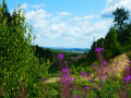
Le Cheslin: viewpoint over the valley and the village of Lavacherie

Golet campsite

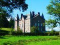
Magnificent houses built from local Lavacherie stone

Always be cautious and plan ahead when you're outdoors. Visorando and the author of this route cannot be held responsible for any accidents occurring on this route.

The GR® and PR® markings are the intellectual property of the Fédération Française de Randonnée Pédestre.

Reviews and comments

4.4 / 5
Based on 3 reviews

Reliability of the description
4.7 / 5
Ease of following the route
4.3 / 5
Route interest
4.3 / 5
Emmanuel Jacquin
Emmanuel Jacquin

Overall rating : 5 / 5

Date of your route : Mar 31, 2025
Reliability of the description : ★★★★★ Very good
Ease of following the route : ★★★★★ Very good
Route interest : ★★★★★ Very good
Very busy route : No

A lovely route. Stunning views across two slopes in succession.

Machine-translated

Olivier5100
Olivier5100

Overall rating : 4.7 / 5

Date of your route : Aug 25, 2023
Reliability of the description : ★★★★★ Very good
Ease of following the route : ★★★★☆ Good
Route interest : ★★★★★ Very good
Very busy route : No

A lovely walk full of discoveries and history.
The Cheslin Viewpoint offers a magnificent view of the Ourthe Valley.
Well worth a visit.

Machine-translated

TABURIAUX j c
TABURIAUX j c

Overall rating : 3.7 / 5

Date of your route : May 17, 2021
Reliability of the description : ★★★★☆ Good
Ease of following the route : ★★★★☆ Good
Route interest : ★★★☆☆ Average
Very busy route : No

a lovely walk

Machine-translated

lazzerini
lazzerini

Unfortunately, on Monday 26 April 2021, a bush fire broke out at the Point de Vue du Cheslin.

Machine-translated

Other walks in the area

For more walks, use our search engine .

The GPS track and description are the property of this route's author. Please do not copy them without permission.