


You can get there by public transport.
Bus stops at Rechrival, Pinsamont, Poisson-Moulin and Chenogne.
Please check timetables with the TEC (Wallonia’s public transport service).
Around the Tram and Laval


Le Laval is the name given to the stream that originates upstream of Magerotte and flows into the Western Ourthe at Sainte-Ode after passing through Magery, Houmont, Rechrival, Laval (near Laval Castle), Fosset and Sprimont.
‘Le Tram’ is the former local railway line that linked Marche to Bastogne: you’ll only really see the route itself near the ‘Espace de jeux’ in Chenogne. A number of signposted walks have been marked out in the region based on this railway line.
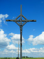
This highly scenic walk takes you through the rolling Ardennes countryside, with its meadows and farmland. There is only 1.5 km of woodland on this route, towards the end between Chenogne and the gigantic commemorative cross erected ‘in the middle of nowhere’.
Details
Creation:
Last update:
Last review:
–
–
-
 Activity: Walking
 -
 Distance: 11.49 mi
 -
 Average duration: 6h 05
 -
 Difficulty: Average
 -
-
 Back to start: Yes
 -
 Ascent: + 951 ft
 -
 Descent: - 928 ft
 -
-
 Highest point: 1,729 ft
 -
 Lowest point: 1,352 ft
-
 Country:
Belgium
Country:
Belgium
-
 Area: Massif des Ardennes
 -
 City:
Sainte-Ode
City:
Sainte-Ode -
 Start/End: N 50.011778° / E 5.580647°
 -


 Hour-by-hour weather
Photos
Waypoints
- S/E : mi 0 - alt. 1,463 ft - Hubermont Church
- 1 : mi 0.32 - alt. 1,381 ft - Rechrival
- 2 : mi 0.37 - alt. 1,352 ft - Bus stop
- 3 : mi 2.15 - alt. 1,499 ft - Pinsamont – bus stop
- 4 : mi 2.88 - alt. 1,427 ft - Picnic table
- 5 : mi 3.58 - alt. 1,512 ft - Magerotte Cemetery
- 6 : mi 5.8 - alt. 1,496 ft - Copon
- 7 : mi 7.28 - alt. 1,555 ft - Poisson-Moulin – bus stop
- 8 : mi 8.63 - alt. 1,565 ft - Chenogne
- 9 : mi 10.83 - alt. 1,588 ft - Commemorative cross
- S/E : mi 11.49 - alt. 1,463 ft - Hubermont Church
Notes
Other walks in the area
In the Laval and Western Ourthe valleys
 Visorando Member
 6.15 mi
+453 ft
-430 ft
3h 15
Average
6.15 mi
+453 ft
-430 ft
3h 15
Average
 Departure from Sainte-Ode (Province de Luxembourg)
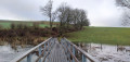
A few sculptures, a bit of nature reserve with the occasional sign of beavers here and there, and a bit of countryside: that’s what this walk has to offer.
Around the hamlet of Beauplateau
 8.89 mi
+794 ft
-768 ft
4h 45
Average
Departure from Sainte-Ode (Province de Luxembourg)
8.89 mi
+794 ft
-768 ft
4h 45
Average
Departure from Sainte-Ode (Province de Luxembourg)
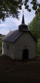
Starting from the hamlet of Beauplateau and the former convent built in 1880, set off to discover the Chapel of Notre-Dame de Lorette via covered and uncovered trails, roads and dirt tracks.
The Art Trail of the Orti Nature Reserve
 2.59 mi
+92 ft
-105 ft
1h 15
2.59 mi
+92 ft
-105 ft
1h 15
 Easy
Departure from Sainte-Ode (Province de Luxembourg)
Easy
Departure from Sainte-Ode (Province de Luxembourg)
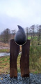
The walk begins in an orchard with heritage fruit varieties and an apiary, before following a sunken path that descends to the bottom of the Laval Valley. Beavers, ponds, artistic installations... so many discoveries await you.
Cheslin loop
 10.40 mi
+1,198 ft
-1,201 ft
5h 50
Average
Departure from Sainte-Ode (Province de Luxembourg)
10.40 mi
+1,198 ft
-1,201 ft
5h 50
Average
Departure from Sainte-Ode (Province de Luxembourg)
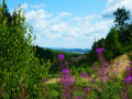
This beautiful hike in Sainte-Ode takes you on a journey of discovery through the valleys of the Ourthe, Baseille and Laval streams, alternating between forest and pretty panoramic views of this region of the Ardennes, with a return trip through the Orti Nature Reserve.
Chapelle de la Bonne Dame and Cheslin Viewpoint
 6.15 mi
+725 ft
-705 ft
3h 30
Average
Departure from Sainte-Ode (Province de Luxembourg)
6.15 mi
+725 ft
-705 ft
3h 30
Average
Departure from Sainte-Ode (Province de Luxembourg)
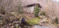
From the beautiful village of Lavacherie, set off to explore the Chapelle de la Bonne Dame and the Cheslin viewpoint. On your way back, pass by the Golet campsite and through the village streets, where magnificent houses built from local stone come into view.
Rolley Pond and the water tower
5.73 mi
+318 ft
-305 ft
2h 55
Average
Departure from Bastogne (Province de Luxembourg)
A walk through fields and woodland, taking in an old water tower and a magnificent pond.
Remience Route
 12.07 mi
+627 ft
-633 ft
6h 05
12.07 mi
+627 ft
-633 ft
6h 05
 Difficult
Departure from Vaux-sur-Sûre (Province de Luxembourg)
Difficult
Departure from Vaux-sur-Sûre (Province de Luxembourg)
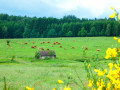
Once upon a time, there was a railway line numbered 163 that linked Libramont to Gouvy via Bastogne. It is the small stretch of the Ardennes situated between Remience and Morhet, to the north of this disused railway line, that this walk invites you to discover.The alternation between forest and countryside provides the variety of experiences essential to any good walk.Although there are a few rather gloomy stretches of pine forest here and there, the walk ends with a splendid stretch of forest, as wild as you could wish for, around the 18 km mark.Architecture-wise: a small castle hidden in the woods near Morhet Station and the Chapel of Remience (where a touch of AI helps remove the countless power lines that spoil the photos).
A circular nature-filled loop starting from Cens
 11.38 mi
+1,070 ft
-1,073 ft
6h 10
Average
Departure from Tenneville (Province de Luxembourg)
11.38 mi
+1,070 ft
-1,073 ft
6h 10
Average
Departure from Tenneville (Province de Luxembourg)
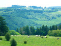
Here is a circular walking route within the Two Ourthes Nature Park, offering a lovely mix of countryside and woodland (alternating between coniferous and deciduous trees) with magnificent views of the Ardennes hills between La Roche-en-Ardenne and the Pays de Bastogne. The section along the River Ourthe is wonderfully wild, and progress is slower here than on the wide country lanes to the north of the route. It is likely that this route would be impassable without getting your feet wet in the event of heavy flooding.
For more walks, use our search engine .
The GPS track and description are the property of this route's author. Please do not copy them without permission.

