Refine your search for walks in Tavaco
Tavaco walks


 Punta Sant’Eliseu from Tavaco
 Visorando Member
 4.85 mi
 +2,582 ft
 -2,595 ft
 4h 30
4h 30
 Moderate
 Departure from Tavaco (Corse-du-Sud)
This walk starts in the heart of the village of Tavaco, situated in a lush green valley surrounded by imposing mountains, and leads to Punta Sant’Eliseu and its orientation table.
Punta Sant'Eliseu from the Col de Tartavello
 4.15 mi
+1,660 ft
-1,660 ft
3h 20
Moderate
Departure from Salice (Corse-du-Sud)
4.15 mi
+1,660 ft
-1,660 ft
3h 20
Moderate
Departure from Salice (Corse-du-Sud)
Through the Corsican vegetation of tree heath, arbutus and pine trees, the discreet path leading to Punta Sant'Eliseu is sometimes peaceful, sometimes challenging. The arrival at the summit offers a superb panoramic view of the bays of Sagone, Liscia and Ajaccio to the west and Monte Renoso and Monte D'Oro to the east. Closer by, below, the villages highlight the gentleness of the Gravone valley.
Punta Sant’Eliséo
 4.73 mi
+1,978 ft
-1,965 ft
3h 55
Moderate
Departure from Salice (Corse-du-Sud)
4.73 mi
+1,978 ft
-1,965 ft
3h 55
Moderate
Departure from Salice (Corse-du-Sud)
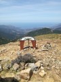
This summit offers a fantastic vantage point over the gulfs of Ajaccio and Sagone, as well as three of the island’s major mountains – a fabulous 360° view.
Please note: some sections require you to use your hands as well as your feet.
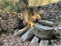
Discovering the mills of Cuttoli
 1.50 mi
+636 ft
-640 ft
1h 15
1.50 mi
+636 ft
-640 ft
1h 15
 Easy
Departure from Cuttoli-Corticchiato (Corse-du-Sud)
Easy
Departure from Cuttoli-Corticchiato (Corse-du-Sud)
A beautiful, short walk to discover old mills.
Punta di à Vita
 6.81 mi
+1,673 ft
-1,654 ft
4h 35
Moderate
Departure from Sari-d'Orcino (Corse-du-Sud)
6.81 mi
+1,673 ft
-1,654 ft
4h 35
Moderate
Departure from Sari-d'Orcino (Corse-du-Sud)
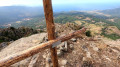
An easy hike from Sari d'Orcino to the two Punta di à Vita peaks: one as indicated on the maps, the other as written on the cross at its summit. Much of the trail is marked in yellow as far as Bocca di à Vita.
The Chemin des Charbonniers, ridge route, starting from Poggiale
 3.27 mi
+1,142 ft
-1,171 ft
2h 30
Moderate
Departure from Valle-di-Mezzana (Corse-du-Sud)
3.27 mi
+1,142 ft
-1,171 ft
2h 30
Moderate
Departure from Valle-di-Mezzana (Corse-du-Sud)
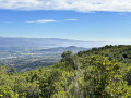
Take the Chemin des Charbonniers on a family walk, learn about their trade and see the stages of charcoal production.
Punta San Damiano
5.35 mi
+1,906 ft
-1,903 ft
4h 05
Moderate
Departure from Sari-d'Orcino (Corse-du-Sud)
A short, well-shaded hike in the morning, close to the coast in the Gulf of Liscia, starting from the beautiful village of Sari d'Orcino. Beautiful 360° view at the summit.
Mont d'Aragnascu loop
 5.11 mi
+1,243 ft
-1,224 ft
3h 25
Moderate
Departure from Cuttoli-Corticchiato (Corse-du-Sud)
5.11 mi
+1,243 ft
-1,224 ft
3h 25
Moderate
Departure from Cuttoli-Corticchiato (Corse-du-Sud)
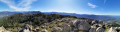
This is a great hike, best done in the morning. Superb views of the Prunelli and Gravone valleys. No difficulties, very well marked route in yellow.
Punta San Petru from Ocana
 5.81 mi
+2,766 ft
-2,759 ft
5h 05
5.81 mi
+2,766 ft
-2,759 ft
5h 05
 Difficult
Departure from Corse-du-Sud
Difficult
Departure from Corse-du-Sud
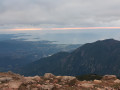
Shady climb to the ridge between Punta San Pietru and Alcadina. Superb view of Aragnascu, Lake Todda, the snow-capped peaks (in winter) and the entire Gulf of Ajaccio. Steeper than the north side, the climb is steep from the start in Ocana.
Punta d’Isa circular route
 Association / Club / Walk leader
 4.51 mi
+2,041 ft
-2,021 ft
3h 50
Moderate
Departure from Tavera (Corse-du-Sud)
4.51 mi
+2,041 ft
-2,021 ft
3h 50
Moderate
Departure from Tavera (Corse-du-Sud)
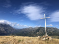
At an altitude of 1,630 m and close to Ajaccio, this easily accessible peak offers stunning views over the Gravona Valley.
Rather than the quick, direct route to the summit from the Col de Scalella, opt for the longer, gentler circular route, with its stunning scenery.
Punta San Sisto from Appietto
6.10 mi
+1,709 ft
-1,716 ft
4h 20
Moderate
Departure from Appietto (Corse-du-Sud)
A very beautiful hike a few kilometres from Ajaccio with magnificent views of the surrounding gulfs and peaks. This walk combines part of the PR® trail between Appietto and Calcatoggio, a magnificent walk along the ridges and numerous points of interest such as the ruins of an old chapel, a dolmen and a stone castle!
Circular route of Rocher des Gozzi and Punta Pastinaca
5.70 mi
+2,018 ft
-2,014 ft
4h 25
Moderate
Departure from Appietto (Corse-du-Sud)
A superb hike to share with others. Circular walk around the popular Rocher des Gozzi, which then climbs back up towards Punta Pastinaca. It continues on to Punta Curbajola, then descends towards the stream to reach Bocca a Foce. It then climbs back up towards San Sisto. It offers 360° views and a chance to share a moment sheltered from the wind in the old chapel.
Rocher des Gozzi and Punta Pastinaca in Apietto
 4.15 mi
+1,375 ft
-1,348 ft
3h 05
Moderate
Departure from Appietto (Corse-du-Sud)
4.15 mi
+1,375 ft
-1,348 ft
3h 05
Moderate
Departure from Appietto (Corse-du-Sud)
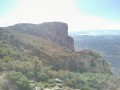
This hike on the outskirts of Ajaccio leads to the Rocher des Gozzi, a red granite cliff, at the top of which there is an exceptional view of the Gulf of Lava, then Ajaccio with its airport and the points of Isulella, Castagna and Capu di Muru, and the Gravone valley.
From Punta Pastinaca, the view is completed to the east by the magnificent view of Monte Rotondo, Monte d'Oro and Monte Renoso and the Gravone valley.
Monte Gozzi
 3.62 mi
+1,060 ft
-1,037 ft
2h 35
Moderate
Departure from Appietto (Corse-du-Sud)
3.62 mi
+1,060 ft
-1,037 ft
2h 35
Moderate
Departure from Appietto (Corse-du-Sud)
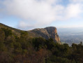
A short walk to enjoy with the family early in the morning, offering magnificent views of Ajaccio Bay and the Gulf of Lava.
Bastelica Circular Loop
 4.33 mi
+1,637 ft
-1,608 ft
3h 25
Moderate
Departure from Bastelica (Corse-du-Sud)
4.33 mi
+1,637 ft
-1,608 ft
3h 25
Moderate
Departure from Bastelica (Corse-du-Sud)
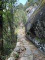
If you don’t like out-and-back routes, here is a circular route that can be done starting from Bastelica. It will allow you to see the Ortola waterfall. You will also pass through the pig farms on this walk.
Ortala waterfall from Bastelica
 3.42 mi
+1,289 ft
-1,280 ft
2h 40
Moderate
Departure from Bastelica (Corse-du-Sud)
3.42 mi
+1,289 ft
-1,280 ft
2h 40
Moderate
Departure from Bastelica (Corse-du-Sud)
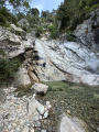
A short hike starting from Bastelica, following the Volta Canal and leading to the Ortola Waterfall. You will pass through a magnificent forest of old chestnut trees.
u Muricintu sheepfold
 4.96 mi
+2,031 ft
-2,001 ft
4h 05
Moderate
Departure from Bocognano (Corse-du-Sud)
4.96 mi
+2,031 ft
-2,001 ft
4h 05
Moderate
Departure from Bocognano (Corse-du-Sud)
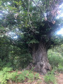
A walk through the hills above Bocognano to reach the u Muricintu sheepfold. After a long climb through chestnut and beech woods, followed by a section along the ridge, you will reach the sheepfold beside a stream and in the cool shade of the alders.
The Voile de la Mariée waterfall from Bocognano
 4.90 mi
+1,135 ft
-1,145 ft
3h 15
Moderate
Departure from Bocognano (Corse-du-Sud)
4.90 mi
+1,135 ft
-1,145 ft
3h 15
Moderate
Departure from Bocognano (Corse-du-Sud)
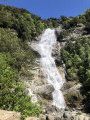
Walk under the oak trees connecting the village of Bocognano to Piscia di Tavera Vechja, also known as the "Voile de la Mariée" waterfall.
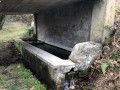
The Ciamburanesi fountains
 1.44 mi
+246 ft
-249 ft
0h 55
Easy
Departure from Bocognano (Corse-du-Sud)
1.44 mi
+246 ft
-249 ft
0h 55
Easy
Departure from Bocognano (Corse-du-Sud)
A family walk starting from Bocognano, taking you back in time to the village of yesteryear.
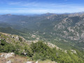
Punta Capiteddu as seen from Bocognano
 5.57 mi
+3,366 ft
-3,360 ft
5h 30
5.57 mi
+3,366 ft
-3,360 ft
5h 30
 Very difficult
Departure from Bocognano (Corse-du-Sud)
Very difficult
Departure from Bocognano (Corse-du-Sud)
A 1,000-metre ascent, above the village of Bocognano, with some steep sections, awaits hikers on this route. The path is sometimes tricky due to frequent fallen trees, which occasionally alter the route. Markings become sparser in the final third. The use of a GPS and walking poles is strongly recommended.
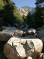
Circular Ricchiusa
 3.38 mi
+1,699 ft
-1,696 ft
3h 00
Moderate
Departure from Bocognano (Corse-du-Sud)
3.38 mi
+1,699 ft
-1,696 ft
3h 00
Moderate
Departure from Bocognano (Corse-du-Sud)
At an altitude of 850 metres, there is a view of Bocognano and the Gravone valley.
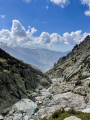
The A Tanedda Glacier
 6.16 mi
+3,343 ft
-3,343 ft
5h 45
Very difficult
Departure from Bocognano (Corse-du-Sud)
6.16 mi
+3,343 ft
-3,343 ft
5h 45
Very difficult
Departure from Bocognano (Corse-du-Sud)
A hike leading to the A Tanedda glacier (or more precisely, the snowfield). This site was used fromthe 17th to the early19th century for the ice trade. After extraction, the ice was transported to Ajaccio. A beautiful ascent, alternating between shaded and sunny areas, which will give you a sense of the harshness of life in days gone by.
Circular loop at Le Corbu
 1.81 mi
+587 ft
-610 ft
1h 20
Moderate
Departure from Bocognano (Corse-du-Sud)
1.81 mi
+587 ft
-610 ft
1h 20
Moderate
Departure from Bocognano (Corse-du-Sud)
A walk through the pine trees. From the top, you can see the village of Bocognano.
Monte Tretorre from Guagno
 6.93 mi
+2,825 ft
-2,815 ft
5h 40
Difficult
Departure from Guagno (Corse-du-Sud)
6.93 mi
+2,825 ft
-2,815 ft
5h 40
Difficult
Departure from Guagno (Corse-du-Sud)
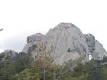
This walk leads to the unusual Monte Tretorre (1,506 m), a geological rarity comprising a trifid summit (three sugar loaves) of syenite. This summit offers a superb vantage point, overlooking a dense forest. To the west, Monte Cervellu (1,624 m) towers above.
Punta d'Urghjavari from Quasquara
 4.89 mi
+1,998 ft
-1,978 ft
4h 00
Moderate
Departure from Quasquara (Corse-du-Sud)
4.89 mi
+1,998 ft
-1,978 ft
4h 00
Moderate
Departure from Quasquara (Corse-du-Sud)
A round-trip hike starting from the small village of Quasquara, leading to the Punta d’Urghjavari (1,345 m), partly following a section ofthe GR® Mare à Mare Centre trail. The ascent passes through a forest of centuries-old chestnut trees up to the Col de Foce. The view then opens up to reveal the Taravo valley and its villages. The final, sometimes steep, ascent to the peak follows a narrow, well-marked path with a few rocky sections. At the summit, a 360° panoramic view stretches over the Taravo valley to the south and the Ajaccio region to the north-west.
Circular loop through the Bois des Anglais
2.67 mi
+682 ft
-705 ft
1h 50
Easy
Departure from Ajaccio (Corse-du-Sud)
A simple, quick and shaded route in the hills above Ajaccio with beautiful views of the gulf.