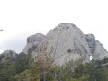
Monte Tretorre from Guagno

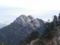
This walk leads to the unusual Monte Tretorre (1,506 m), a geological rarity comprising a trifid summit (three sugar loaves) of syenite. This summit offers a superb vantage point, overlooking a dense forest. To the west, Monte Cervellu (1,624 m) towers above.

Details

n°226141
Creation:
Last update:
Last review:
  • Walking
    Activity: Walking
  • ↔
    Distance: 6.93 mi
  • ◔
    Average duration: 5h 40 
  • ▲
    Difficulty: Difficult

  • ⚐
    Back to start: Yes
  • ↗
    Ascent: + 2,825 ft
  • ↘
    Descent: - 2,815 ft

  • ▲
    Highest point: 4,839 ft
  • ▼
    Lowest point: 2,290 ft
  • ⚐ Country: France
  • ⚐ City: Guagno (20160)
  • ⚑
    Start/End: N 42.168284° / E 8.950123°
  • ❏
    IGN map(s): Ref. 4251OT, 4251OTR
  • Hour-by-hour weather

Photos

Description of the walk

Parking is available on the main street near the church in the village.

(S/E) Walk round the back of the church and take a tarmac path down to the lower street. At the T-junction, turn left. Soon after, take the first alleyway on the right (signposted for the Tretorre path). The road becomes a track.

(1) Take a small path on the left (signposted) which descends towards the Albelli stream; cross it via a footbridge. The path then climbs through the forest with a few hairpin bends (irregular orange markings). Once you reach a recently created track, the path climbs steeply for 50 metres through a sandy area to join the wide track above

N.B. This new track does not yet appear on maps). Do not hesitate to mark this access point, either on the ground or with a stone, to make it easier to find on the way back (there are no signposts or directions whatsoever).

(2) Follow the track to the right, heading uphill, to reach Bocca du Campu d’Occhiu.

(3) At Bocca du Campu d’Occhiu (large turning area), take the path opposite, in line with the approach track (orange markings). Then follow the track to the right, which crosses meadows of asphodels and through the undergrowth.

(4) At the foot of Mount Tretorre, there are two options:
- Generally recommended option: take a break and then turn back.
- Option (marked on the map) for walkers familiar with climbing and unafraid of heights: a grassy, rocky gully leads up to the intermediate summit of the Trétorre, from where a magnificent view unfolds. Caution! Difficult climb and a sheer cliff at the summit; may cause vertigo: this option is reserved for experienced walkers.

(4) For the return journey, follow the same route in the opposite direction.

(2) Please note: on the wide track, do not miss the entrance to the path leading down to Guagno (this access is not signposted) and make your way back to the car park (S/E).

Waypoints

  1. S/E : mi 0 - alt. 2,503 ft - Start near the church in Guagno
  2. 1 : mi 0.17 - alt. 2,388 ft - Start of the trail
  3. 2 : mi 1.83 - alt. 3,894 ft - Access to a wide track – Make a note of this for the return journey
  4. 3 : mi 2.1 - alt. 3,963 ft - Boca di campu d’occhiu.
  5. 4 : mi 3.25 - alt. 4,498 ft - Access route to the Trétorre. Dangerous section
  6. S/E : mi 6.93 - alt. 2,513 ft - Return to the area near the church in Guagno.

Notes

Access: reach Guagno via the RD 23 from Vico. Walk through the village to the upper part and park near the church, the starting point.

Reviews and comments

4.3 / 5
Based on 2 reviews

Reliability of the description
4.5 / 5
Ease of following the route
4.5 / 5
Route interest
4 / 5
Dominik Moll
Dominik Moll

Overall rating : 5 / 5

Date of your route : Jul 30, 2021
Reliability of the description : ★★★★★ Very good
Ease of following the route : ★★★★★ Very good
Route interest : ★★★★★ Very good
Very busy route : No

A lovely walk to a truly unique and magical peak. Walk completed on 30 July 2021. The path has recently been cleared (thanks to the ‘Brigades Vertes’), and the markings (yellow stripes) and signposts have been renewed. It’s impossible to go wrong. The only point that isn’t very well signposted is right at the start, where the path begins (1) from the tarmac track.
The ascent is shaded, with some beautiful, hundred-year-old chestnut trees.
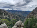
After Bocca di Campo Occhiu (3), the path runs along a ridge with lovely views over the surrounding valleys and mountain ranges. Up to the foot of Mount Tretorre, the hike is of moderate difficulty (due to the elevation gain, but with no technical difficulties).
This walk is well worth doing even if you stop at the foot of Mount Tretorre; you can admire its distinctive shape with the gullies carved out by the rain – it looks like a sacred mountain in Indian territory.
The climb to the summit of Mont Tretorre is well worth the effort but becomes much more technical and difficult. The grassy, rocky gully presents some real challenges in the first half, where you have to negotiate large boulders (you’ll regularly need to use your hands), but becomes easier in the second half (a steep but grassy path). Do not attempt this if you do not feel confident. At the top of the climb, you emerge onto a sort of large platform or balcony with magnificent views (and it’s fairly safe as long as you don’t go near the edges).
For the final section, a rope has been installed to aid the ascent of the main dome (July 2021). It makes the climb to the summit much easier, but this route is still reserved for experienced walkers who aren’t afraid of heights, as Patricklanglois’s description already points out.
Once at the summit, there’s a splendid 360° view.
Duration: 5 hours 30 minutes return, not including breaks.
Please note: there are no water sources along the route.

Machine-translated

jeannot15
jeannot15

Overall rating : 3.7 / 5

Date of your route : Aug 08, 2017
Reliability of the description : ★★★★☆ Good
Ease of following the route : ★★★★☆ Good
Route interest : ★★★☆☆ Average

A lovely walk – on the way back, the two of us carried on along the track and came down via the Mare à Mare route

Machine-translated

Other walks in the area

For more walks, use our search engine .

The GPS track and description are the property of this route's author. Please do not copy them without permission.