Refine your search for walks in Täsch
Täsch walks


 Europaweg-Hütte - Théodule refuge
 Visorando Member
 12.57 mi
 +6,768 ft
 -3,114 ft
 11h 40
 Difficult
 Departure from Täsch (Valais)
Due to the closure of the Europaweg trail between Täschalp and Zermatt, we had to modify the original route. Return to Täsch via another trail and, given the long distance to cover, take the shuttle to Zermatt. Short break in this unique town at the foot of the Matterhorn, cable car to Trockener Steg and then walk to the Théodule refuge.
Täschhütte from Täschalp
3.40 mi
+1,768 ft
-1,775 ft
3h 05
 Moderate
Departure from Täsch (Valais)
Moderate
Departure from Täsch (Valais)
After a winding toll road, park at Täschalp. Then, continue climbing to the Täschhütte refuge located at the top of a rocky outcrop. Return via a slightly different route, after enjoying a delicious homemade soup at the refuge.
Visit Täsch and its lake
3.62 mi
+312 ft
-335 ft
1h 55
 Easy
Departure from Täsch (Valais)
Easy
Departure from Täsch (Valais)
Far from the hustle and bustle of Zermatt and away from the tourists, this flat walk allows you to discover the village and its recreational lake. Numerous granaries can be seen along this loop
Route des cinq lacs, above Zermatt
5.65 mi
+1,152 ft
-1,375 ft
3h 35
Easy
Departure from Zermatt (Valais)
Imagine a world-famous postcard backdrop and a route along five lakes perched above Zermatt. What's more, it's effortless, as you go up by funicular and come down by train. The only downside is the cost of transport!
The Five Lakes Trail to Zermatt with a view of the Matterhorn
6.33 mi
+1,526 ft
-1,512 ft
4h 15
Moderate
Departure from Zermatt (Valais)
In breathtaking surroundings, you will follow a route leading to five lakes below the Matterhorn (Stellisee, Grindjisee, Grünsee, Mosjesee and Leisee). In fine weather during the summer, you can swim in the Grünsee and Leisee lakes.
The Five Lakes Trail from Sunnegga to Zermatt
5.99 mi
+1,667 ft
-1,657 ft
4h 10
Moderate
Departure from Zermatt (Valais)
A variation on the Five Lakes Circuit, this route takes you along a vertiginous ridge offering spectacular views of the Findelgletscher glacier, the Schwarzberghorn (3,610 m) and the Cima di Jazzi (3,793 m). The lakes are all different and offer breathtaking views of the Matterhorn.
Zermatt - Europahutte
 10.43 mi
+4,823 ft
-2,687 ft
9h 00
Moderate
Departure from Zermatt (Valais)
10.43 mi
+4,823 ft
-2,687 ft
9h 00
Moderate
Departure from Zermatt (Valais)
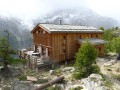
After an easy climb to reach part of the Zermatt ski slopes, the route continues along an ascending-descending balcony path leading to the famous Europahutte mountain hut.
Please note: the Himalayan footbridge before Europahutte is currently out of service. You will need to descend into the Randa valley via the second blue trail marked on the map before climbing back up to the hut (allow approximately 2 additional hours).
Route to the Charles Kuonen footbridge
 3.97 mi
+2,215 ft
-2,211 ft
3h 45
Moderate
Departure from Randa (Valais)
3.97 mi
+2,215 ft
-2,211 ft
3h 45
Moderate
Departure from Randa (Valais)
After passing through Swiss stone pine forests, this circular hike leads to an impressive record-breaker: the Charles Kuonen Footbridge, the longest pedestrian suspension bridge in the world.
Europahütte - Europaweghütte
 6.95 mi
+3,107 ft
-3,392 ft
5h 55
Difficult
Departure from Randa (Valais)
6.95 mi
+3,107 ft
-3,392 ft
5h 55
Difficult
Departure from Randa (Valais)
Due to the closure of the large Himalayan footbridge over the Grabengufer scree, it is necessary to take the emergency path down to Tasch and then undertake a remarkable climb to the alpine hamlet of Täschalp, where the Europaweghütte lodge is located.
Europahutte - Saint Nicklaus
 9.38 mi
+2,802 ft
-6,529 ft
6h 45
Difficult
Departure from Randa (Valais)
9.38 mi
+2,802 ft
-6,529 ft
6h 45
Difficult
Departure from Randa (Valais)
A new stage on the balcony at the foot of the great peaks separating the valleys of Zermatt and Saas Fee.
Herbriggen – Topalihütte
5.85 mi
+6,791 ft
-2,152 ft
7 hrs
 Very difficult
Departure from St. Niklaus (Valais)
Very difficult
Departure from St. Niklaus (Valais)
See the guide on route moderation.
The classic hike from Randa is very often closed. This hike starts at Herbriggen (accessible by train from Randa).The route is much steeper than the one starting from Randa; furthermore, once you reach Tälli, the ‘normal’ route is also closed due to rockfalls, and a new route has been marked out joining the alpine path linking the Topali Hut (Topalihütte) to the Barrhorn, which adds 400 metres of elevation gain. The difficulty rating is ‘very difficult’, to reflect the total duration of the hike, which takes into account the significant elevation gain covered in two main sections, and the steep nature of the first ascent. There are no technical difficulties other than the elevation gain (2,000 m elevation gain over 9.5 km).
Tour of the Matterhorn, Gandeg Hut – Zermatt
5.69 mi
+16 ft
-4,610 ft
2h 40
Very difficult
Departure from Zermatt (Valais)
This ninth stage involves the final descent to Zermatt. Once again, the walk can be shortened at Furi by taking the section of the Matterhorn Express that runs to Zermatt. The walk remains within the Zermatt ski area.
Gandeg Hut - Zermatt
 9.67 mi
+640 ft
-5,282 ft
5h 00
Moderate
Departure from Zermatt (Valais)
9.67 mi
+640 ft
-5,282 ft
5h 00
Moderate
Departure from Zermatt (Valais)
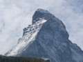
Today's variation on the Matterhorn Tour is to visit the north face of the giant before returning to Zermatt.
Topalihütte – Jungu
6.94 mi
+1,860 ft
-4,055 ft
4h 50
Difficult
Departure from St. Niklaus (Valais)
Jungu/Jungen (1,954 m) is a village situated above St-Niklaus. The journey is made by cable car. If the cable cars are not running, an intercom at the Jungu station allows you to contact the operator: payment is made at the bottom.The descent down the Wasulicke features several sections secured with fixed ropes and ladders, as the ground is quite unstable and sloping. The descent is currently not particularly exposed: a 45° slope, which allows for a fairly safe descent with the safety measures in place. There is currently no route across what remains of the glacier. This forms the second stage of the Tour du Cervin, passing through the western part of the Matter Vispa valley.
Saas Fee - Grachen
 9.72 mi
+4,268 ft
-3,212 ft
10 hrs
Very difficult
Departure from Saas Fee (Valais)
9.72 mi
+4,268 ft
-3,212 ft
10 hrs
Very difficult
Departure from Saas Fee (Valais)
A long balcony stage allowing you to climb up the Saas Fée valley, dominating it by about 500m and sometimes more. A spectacular route passing from one valley floor to another, with the special feature of being able to see the next change in valley floor in the distance.
Saas-Almagell - Gspon
 14.96 mi
+4,616 ft
-3,953 ft
10 hrs
Very difficult
Departure from Saas Almagell (Valais)
14.96 mi
+4,616 ft
-3,953 ft
10 hrs
Very difficult
Departure from Saas Almagell (Valais)
You will return to Almageller Alp via the Almagellerhorn adventure trail, which is marked with ladders, steps and a suspension bridge. The trail returns to the Saas Valley and remains at almost the same altitude until Kreuzboden. From this balcony, you can admire the Mischabel massif and the resort of Saas Fee. Overlooking the Saastal and at the foot of the Fletschorn, you will walk through old pastures. You will pass through several Walser hamlets before arriving in Gspon.
Saas Almagell - Gspon
 11.96 mi
+3,681 ft
-3,015 ft
8h 40
Very difficult
Departure from Saas Almagell (Valais)
11.96 mi
+3,681 ft
-3,015 ft
8h 40
Very difficult
Departure from Saas Almagell (Valais)
Balcony stage above the Saastal.
Hike with a brief description, to be followed with the Visorando app.
Théodule Refuge - Saint-Jacques
 9.00 mi
+912 ft
-6,119 ft
4h 55
Difficult
Departure from Italy
9.00 mi
+912 ft
-6,119 ft
4h 55
Difficult
Departure from Italy
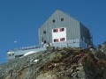
The final stage is almost entirely downhill, except for a short climb to cross the Col Nord des Cimes Blanches. The descent takes place in long valleys, interspersed with very steep slopes. The arrival at the hamlets of Fury and Blanchard is a real relief after 10 days of hiking.
Sankt Niklaus - Zermatt
 12.37 mi
+2,178 ft
-541 ft
7h 35
Difficult
Departure from St. Niklaus (Valais)
12.37 mi
+2,178 ft
-541 ft
7h 35
Difficult
Departure from St. Niklaus (Valais)
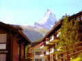
This fourteenth and final stage is the longest, but does not present any difficulties. The route from Sankt Niklaus to Zermatt is obvious. It follows the Matter Vispa, the river that flows down from Zermatt, and the rack railway line, which terminates in Zermatt. All the ingredients for a picture-postcard Swiss scene are there: the Matterhorn, glaciers, the torrent, churches with bulbous steeples, the little rack railway and the magnificent car-free village of Zermatt.
Saint Nicklaus - Gruben
 9.72 mi
+6,283 ft
-3,980 ft
8 hrs
Very difficult
Departure from St. Niklaus (Valais)
9.72 mi
+6,283 ft
-3,980 ft
8 hrs
Very difficult
Departure from St. Niklaus (Valais)
A beautiful mountain stage with a pass bearing the sweet name of Augstbordpass.
Macugnaga - Saas Fee
 7.83 mi
+5,364 ft
-2,438 ft
10 hrs
Very difficult
Departure from Macugnaga (Verbano-Cusio-Ossola)
7.83 mi
+5,364 ft
-2,438 ft
10 hrs
Very difficult
Departure from Macugnaga (Verbano-Cusio-Ossola)
This stage takes you through Switzerland via the Grand Col du Monte Moro, followed by a beautiful descent to Lake Mattmark. Once you reach the lake, take the bus to Saas Fée.
Jungu – Grüben
7.79 mi
+3,848 ft
-4,318 ft
6h 55
Difficult
Departure from St. Niklaus (Valais)
The first of the three stages that make up the northern traverse of the massif from east to west.No particular difficulties: you just need to take care on the first section, which follows a narrow path along the cliff face. Fixed equipment (ropes) secures the most exposed sections.The route starts from the same cable car used on the previous stage to descend to St-Niklaus.
Macugnaga - Saas Almagell
 12.52 mi
+5,548 ft
-4,314 ft
10h 35
Very difficult
Departure from Macugnaga (Verbano-Cusio-Ossola)
12.52 mi
+5,548 ft
-4,314 ft
10h 35
Very difficult
Departure from Macugnaga (Verbano-Cusio-Ossola)
During this stage, at Passo di Monte Moro, you cross from Italy (Piedmont) to Switzerland (German-speaking Valais).
Hike with a brief description, to be followed with the Visorando app.
Zinal - Cabane de Moiry
 7.69 mi
+6,066 ft
-2,306 ft
8h 50
Difficult
Departure from Ayer (Valais)
7.69 mi
+6,066 ft
-2,306 ft
8h 50
Difficult
Departure from Ayer (Valais)
The Val d'Anniviers ends at the Zinal Glacier and the Moiry Glacier, separated by the Pigne de la Lé and the Garda Bordon. The route of this fourth stage will take you to the Cabane de Moiry, very close to the glacier of the same name. To avoid the long climb to Sorebois, take the cable car to the Weisshorn area. You will switch to the Moiry side and overlook this magnificent lake at an average altitude of 2,500 metres. Upon arrival at the Cabane de Moiry, you will be richly rewarded.
Grachen - Europahutte
 9.30 mi
+4,780 ft
-2,789 ft
10 hrs
Very difficult
Departure from Grächen (Valais)
9.30 mi
+4,780 ft
-2,789 ft
10 hrs
Very difficult
Departure from Grächen (Valais)
Grachen, an important village, dominates the Zermatt valley, which you will be flying over all day. After a gentle climb to Saint-Nicolas on its pedestal, you just need to pass from scree to scree to reach the welcome Refuge d'Europahutte after a long traverse.
Zinal - Arolla
 16.23 mi
+7,106 ft
-5,955 ft
8 hrs
Very difficult
Departure from Ayer (Valais)
16.23 mi
+7,106 ft
-5,955 ft
8 hrs
Very difficult
Departure from Ayer (Valais)
This is a long stage passing through two mountain passes, but it is shortened by the cable car connection from Zinal and the bus transfer between Villa Evolène and Arolla.
Please note: taking into account the cable car transport, the positive elevation gain is not 2,156 metres as indicated, but only 1,380 metres.
Grachen - Saas-Fee
 11.39 mi
+5,226 ft
-4,606 ft
9h 45
Difficult
Departure from Grächen (Valais)
11.39 mi
+5,226 ft
-4,606 ft
9h 45
Difficult
Departure from Grächen (Valais)
And here is the last stage of this route, and what a stage it is! A pleasant climb to reach Hannigalp and find the famous balcony trail that overlooks the valley leading to Saas Fee.
The Barrhorn
11.72 mi
+6,965 ft
-6,939 ft
10 hrs
Very difficult
Departure from Oberems (Valais)
One of the highest hikes in Europe that requires no mountaineering equipment, the ascent to the Barrhorn crosses and runs alongside a variety of environments and landscapes (forest, mountain pastures, glaciers, torrents, moraines, high-altitude ridges, etc.), offering a truly breathtaking spectacle. The summit, surrounded by other peaks of similar height or even more imposing, offers a breathtaking panorama combining black rock and white glaciers.
Suitable only for experienced hikers accustomed to high altitudes.
Tour du Cervin, Breuil – Cabane Gandeg
7.17 mi
+4,373 ft
-1,060 ft
7h 05
Difficult
Departure from Valtournenche (Aosta Valley)
For this eighth stage, it is possible to take the ski lifts up to the Théodule Refuge, depending on conditions, in particular the Plan Maison lift from Breuil; or even as far as Fornet, to get even closer.