Refine your search for walks in Savigny (Haute-Savoie)
Savigny (Haute-Savoie) walks
 The Morennes trail in Dingy-en-Vuache
 Local authority
 9.15 mi
 +863 ft
 -863 ft
 5h 00
5h 00
 Moderate
 Departure from Dingy-en-Vuache (Haute-Savoie)
Spanning four local authorities, this long circular walk allows you to explore the Pays du Vuache, a region rich in rural and natural heritage that remains well preserved.
After passing through the Bois du Mont (Chênex) and enjoying its cool shade, you’ll reach the Longues Reisses plateau, where the panoramic view stretches from the Haute-Chaîne du Jura to the Alps (orientation board). Continue your walk along the botanical trail and head towards the village of Epagny. Walk along the edge of the Vuache Massif at the end of the walk.
The Plateau des Daines
 Tourist office
 4.70 mi
+942 ft
-951 ft
3h 00
Moderate
Departure from Chaumont (Haute-Savoie) (Haute-Savoie)
4.70 mi
+942 ft
-951 ft
3h 00
Moderate
Departure from Chaumont (Haute-Savoie) (Haute-Savoie)
This moderate-difficulty circular walk takes you across the Plateau des Daines. During the walk, you’ll discover the Frangy vineyards with their iconic grape variety: the Roussette.
The Chaumont Circuit
 2.00 mi
+446 ft
-440 ft
1h 20
2.00 mi
+446 ft
-440 ft
1h 20
 Easy
Departure from Chaumont (Haute-Savoie) (Haute-Savoie)
Easy
Departure from Chaumont (Haute-Savoie) (Haute-Savoie)
This circular walk, which winds its way along the foot of the Vuache, will introduce you to the natural (Rocher Bataillard, sharp limestone pavement, cliffs) and historical heritage of the area around Chaumont. Don’t forget to make a round trip to the ruins of Chaumont Castle and enjoy the panoramic view.
The Vuache from Chaumont
 Visorando Member
 4.65 mi
+1,673 ft
-1,663 ft
3h 35
Moderate
Departure from Chaumont (Haute-Savoie) (Haute-Savoie)
4.65 mi
+1,673 ft
-1,663 ft
3h 35
Moderate
Departure from Chaumont (Haute-Savoie) (Haute-Savoie)
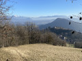
An easy walk with magnificent views of the Retord, Lake Geneva, Mont Blanc and the mountains around Lake Annecy.
The Tour du Vuache
 16.00 mi
+2,651 ft
-2,648 ft
8 hrs
16.00 mi
+2,651 ft
-2,648 ft
8 hrs
 Very difficult
Departure from Vulbens (Haute-Savoie)
Very difficult
Departure from Vulbens (Haute-Savoie)
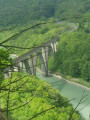
A long journey through the Jura mountain range. Between the Défilé de l’Écluse and the medieval village of Chaumont, Mont Vuache offers a striking contrast, from its eastern forest to its western cliffs!
The Nant en Rhône stream trail
 7.86 mi
+1,519 ft
-1,496 ft
4h 55
Moderate
Departure from Clarafond-Arcine (Haute-Savoie)
7.86 mi
+1,519 ft
-1,496 ft
4h 55
Moderate
Departure from Clarafond-Arcine (Haute-Savoie)
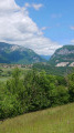
Featuring 16 information panels, this route introduces you to the region’s flora, fauna, geology and history.
The natural riches of the landscape and the harvests around Chênex
 5.63 mi
+771 ft
-778 ft
3h 15
Easy
Departure from Chênex (Haute-Savoie)
5.63 mi
+771 ft
-778 ft
3h 15
Easy
Departure from Chênex (Haute-Savoie)
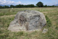
Set in the heart of the Geneva countryside, this lovely circular walk allows you to discover the region’s agricultural traditions, as you make your way through the fields and crops of the plain. You’ll also pass through the magnificent Bois aux Reynauds and enjoy stunning panoramic views of the surrounding mountains!
At the source of the Parnant
 5.07 mi
+538 ft
-535 ft
2h 50
Easy
Departure from Clarafond-Arcine (Haute-Savoie)
5.07 mi
+538 ft
-535 ft
2h 50
Easy
Departure from Clarafond-Arcine (Haute-Savoie)
A lovely circular route, skirting the headwaters of the Parnant (a small tributary of the Rhône) and offering varied routes through farmland, woodland or across an ancient glacial moraine where the views are stunning.
Moderator’s note -problem in (2), see reviews 02/08/2022
The Vuache in its entirety from Chevrier
 14.24 mi
+3,550 ft
-3,550 ft
9h 40
14.24 mi
+3,550 ft
-3,550 ft
9h 40
 Difficult
Departure from Chevrier (Haute-Savoie)
Difficult
Departure from Chevrier (Haute-Savoie)
Starting from Chevrier, I suggest you walk the entire length of the Vuache, through a largely wooded landscape, dotted with some lovely viewpoints. The return route follows the foot of the mountain on the eastern side, offering beautiful panoramic views. The main challenge is the distance to be covered.
The Marlioz Hill, from Chez les Gay to Pierre 33
6.38 mi
+909 ft
-909 ft
3h 45
Moderate
Departure from Marlioz (Haute-Savoie)
Circular walk starting from Les Usses, at the hamlet of Chez les Gay. Climb via Le Muralet, passing by Marlioz Castle, the forest and its chapel, then on to Le Sion. Arrival at Pierre 33, descent to Minzier, and return via the Route de la Forêt and the Chemin du Muralet. A fairly easy walk, even though the climbs are quite steep; the paths are passable, although sometimes muddy.
Through the Grands Bois, starting from Valleiry
 3.79 mi
+262 ft
-246 ft
2h 00
Easy
Departure from Valleiry (Haute-Savoie)
3.79 mi
+262 ft
-246 ft
2h 00
Easy
Departure from Valleiry (Haute-Savoie)
This signposted route, suitable for both walking and horse riding, invites you to explore the Grands Bois, a forest on the Geneva plain situated in the municipalities of Valleiry and Viry, along the French-Swiss border.
The Via Romana
 5.16 mi
+561 ft
-558 ft
2h 50
Easy
Departure from Viry (Haute-Savoie) (Haute-Savoie)
5.16 mi
+561 ft
-558 ft
2h 50
Easy
Departure from Viry (Haute-Savoie) (Haute-Savoie)
Straddling the municipalities of Vers and Viry, this charming little circular walk takes you along the ancient paths of the Pays du Vuache.
During this walk, you can choose to make a round trip to the Notre-Dame des Voyageurs Chapel. From the top of this oratory, a stunning panoramic view of the Geneva plain, surrounded by the Jura and Salève mountain ranges, awaits you. A picnic area is available for your use.
From Bois de Chancy to the banks of the Rhône
 3.68 mi
+466 ft
-463 ft
2h 05
Easy
Departure from Chancy (Canton of Geneva)
3.68 mi
+466 ft
-463 ft
2h 05
Easy
Departure from Chancy (Canton of Geneva)
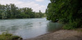
A family walk in the Chancy woods (Geneva, Switzerland) leading to the banks of the Rhône. There are some lovely surprises to discover along the way, such as a suspension bridge, views of the Jura and Vuache mountains, and streams. The perfect hike for hot summer days!
Fort l'écluse loop via the Belvédère de Léaz
 6.46 mi
+1,939 ft
-1,939 ft
4h 40
Moderate
Departure from Léaz (Ain)
6.46 mi
+1,939 ft
-1,939 ft
4h 40
Moderate
Departure from Léaz (Ain)
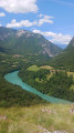
Fort l'Ecluse, a fortified military structure dating from the 16th and 17th centuries.
Léaz viewpoint.
Panoramic view of the Rhône valley.
On the banks of the Rhône from Fort l'Écluse
 7.53 mi
+1,854 ft
-1,841 ft
5h 05
Moderate
Departure from Léaz (Ain)
7.53 mi
+1,854 ft
-1,841 ft
5h 05
Moderate
Departure from Léaz (Ain)
Open from mid-June to mid-October, during the Fort's opening hours.
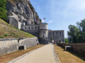
A trail combining history and nature, starting within the fort itself. The final ascent rewards walkers with an exceptional panorama before descending back to the fort.
Starting from Fort l'Écluse when it is open (from June to September), the path enters the forest before reaching the banks of the Rhône. It winds its way between stone steps, medieval ruins and wooded passages to the heights of Léaz, where you can enjoy a breathtaking view of the Rhône valley. The route then continues to the heights of the Upper Fort, offering a panoramic view of the Rhône gorge, the Vuache and the Étournel. The descent to the Lower Fort concludes this circular route rich in history and emotion.
Grand Crêt d'Eau via the Crête du Fort l'Écluse
 8.75 mi
+3,717 ft
-3,730 ft
5 hrs
Very difficult
Departure from Léaz (Ain)
8.75 mi
+3,717 ft
-3,730 ft
5 hrs
Very difficult
Departure from Léaz (Ain)
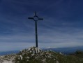
The aim of the route is to reach the Crêt de la Goutte via the Crête du Fort l'Écluse.
The main difficulty will be encountered during the ascent; the slope is quite steep up to the red and white high-voltage pylon, and at times you will need to use your hands (avoid this when descending and on wet ground).
From Chalet Bizot, the route is straightforward.
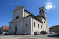
The churches and chapels of Viry
 6.89 mi
+476 ft
-492 ft
3h 35
Moderate
Departure from Viry (Haute-Savoie) (Haute-Savoie)
6.89 mi
+476 ft
-492 ft
3h 35
Moderate
Departure from Viry (Haute-Savoie) (Haute-Savoie)
A lovely circular walk through the agricultural plain of Viry, taking you on a journey of discovery through the history of the commune and its former parishes. Ten information panels mark the route.
The water ridges
 8.42 mi
+3,196 ft
-3,163 ft
6h 40
Difficult
Departure from Bellegarde-sur-Valserine (Ain)
8.42 mi
+3,196 ft
-3,163 ft
6h 40
Difficult
Departure from Bellegarde-sur-Valserine (Ain)
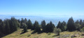
Plateau of the Jura mountain range, overlooking the valleys of Bellegarde sur Valserine and Fort l'écluse. The highest point of the Crêt de la Goutte offers a 360° panorama of the Jura Natural Park and Lake Geneva on the Geneva side, with a horizon dominated by the Alps, including Mont Blanc.
The Chosal and Copponex loop and the Land Art circuit
 6.13 mi
+781 ft
-761 ft
3h 30
Moderate
Departure from Copponex (Haute-Savoie)
6.13 mi
+781 ft
-761 ft
3h 30
Moderate
Departure from Copponex (Haute-Savoie)
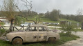
Walk starting from the Chosal farm, including the Land Art trail and its twenty or so installations in the heart of nature.
Usses Valley and Land Art
 6.58 mi
+659 ft
-643 ft
3h 35
Moderate
Departure from Cruseilles (Haute-Savoie)
6.58 mi
+659 ft
-643 ft
3h 35
Moderate
Departure from Cruseilles (Haute-Savoie)
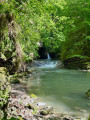
Here is a double circular route that stays at low altitude, making it suitable for all seasons. It first takes you on a Land Art route at the Ferme de Chosal, then follows the right bank of the Usses upstream to the Ponts de la Caille, passing by the former thermal spa site of the Bains de la Caille, before returning along the wooded left bank.
Circular at Grand Crêt d'Eau
 4.62 mi
+1,345 ft
-1,375 ft
3h 20
Moderate
Departure from Lancrans (Ain)
4.62 mi
+1,345 ft
-1,375 ft
3h 20
Moderate
Departure from Lancrans (Ain)
A circular with limited elevation gain, winding through mountain pastures, allowing you to visit three of the ridges that form the Grand Crêt d'Eau (including the highest point) and enjoy breathtaking views of the Genevois and the Alps.