A circular walk crossing the border from Malagny

Created as part of a project to explore cross-border heritage along the paths of the Geneva basin, this circular walk takes you from Malagny (Viry / France) to Avusy and Sézegnin (Switzerland).
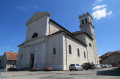
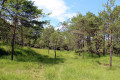
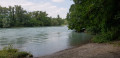
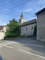
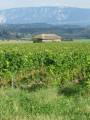
As you pass through the three villages, you’ll be able to enjoy a well-preserved built heritage, including Champlong Castle, Avusy Church, the fountains of Sézegnin and the bridges over the River Laire. You’ll also appreciate the diversity of the natural environments you’ll encounter, including the woods of Humilly, the remarkable protected biotope of the Teppes de la Repentance, the banks of the River Laire and the vineyards of the Geneva Champagne region.

Details

n°48628291
Creation:
Last update:
Last review:
  • Walking
    Activity: Walking
  • ↔
    Distance: 6.31 mi
  • ◔
    Average duration: 3h 20 
  • ▲
    Difficulty: Average

  • ⚐
    Back to start: Yes
  • ↗
    Ascent: + 515 ft
  • ↘
    Descent: - 535 ft

  • ▲
    Highest point: 1,437 ft
  • ▼
    Lowest point: 1,158 ft

Description of the walk

The walk starts in the heart of the hamlet of Malagny (in the commune of Viry). A car park with six spaces and a welcome sign are available.

(S/E) With the cemetery on your right, take the road (heading north) to reach the village centre. Opposite the wash house, turn left and walk for about 100 metres; at the hamlet known as ‘Au Benaude’, you’ll reach the path of the same name.

(1) Turn right, then take the left fork onto the stony path that descends between the fields. The path then enters the woodland, crosses the Chênex stream (via a concrete footbridge), before climbing again and emerging into a dry clearing. Continue uphill to the edge of the woodland and you’ll reach the La Tuilière equestrian centre.

(2) Then turn right onto the road that runs alongside the private property and continue straight on along the path that descends between the grazed meadows. As you approach the forest, head left (automatic gate); you will then enter the protected biotope of the Teppes de la Repentance.

(3) Go round the site to the right, then leave the track and take the path on the left which climbs into the nature reserve. Cross a wooden walkway, then turn right (footpath) to reach the highest point of the site.

(4) At the junction with the Chemin de la Repentance, carry on straight ahead and begin the descent towards the Laire, the river that marks the border.

(5) Cross the border and the River Laire via the large footbridge (please note: you must carry your identity documents), then follow the new signposting (Yellow Diamonds). At the junction, keep right onto the path that takes you through the Geneva countryside to the picturesque Swiss village of Avusy. Keep right three times until you reach the fourth junction and the Chemin du Moulin de la Grave.

(6) Take this path (road), then turn left onto the shaded path that leads back down towards the Laire. As you approach the vineyard, start the climb back up to Sézegnin via the Chemin des Plantées.

(7) Keep to the right towards the Sézegnin district. Once on the road, continue to the right, then straight on until you reach the third junction with its remarkable fountains.

(8) There are two options:
1) Turn right to go directly to Malagny (via the Route de Sézegnin).
2) Carry on straight ahead. This is the option shown on the map and in the description.
Then follow the Route du Creux de Boisset to the junction where the road meets three paths, marked by a sign and two directional markers.

(9) Turn onto thefirst track on the right, which leads downhill to the remarkable Pont de Veigy.

(10) Back in France, head up the Chemin de la Laire, then take the Route du Pontey on the right. Finally, turn right onto the Chemin de la Ferat (bison park), heading due west to the T-junction.

(11) Turn left; the path takes you back to Malagny. Follow the road to the right, then turn left towards the cemetery (S/E).

Waypoints

  1. S/E : mi 0 - alt. 1,424 ft - Malagny (car park)
  2. 1 : mi 0.13 - alt. 1,411 ft - At Le Benaude
  3. 2 : mi 0.91 - alt. 1,362 ft - La Tuilière
  4. 3 : mi 1.46 - alt. 1,230 ft - Teppes de la Repentance
  5. 4 : mi 1.72 - alt. 1,293 ft - La Repentance
  6. 5 : mi 2.15 - alt. 1,165 ft - Footbridge at the - Laire (rivière) - Affluent du Rhône
  7. 6 : mi 3.37 - alt. 1,362 ft - Avusy
  8. 7 : mi 3.99 - alt. 1,345 ft - Les Plantées
  9. 8 : mi 4.59 - alt. 1,365 ft - Sézegnin
  10. 9 : mi 5.19 - alt. 1,437 ft - Creux de Boisset – Junction of Road and Footpaths
  11. 10 : mi 5.46 - alt. 1,355 ft - Veigy Bridge
  12. 11 : mi 5.95 - alt. 1,401 ft - T-junction
  13. S/E : mi 6.31 - alt. 1,424 ft - Malagny (car park)

Notes

Worth a visit

Protected by a prefectural decree, the Teppes de la Repentance biotope (fifteen hectares) is home to remarkable flora and fauna. The clayey nature of the soil allows both wet and dry habitats to coexist. This results in exceptional biological diversity, making it one of the most beautiful molinia grasslands in Haute-Savoie!
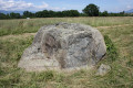
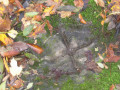
A little way past the biotope, on the left bank of the Laire, stone markers have been installed to help you discover the history of the border (the Allobroges period to the year 1000, the Second World War, the free zones, etc.). Footprints of wild animals and tree leaves are also depicted on the Japanese stepping stones!

Reviews and comments

4.3 / 5
Based on 2 reviews

Reliability of the description
4.5 / 5
Ease of following the route
4 / 5
Route interest
4.5 / 5
gaud bernard
gaud bernard

Overall rating : 4 / 5

Date of your route : May 11, 2026
Reliability of the description : ★★★★☆ Good
Ease of following the route : ★★★★☆ Good
Route interest : ★★★★☆ Good
Very busy route : Yes

well

Machine-translated

User 28862477
• Edited:

Overall rating : 4.7 / 5

Date of your route : Apr 04, 2026
Reliability of the description : ★★★★★ Very good
Ease of following the route : ★★★★☆ Good
Route interest : ★★★★★ Very good
Very busy route : No

Pretty good
Very few people and lovely scenery and villages; you won’t be out in the sun for too long if you go in the height of summer.
It goes through villages, woods and along a river.

However, make sure you follow the signposts carefully.

Machine-translated

Other walks in the area

For more walks, use our search engine .

The GPS track and description are the property of this route's author. Please do not copy them without permission.