


 Country:

 City:
City:


The starting point is in the car park of the ECLA Cultural Centre in Vulbens (around 50 spaces). It can also be reached by public transport (TPG bus, Line N).
(S/E) Head towards Vulbens Town Hall, an imposing building dating from 1884. This former ‘town hall and school’, which has been completely renovated, now houses the community centre. Then follow the signposting: yellow arrows on a green background which will lead you to Raclaz, in the commune of Dingy-en-Vuache, via the Chemin de la Fontaine.
(1) In Raclaz (west), carefully take the road on the left for 300 metres, then turn left again in the centre of the hamlet, towards Le Pontet.
(2) At the crossroads, turn left towards Valleiry. You will then be walking along a small local road that winds through the farmland, first along the Chemin des Reffaz, then, after a left-right turn, the Chemin des Tattes.
(3) When you reach the departmental road, turn right with care to reach the Collège du Vuache.
(4) Then carry on straight ahead to the centre of Valleiry.
(5) At the church, turn left towards the cemetery.
(6) You are now on the Grande Randonnée (GR®) trail ‘In the Footsteps of the Huguenots’, marked in red and white – an international route travelled by Protestants in exile at the end of the 17th century. Stretching 1,600 km, it links the south of the Drôme to northern Germany. You are also on the famous “Via Rhôna” cycle route, which links the shores of Lake Geneva to the Mediterranean beaches by following the River Rhône! So watch out for cyclists coming towards you! Continue towards the Swiss border.
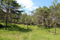
(7) At a place called La Colombière, turn left onto the small path that leads into the forest. You are now in the Bois de Vosogne, on the right bank of the stream of the same name.
(8) As you emerge from the woods, turn left onto the Route de Matailly for 500 metres, then carry on straight ahead along the cycle path.
Stone markers and wooden information boards have been installed along this path to help you discover the history of the border (Geneva and the Reformation, the Treaty of Saint-Julien, the exile of the Huguenots, invasions and revolutions, border dwellers, etc.).
(9) When you reach the border at Les Plantons, turn left and head down the customs officers’ steps (steep). Wooden totems symbolise the successive terraces of the Rhône and evoke the boundary markers, the fluvio-glacial terraces and the customs path.
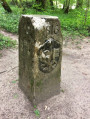
(10) At the bottom of the stairs, take the path on the left at the edge of the woods and head towards the remarkable ‘Border Marker No. 1’. An interactive display introduces you to the various aspects of the ‘King of Rivers’.
(11) Then cross the Vosogne (wooden bridge) and turn left.
(12) At the building (pumping station), turn left again (go under the barrier) and take the Moissey track (suitable for vehicles) which climbs towards Vulbens (S/E).


 Local authority
 Very difficult
 Visorando Member
 Difficult
 Tourist office
 Easy
Easy 
