The natural riches of the landscape and the harvests around Chênex

Set in the heart of the Geneva countryside, this lovely circular walk allows you to discover the region’s agricultural traditions, as you make your way through the fields and crops of the plain. You’ll also pass through the magnificent Bois aux Reynauds and enjoy stunning panoramic views of the surrounding mountains!

Details

48427999
Creation:
Last update:
Last review:
  • Walking
    Activity: Walking
  • ↔
    Distance: 5.63 mi
  • ◔
    Average duration: 3h 15 
  • ▲
    Difficulty: Easy

  • ⚐
    Back to start: Yes
  • ↗
    Ascent: + 771 ft
  • ↘
    Descent: - 778 ft

  • ▲
    Highest point: 2,369 ft
  • ▼
    Lowest point: 1,608 ft

Photos

Description of the walk

The starting point is situated next to the church in Chênex. A car park with around ten spaces is available, as well as a welcome sign. Access by public transport is available via the TPG (Transports Publics Genevois) N line. Alight at the ‘Chênex, La Boutique’ stop, then walk to the village centre (southbound/5 mins).

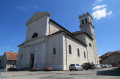
(S/E) Before setting off on this walk, do take the time to visit the remarkable neo-Romanesque church in Chênex. Built in 1881, it houses two items listed as national heritage: a 17th-century tabernacle from the Chartreuse de Pomier and an 18th-century statue of the Virgin Mary.

Set off along the departmental road heading south. After 250 m, turn right onto the Route de Chez Vauthier, a hamlet of Chênex.

(1) In the heart of the hamlet, continue climbing straight on along the Route du Biollay (initially tarmac, then stony). As you approach the woods, stay at the edge for 300 metres.

(2) Enter the forest to reach the Bois du Mont crossroads.

(3) Turn right and then continue uphill towards Les Longues Reisses. The path leaves the forest and winds its way through the fields.

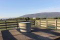
(4) At a place called Les Granges, turn left onto the track suitable for vehicles and then, after 200 metres, turn left again at the Pre Recoup crossroads. A picnic table, a drinking fountain and information boards are available here.

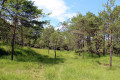
(5) The walk continues along a wide farm track, which enters the Bois aux Reynauds. The path then narrows, begins to descend and winds its way over the glacial moraines to reach the hamlet of Bellossy.

(6) Turn left here and walk alongside the departmental road for 150 metres. In the centre of the village (by the old chestnut tree), turn right onto the Chemin du Vieux Bellossy. Then turn left and walk for 100 metres, before turning right again onto the Chemin de Germagny (hamlet of Viry). Take a moment to enjoy this unspoilt hedgerow landscape and the panoramic view of the Geneva plain that unfolds before you. You will soon reach the first houses.

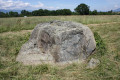
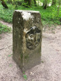
(7) Turn left onto the Route de Pommery, then, at a beautiful white Cross carved from stone, turn right onto the Route de Germagn and continue to the last houses.

(8) Turn left onto the Chemin de la Combette, which takes you back to Chênex (S/E).

Finally, take in the village centre, with its covered porch marking the entrance to a former bourgeois estate, its chestnut trees and its two fountains.

Waypoints

  1. S/E : mi 0 - alt. 1,660 ft - Chênex
  2. 1 : mi 0.37 - alt. 1,788 ft - Chez Vauthier hamlet
  3. 2 : mi 0.83 - alt. 2,051 ft - Entrance to the woods
  4. 3 : mi 1.16 - alt. 2,221 ft - Carrefour du Bois du Mont
  5. 4 : mi 1.53 - alt. 2,359 ft - Les Granges
  6. 5 : mi 1.66 - alt. 2,352 ft - Prés Recoup
  7. 6 : mi 3.17 - alt. 2,054 ft - Bellossy
  8. 7 : mi 4.2 - alt. 1,759 ft - Germagny (south)
  9. 8 : mi 4.57 - alt. 1,640 ft - Germagny (north)
  10. S/E : mi 5.63 - alt. 1,660 ft - Chênex

Worth a visit

Church of Chênex.

In Chênex, as in Germagny, one can still see old ‘fruitières’:

Established in the mid-19th century, the ‘fruitières’ are farmers’ co-operatives that transform the
‘produce’ of dairy farming into various products. Morning and evening, after milking, the milk is delivered to the
‘fruitière’; it is then ‘processed’ into cheese, cream or butter – products that are sold on the market.
A pigsty, situated next to the dairy, was used to fatten pigs on whey, thus providing an additional source of income for the farmers.

Dairy centres were once important meeting places in villages. Today they have become rare; many have been demolished, whilst others have been converted, for example into inns or homes.

Reviews and comments

4.7 / 5
Based on 2 reviews

Reliability of the description
5 / 5
Ease of following the route
5 / 5
Route interest
4 / 5
M.M-B
M.M-B

Overall rating : 4.7 / 5

Date of your route : Mar 19, 2026
Reliability of the description : ★★★★★ Very good
Ease of following the route : ★★★★★ Very good
Route interest : ★★★★☆ Good
Very busy route : No

An interesting route. A bit of tarmac at the start, but then pleasant paths. A bit muddy if it’s rained a few days beforehand

Machine-translated

toinede5974
toinede5974

Overall rating : 4.7 / 5

Date of your route : Jan 31, 2026
Reliability of the description : ★★★★★ Very good
Ease of following the route : ★★★★★ Very good
Route interest : ★★★★☆ Good
Very busy route : Yes

Easy hike, with a slight climb at the start, but then the route is pleasant and ends on flat ground.

Machine-translated

Other walks in the area

For more walks, use our search engine .

The GPS track and description are the property of this route's author. Please do not copy them without permission.