


Refine your search for walks in Salmiech
Salmiech walks


 The Céor Meanders from Salmiech
 Tourist office
 6.22 mi
 +696 ft
 -709 ft
 3h 30
 Easy
 Departure from Salmiech (Aveyron)
Nestled in the Céor valley, a true paradise for fishermen, the village of Salmiech enjoyed a successful revival during the Salt Road era.
The Moulin de la Gineste
 2.50 mi
+312 ft
-318 ft
1h 25
Easy
Departure from Arvieu (Aveyron)
A short, idyllic circular route through the cultivated, wooded and lush countryside of Lévézou.
The Massebaque stream
 Visorando Member
 4.57 mi
+778 ft
-768 ft
2h 45
Easy
Departure from La Selve (Aveyron) (Aveyron)
La Selve, a former Templar commandery, is situated on the D902, 10 minutes from Réquista and 40 minutes from Rodez. La Selve is primarily an agricultural community, with sheep farming being particularly well established there.
Around Taurines Castle
 3.21 mi
+679 ft
-686 ft
2h 05
Easy
Departure from Centrès (Aveyron)
An easy walk, combining wooded paths and tarmac roads.
A pleasant, shaded route despite the undulating terrain.
From Durenque to the summit of Lagast
8.71 mi
+1,073 ft
-1,079 ft
4h 55
 Moderate
Departure from Durenque (Aveyron)
A walk on the border between Ségala and Lévézou, passing through the beautiful Lagast forest and up to the summit of Lagast.
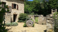
The Moulin de Roupeyrac
 6.98 mi
+866 ft
-873 ft
4h 00
Moderate
Departure from Durenque (Aveyron)
A walk that follows, for the most part, the Roupeyrac beech forest and offers beautiful views over the Lévézou.
Around Magrin – views of the Viaur valley and the wind turbines
3.52 mi
+184 ft
-197 ft
1h 45
Easy
Departure from Calmont (Aveyron)
A circular walk passing through the village of Magrin. The final section of the walk offers a lovely view of the Viaur valley and the wind turbines.
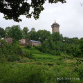
The Peyrebrune Tower from Alrance
 5.25 mi
+774 ft
-797 ft
3h 05
Easy
Departure from Alrance (Aveyron)
The Peyrebrune Tower is accessible on foot or by car from several villages. Pilgrimages take place regularly from these different starting points. Here, the departure point is from the village of Alrance.
From the basilica to the oratory at Ceignac
 2.50 mi
+344 ft
-367 ft
1h 25
Easy
Departure from Calmont (Aveyron)
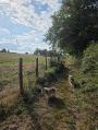
A walk to enjoy on your own or with the family. Lots of tree-lined paths, some of which are narrow. Starting from the Basilica of Notre-Dame de Ceignac, the route follows small streams before becoming circular and returning to the start, passing in front of the oratory.
Lac de la Gourde via the Santa Fé path
4.76 mi
+423 ft
-443 ft
2h 35
Easy
Departure from Arvieu (Aveyron)
A pleasant, shaded walk in summer that takes you to Lac de la Gourde from the Pareloup leisure centre.
Short route around Lac de la Gourde
4.52 mi
+223 ft
-236 ft
2h 15
Easy
Departure from Arvieu (Aveyron)
A short route that takes you along Lac de la Gourde, classified as a Sensitive Natural Area, equipped with fishing piers and an observatory for lake fauna and flora.
Exploring the Ségala on foot: Discovering a rich local heritage
7.16 mi
+1,214 ft
-1,184 ft
4h 20
Moderate
Departure from Manhac (Aveyron)
Travellers at the turn of the century who took the royal road from Rodez to Toulouse, between the two coaching inns at La Primaube and Baraqueville (Baraque de Fraysse), crossed an almost deserted plateau covered in moorland and chestnut groves.Only the riverbanks and the valley slopes were cultivated. The region was plagued by famine. It was the land of the ‘black bellies’; their diet consisted mainly of rye bread and chestnuts.The arrival of the railway in 1902 made it possible to bring in lime to improve these acidic soils. Rye disappeared, replaced by crops of wheat, potatoes and maize, which enabled the establishment of high-quality cattle farming.This agricultural revolution reshaped the region and led to the creation of two new towns, Baraqueville and La Primaube.
Nauze Valley
 7.01 mi
+1,079 ft
-1,099 ft
4h 10
Moderate
Departure from Camboulazet (Aveyron)
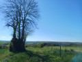
Partly forest walk down into the Nauze and Viaur valley where the Versailles site is located: a little paradise by the stream, ideal for a picnic, a spot of fishing or simply a break.
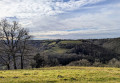
Trémolières: between Cône and Giffou
 5.51 mi
+1,001 ft
-1,014 ft
3h 25
Easy
Departure from Rullac-Saint-Cirq (Aveyron)
A chance to explore the area around Trémolières, a hamlet in the commune of Rullac-Saint-Cirq, situated on a plateau between the Cône and Giffou valleys.
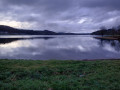
From the dam to the Tower in Villefranche-de-Panat
 9.48 mi
+856 ft
-846 ft
5h 05
Moderate
Departure from Villefranche-de-Panat (Aveyron)
A contrasting walk, between panoramic views from a historic hilltop site and the shores of Lake Villefranche, with its footpath passing through the green landscapes typical of the Lévézou.
Moderator's note problem with the passage between (9) and (10), see the notice dated 14/07/2022, and the description between (8) and (9).
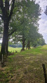
Exploring the Ségala on foot: The Lakes Trail
 6.29 mi
+614 ft
-614 ft
3h 25
Moderate
Departure from Baraqueville (Aveyron)
This is the land of white water and a thousand springs that feed numerous streams and small lakes further downstream. A short detour at the town’s main crossroads allows you to see three spires: since 1997, they have stood at the centre of the crossroads where Baraqueville was founded, clearly marking the place the town intends to retain at the heart of the Ségala, that of the main hub for events and interaction. The three spikes symbolise the Ségala’s past and give way between them to the three roads of the crossroads, which, when viewed from above, form the spokes of a turning wheel.
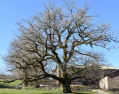
Alaret–Méjanès–Mérican circular loop
 6.73 mi
+709 ft
-712 ft
3h 45
 Difficult
Departure from Pont-de-Salars (Aveyron)
A refreshing circular walk that takes you above, and then alongside, Pont-de-Salars Lake.
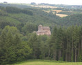
The Pont de Saint-Georges from Pont-de-Salars
 5.75 mi
+1,204 ft
-1,201 ft
3h 40
Moderate
Departure from Pont-de-Salars (Aveyron)
A route that takes you to the wooded, shaded depths of the Viaur valley. The elevation gain is quite significant, but the heritage sites along the way are well worth the effort!
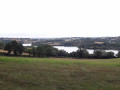
The Viaur Gorges and Lake Bages
 9.44 mi
+1,365 ft
-1,348 ft
5h 30
Moderate
Departure from Pont-de-Salars (Aveyron)
Hike at the gateway to Lévezou and the deep, narrow Viaur valley.
La Clauze route starting from Saint-Jean-Delnous
6.53 mi
+728 ft
-735 ft
3h 40
Moderate
Departure from Saint-Jean-Delnous (Aveyron)
Walk from the village of Saint-Jean-Delnous. Much of the route runs through woodland, alongside the Ruisseau de Farradet, passing from farm to farm. The route presents no particular difficulty.
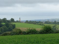
The meandering Giffou river as it flows out of Réquista
 6.45 mi
+814 ft
-810 ft
3h 40
Moderate
Departure from Réquista (Aveyron)
Réquista is France’sleading sheep-farming canton. Here, the Lacaune ewe reigns supreme. It is from her milk that the famous Roquefort is made. And it is here, in Réquista, that the Société dairy is located, where the cheeses are produced before being sent to the cellars of Roquefort to be matured.
Every year, on thefirst weekend in June, the Sheep Festival is held: walks, meals, street entertainment, a dance… and more.