


Refine your search for walks in Saint-Nic
Saint-Nic walks


 Route des fontaines autour de Saint-Nic
 Visorando Member
 7.20 mi
 +584 ft
 -554 ft
 3h 50
3h 50
 Moderate
 Departure from Saint-Nic (Finistère)
A countryside route following part of the old Camaret-Châteaulin railway line. Beautiful views over Douarnenez Bay and the western flank of Ménez Hom
From the heights of Saint-Nic to Pentrez Beach
 6.20 mi
+561 ft
-561 ft
3h 20
6.20 mi
+561 ft
-561 ft
3h 20
 Easy
Departure from Saint-Nic (Finistère)
Easy
Departure from Saint-Nic (Finistère)
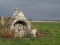
From the small village of Saint-Nic, climb up to the top of the plateau overlooking Douarnenez Bay. Follow a gentle descent to reach Pentrez Beach.
On this route, you’ll pass the Ménez Lié dolmen, the Saint-Côme Chapel and its votive fountain, and finally the fountain near the Saint-Nicaise Church in Saint-Nic.
Ménez-Hom circuit
 7.20 mi
+1,099 ft
-1,073 ft
4h 15
Moderate
Departure from Saint-Nic (Finistère)
7.20 mi
+1,099 ft
-1,073 ft
4h 15
Moderate
Departure from Saint-Nic (Finistère)
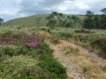
Hike to the summit of Ménez-Hom (330 m), the highest point of the Montagnes Noires in Brittany.
Great views of Douarnenez Bay, the Crozon peninsula and the Aulne maritime.
A mecca for model aircraft enthusiasts.
From Kerolier to Plomodiern via Ménez Hom
 7.63 mi
+1,276 ft
-1,168 ft
4h 35
Moderate
Departure from Saint-Nic (Finistère)
7.63 mi
+1,276 ft
-1,168 ft
4h 35
Moderate
Departure from Saint-Nic (Finistère)
The final stage is the shortest, but it is this one that takes us to the highest point of this tour of Crozon, the Ménez Hom at an altitude of 329 m, from where you can enjoy a sweeping panorama.
Pentrez - Pointe du Kerric via the Saint-Jean Chapel
 6.87 mi
+459 ft
-456 ft
3h 35
Moderate
Departure from Saint-Nic (Finistère)
6.87 mi
+459 ft
-456 ft
3h 35
Moderate
Departure from Saint-Nic (Finistère)
Circuit combining a route through the countryside and a return via the coastal path with views of Douarnenez Bay.
Porslous via the ruined chapel of Lanjulitte
 7.12 mi
+420 ft
-410 ft
3h 40
Moderate
Departure from Saint-Nic (Finistère)
7.12 mi
+420 ft
-410 ft
3h 40
Moderate
Departure from Saint-Nic (Finistère)
A countryside route along small roads and stony paths.The route passes the ruined chapel of Lanjulitte (1677) and returns via theGR®®34, overlooking Douarnenez Bay.
On the heights of Ménez Lié
 7.17 mi
+610 ft
-600 ft
3h 50
Moderate
Departure from Plomodiern (Finistère)
7.17 mi
+610 ft
-600 ft
3h 50
Moderate
Departure from Plomodiern (Finistère)
Starting from Lestrévet beach, climb towards the Ménez Lié dolmen via the Saint-Suliau Chapel. Descend facing Douarnenez Bay via the Saint-Côme Chapel to return to the beach.
Around and on the peaks of Ménez-Hom
 7.73 mi
+942 ft
-942 ft
4h 25
Moderate
Departure from Plomodiern (Finistère)
7.73 mi
+942 ft
-942 ft
4h 25
Moderate
Departure from Plomodiern (Finistère)
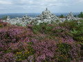
Circular route around Ménez-Hom, the final peak of the Montagnes Noires, via a route through the countryside on the eastern side before beginning the ascent to pass over the two peaks: Le Yed (329m) and then Le Hielc’h (298m).Wide panoramic views over the Aulne Valley and its suspension bridge, the head of Brest harbour and the whole of Douarnenez Bay.Beautiful vegetation comprising open heathland and heather in bloom from June onwards.You can visit the imposing chapel (if open) and its churchyard, which features a calvary dating from 1544.
Tour of Ménez Hom from the Sainte-Marie Chapel
 7.17 mi
+850 ft
-869 ft
4h 00
Moderate
Departure from Plomodiern (Finistère)
7.17 mi
+850 ft
-869 ft
4h 00
Moderate
Departure from Plomodiern (Finistère)
Ménez Hom is the highest hill in the western Montagnes Noires. Its two main peaks, Yelc'h (or Hielc'h according to the IGN map) and Yed, overlook Douarnenez Bay and Brest Harbour.
This route goes around them, along paths that are sometimes very discreet on its slopes and summits, and offers a vast panorama between the Aulne Valley and the Iroise Marine Natural Park.
Land and sea around Telgruc-sur-Mer
 13.02 mi
+935 ft
-935 ft
6h 50
Moderate
Departure from Telgruc-sur-Mer (Finistère)
13.02 mi
+935 ft
-935 ft
6h 50
Moderate
Departure from Telgruc-sur-Mer (Finistère)
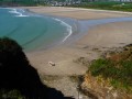
Starting on small country roads, then following numerous footpaths and an old railway line, discover the countryside around Telgruc-sur-Mer.Carry on to reach Trez Bellec beach and the coastal path back, to enjoy the seaside scenery.Along the way, you can admire the imposing Pen ar Run dolmen, the double-deck Launay bridge and the restored mill at Luzéoc.
The Ménez Hom tour through the Trégarvan Communal Forest
 6.31 mi
+801 ft
-801 ft
3h 35
Moderate
Departure from Dinéault (Finistère)
6.31 mi
+801 ft
-801 ft
3h 35
Moderate
Departure from Dinéault (Finistère)
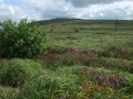
Ménez Hom, the last peak in the Montagnes Noires range, part of the Armorican Massif, rises to 330 m above Douarnenez Bay.
Starting from the summit, this route descends on the west side, then goes around the north side through the Trégarvan Communal Forest and finally climbs back up on the east side.
Beautiful views over Douarnenez Bay and the entire Châteaulin basin where the Aulne river flows.
From the summit of Ménez Hom to the banks of the Aulne via Trégarvan
 11.49 mi
+1,375 ft
-1,365 ft
6h 30
Moderate
Departure from Dinéault (Finistère)
11.49 mi
+1,375 ft
-1,365 ft
6h 30
Moderate
Departure from Dinéault (Finistère)
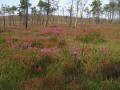
Start at the summit of Ménez-hom (330 m) and descend on the west side with views of Douarnenez Bay.Stroll through pine forests to the banks of the River Aulne in Trégarvan, then return to the summit via the eastern side.
Coastal path of Douarnenez Bay via Pointe de Tal ar Grip
 5.66 mi
+276 ft
-276 ft
2h 50
Moderate
Departure from Plomodiern (Finistère)
5.66 mi
+276 ft
-276 ft
2h 50
Moderate
Departure from Plomodiern (Finistère)
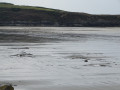
A seaside walk following theGR®®34past Pointe de Tal ar Grip, where the view takes in the long Pentrez Beach. Return via small roads to discover Saint-Sébastien Chapel and its fountain.Finally, rejoin the coastal path you took on the way out and observe how the landscape changes with the tide.
Take care at high tide when crossing part of Pors ar Vag beach!
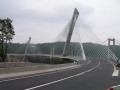
The River Aulne and the Térenez Bridge as seen from Argol
 12.84 mi
+1,083 ft
-1,112 ft
6h 50
12.84 mi
+1,083 ft
-1,112 ft
6h 50
 Difficult
Departure from Argol (Finistère)
Difficult
Departure from Argol (Finistère)
Starting from Argol, at the gateway to the Crozon Peninsula, this route leads to the coastal stretch of the River Aulne.
Highlight of the route: the new Térénez Bridge, opened in 2011 to replace the old one, which was converted into two viewing points following its demolition. This magnificent curved structure holds the world record for the longest span of its kind, at 515 metres in length, with its bold and highly aesthetic design. Also along the route are an old tide mill and the Folgoat Chapel.
Through the Argol Communal Forest
 5.53 mi
+472 ft
-472 ft
2h 55
Easy
Departure from Argol (Finistère)
5.53 mi
+472 ft
-472 ft
2h 55
Easy
Departure from Argol (Finistère)
Trail through Argol’s communal forest, featuring the listed Ar C’hléguer Braz climbing site.Don’t forget to admire the triumphal arch on your way to visit Argol Church, the garden of the former presbytery and the Breton games park.