


Refine your search for walks in Saint-Laurent-de-la-Cabrerisse
Saint-Laurent-de-la-Cabrerisse walks
 Les Terres Rouges in Tournissan
 Visorando Member
 6.99 mi
 +1,106 ft
 -1,093 ft
 4h 10
 Moderate
 Departure from Tournissan (Aude)
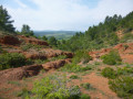
A walk in the hills above Tournissan, surrounded by pine trees, vineyards and heath. Geology enthusiasts will particularly enjoy the section through the Terres Rouges, where you follow part of the Sentier Francis Lastenouse trail, which is full of informative signs. Not to mention the magnificent natural surroundings, rich in striking colour contrasts, which are sure to delight other walkers.
Roca Dansaïra
 8.55 mi
+1,106 ft
-1,086 ft
4h 55
Moderate
Departure from Talairan (Aude)
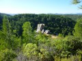
A curious rock that dances, at least according to legend, a comprehensive botanical trail and an orientation table offering a magnificent 360° panorama: this is what you can expect on this easy hike through the sweet scent of pine trees. Not to mention the numerous ridge passages that offer beautiful views of the surrounding villages, the Corbières vineyards and, at the very end of the route, the great peaks of Occitanie.
The Gourg Goutonniet and Notre-Dame de Lère in Talairan
 5.40 mi
+607 ft
-604 ft
3h 00
 Easy
Departure from Talairan (Aude)
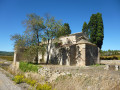
The Gourg Goutonnier, an enormous giant’s kettle carved out over millennia in the bed of the Nielle, is the destination of this hike. You reach it after a charming walk through vineyards and heath. The return route takes you past the Chapel of Notre-Dame de Lère, which stands in a secluded spot amidst a sea of vines over which it seems to watch jealously. All the charm of the Corbières in a relatively short route, ideal for a half-day outing.
Above Coustouge
 5.58 mi
+810 ft
-830 ft
3h 15
Moderate
Departure from Coustouge (Aude)
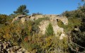
In the heart of the Corbières, a circular route north of the small village of Coustouge. This hilly and shaded route is particularly pleasant in summer. Through pine forests and heaths, we will come across some ruins of old sheepfolds.
Between Coustouge and Fontjoncouse
 11.80 mi
+1,430 ft
-1,444 ft
6h 40
 Difficult
Departure from Coustouge (Aude)
In the heart of the Corbières, an unpretentious walk, simply for the pleasure of strolling through the heath and beneath the pine trees. Several beautiful viewpoints, the pretty village of Fontjoncouse, a lovely church, an old mill and the remains of an ancient lime kiln punctuate this route through a little-visited area. On the way back, a fairly long flat stretch through the heath may seem monotonous to some. But once you reach the end, the view opens up once more onto the rolling hills of the Corbières, the Montagne d’Alaric and the Pyrenees. You’ll therefore need to be patient to enjoy it to the full.
Vineyards and heath around Thézan-des-Corbières
 Association / Club / Walk leader6.50 mi
+653 ft
-636 ft
3h 35
Moderate
Departure from Thézan-des-Corbières (Aude)
Walk through the foothills of Thézan-des-Corbières, Caraguilhes-Poursan-Roques d’Agnel, amongst vineyards, heaths, plateaus and scenic viewpoints.
The Cirque de Viviès via the Plat de l'Aven
 8.22 mi
+814 ft
-807 ft
4h 30
Moderate
Departure from Thézan-des-Corbières (Aude)
Starting from Thézan-des-Corbières, this hike through pine trees and heathland leads to the natural amphitheatre of the Cirque de Viviès, a geological curiosity of the Corbières. After a somewhat challenging descent to the wild valley floor, the landscape opens up and vineyards appear everywhere. At the end of the route, the magnificent Château de Caraguilhes wine estate is a tempting invitation to end the day on a delicious note.
Notre Dame du Carla
 6.60 mi
+922 ft
-958 ft
3h 50
Moderate
Departure from Lagrasse (Aude)
This hike, a little longer than Charlemagne's buttocks, takes you to a chapel and a viewpoint overlooking the surrounding area, all surrounded by wild vegetation.
Charlemagne's buttocks
 3.23 mi
+551 ft
-551 ft
2h 00
Easy
Departure from Lagrasse (Aude)
This short hike takes you up to a vantage point where you can admire the village of Lagrasse and its listed abbey. The name "fesses de Charlemagne" (Charlemagne's buttocks) comes from a legend which tells how Charlemagne's horse stumbled, throwing him onto the hill where he landed on his backside.
Lagrasse – Mayronnes
 10.62 mi
+1,880 ft
-1,430 ft
6h 30
Difficult
Departure from Lagrasse (Aude)
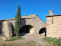
The third and final stage runs between the medieval village of Lagrasse and the village of Mayronnes, passing by the Notre-Dame du Carla Chapel and the Roman bridge at Rieux-en-Val.
Mont Major
 8.68 mi
+1,398 ft
-1,394 ft
5h 10
Moderate
Departure from Saint-Pierre-des-Champs (Aude)
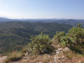
Despite its modest altitude, Mont Major (542 m), the highest point of the Serre de Blanes, offers a magnificent, almost 360° panorama encompassing the Montagne d’Alaric, the Carcassonne plain and, on a clear day, the peaks of the Ariège Pyrenees and the Canigou. The ascent, starting from the village of Saint-Pierre-des-Champs, takes place amidst a landscape typical of the Corbières, with small, isolated vineyards, pine trees and heath where holm oaks reign supreme. A breath of fresh air in a setting where peace and quiet are guaranteed.
Pic Saint-Victor from Fontjoncouse
 6.86 mi
+1,581 ft
-1,572 ft
4h 30
Moderate
Departure from Fontjoncouse (Aude)
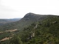
The hike involves climbing the normal route up Pic Saint-Victor, the highest point in the County of Durban. At the summit, there are orientation tables and a thousand-year-old hermitage.
There is a sweeping view of the lakes and the sea, as well as the Pyrenees mountain range stretching to the peaks of Luchonnais.
La Combe Paradis
 8.70 mi
+1,234 ft
-1,211 ft
5h 05
Moderate
Departure from Fontjoncouse (Aude)
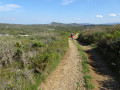
A large circular route starting from Fontjoncouse, crossing the limestone plateaus (Selve and Blaquière) and the "secret" Combe Paradis, taking the old Gallo-Roman road from Donos to Fontjoncouse.
The route is picturesque, following old paths that have been lost and rediscovered, with magnificent views of Mont Saint-Victor, the Mediterranean and La Clape, as well as the borders of the Hautes Corbières and the blue line of the Pyrenees.
A very wild route (Combe Paradis), home to golden eagles.
The sublime tour of Fontjoncouse
 11.23 mi
+1,273 ft
-1,250 ft
6h 15
Moderate
Departure from Fontjoncouse (Aude)
Fontjoncouse is enclosed by four large limestone plateaus: to the north, the Selve plateau; to the south, the La Mulgue plateau; to the west, the Devès and Monedières plateau; to the east, the Pic Saint-Victor (the highest point in the municipality). This hike takes you across these large plateaus to discover the wonders of botany and geology, as well as the historical traces left by humans from the Neolithic period to the Middle Ages.
The Lost Ark and Pic Saint-Victor
 10.43 mi
+1,240 ft
-1,227 ft
5h 55
Moderate
Departure from Fontjoncouse (Aude)
This is a sunny hike between heathland and rock formations, best avoided on hot days. Hike through the heathland, which combines natural geological, plant and man-made formations: arches, mills, sheepfolds, a fountain, a 12th-century church, a hermitage and a lookout point. The goal is to reach the 360° viewpoint over the Corbières at the top of the Ermitage Saint-Victor.
Roc Malpas
 3.70 mi
+738 ft
-722 ft
3 hrs
 Very difficult
Departure from Fontjoncouse (Aude)
A circular hike to climb Roc Malpas via Pech Fourcan.
A wild and narrow summit.
Extensive panoramic views: in the foreground, Mont Saint-Victor, as well as the Roc de Tautavel, the sea, the lakes and Île Sainte-Lucie, the Pic des 3 Seigneurs and the Thézan plain.
See practical information.
The geologist in Albas with panoramic variations
 6.18 mi
+1,004 ft
-1,024 ft
3h 45
Moderate
Departure from Albas (Aude)
This hike offers fascinating geological discoveries, fossils and minerals, and splendid panoramic views. The route leads through diverse landscapes, from windmill ruins to green valleys, dotted with information panels on the geological history of the region. This geological experience and the flora open your eyes to the beauty and richness of the Corbières. On the square in front of the town hall in the village of Albas, several information panels tell you about the geological evolution of the area.
Roque Sestière and Saint-Siméon from Boutenac
 5.17 mi
+669 ft
-666 ft
3h 00
Easy
Departure from Boutenac (Aude)
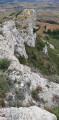
This sunny and windy trip will take you to the heart of the Boutenac National Forest, better known for its wine than for its hikes. In a setting that smells of pine and rosemary, discover the cave and the Chapel of Saint-Siméon, with a fresco depicting its history, its life and its work. Then head to the rocky barrier of Roque Sestière, the highest point of the Boutenac massif, a landmark for birds of prey and an area where the Cers wind has left no chance for vegetation.
Montpenery and La Roche Trouée
 3.57 mi
+367 ft
-361 ft
2h 00
Easy
Departure from Boutenac (Aude)
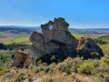
A lovely walk with the scent of the heath in the air. The walk starts at the recently rebuilt Boutenac washhouse, takes you past the church – which has also been renovated – and the remains of the tower. After a visit to the old village, head towards Mount Penery to enjoy a 360° view very close to the Roche Trouée, but be careful not to take any unnecessary risks: if you ask locals for directions, say ‘le Trou de la Lunette’.
Circular route from the watchtower via Moux
7.58 mi
+2,064 ft
-2,083 ft
5h 15
Moderate
Departure from Moux (Aude)
A challenging hike, with no major difficulties, apart from the total lack of signposting or, frequently, numerous signs that contradict this route. The route follows deeply rutted paths, with loose gravel underfoot. The start crosses a pine forest devastated by fire, but after that it’s pure joy through dense vegetation, consisting of pines, holm oaks, boxwoods, junipers, kade trees, and the full range of Mediterranean plants – a feast of scents. Avoid doing this in summer or after a storm.
La Montagne D'Alaric - Roc De L'Aigle
 10.28 mi
+2,264 ft
-2,267 ft
6h 40
Moderate
Departure from Moux (Aude)
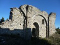
At the gates of Carcassonne, the Montagne d'Alaric offers a superb viewpoint over the Pyrenees and the Aude plain. The ruins of the priories of Saint-Pierre d'Alaric and Saint-Michel de Nahuze, as well as those of the Métairie de Vidal, encourage us to reflect on the history of this mountain and the life that must have once animated it. Finally, the return journey through the vineyards of the Corbières region is an invitation to end this day's walk with a well-deserved wine tasting.
Villerouge-Termenès – Lagrasse
 11.57 mi
+1,496 ft
-2,146 ft
6h 35
Moderate
Departure from Villerouge-Termenès (Aude)
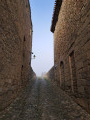
The second stage between Villerouge-Termenès and Lagrasse begins on the heights of the Corbières and then descends gradually towards the superb medieval village of Lagrasse and its abbey.
The red earth and two chapels
 5.91 mi
+1,007 ft
-1,030 ft
3h 35
Moderate
Departure from Villerouge-Termenès (Aude)
Starting from the small medieval village of Villerouge-Termenès, this route offers a wide variety of views over the vineyards of the plain, the scrubland, the woods and the wild canyons of the Hautes Corbières. At an altitude of 500 metres, you can see the Montagne Noire and the magnificent Pyrenees mountain range in the distance.
Alaric between valleys, ridges and splendid views
 11.00 mi
+2,543 ft
-2,572 ft
7h 15
Moderate
Departure from Douzens (Aude)
A beautiful circular route around Alaric, along ridges and valleys from north to south, offering views of the Montagne Noire, the Aude valley from Carcassonne to Lezignan, and the Corbières Massif with the Pyrenees in the background, surrounded by vegetation including thyme, rosemary, boxwood, pine and lavender. Very quiet paths.
Alaric loop via Combe du Gravier
 5.23 mi
+1,539 ft
-1,539 ft
3h 45
Moderate
Departure from Douzens (Aude)
This is a great walk in the heart of the Alaric massif, where you can explore deep valleys and forests of holm oaks and Austrian black pines. Legend has it that the Visigoth king Alaric, passing through the region, gave the mountain its name, and some say that his treasure is hidden here.
A trip to the summit offers views of the entire Aude plain, the Corbières, the Eastern Pyrenees and the Mediterranean Sea if the weather is clear enough.
Termes and Villerouge-Termenès circular loop
 12.55 mi
+1,972 ft
-1,978 ft
7h 30
Difficult
Departure from Félines-Termenès (Aude)
This circular walk, starting from Félines-Termenès, passes through woodland and heath, leading first to Termes and then to Villerouge-Termenès, two charming villages boasting exceptional architectural heritage. Numerous sections through the woodland or alongside small, fast-flowing streams provide welcome shade and coolness during the hot season. Once on the ridge, the view stretches as far as the Pyrenees and Mont Canigou, as is particularly the case at the Col de Termes.
Prat de Labat Plateau and Pech de Guilloumet
 11.55 mi
+1,834 ft
-1,844 ft
6h 55
Moderate
Departure from Félines-Termenès (Aude)
The Prat de Labat Plateau is now a vast, unspoilt natural area used for rearing sheep and pigs in semi-free-range conditions. However, it was once a major centre for the extraction and processing of iron ore, as evidenced by the numerous excavations still visible today. This walk, which partly follows the ‘Sentier des Mines’, allows you to discover this ancient heritage, culminating in the climb to the Puech de Guilloumet to enjoy its exceptional panoramic views.