Country:

 City:
City:


Once you reach Félines-Termenès coming from Villerouge-Termenès, walk through the village and park in the shaded car park on the left as you leave the village.
No signposting
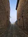
(S/E) Head back towards the village, cross the bridge over the Libre and then take the second street on the right, Rue de l’Église. At the church and cemetery, keep left onto a narrow road, leaving the Chemin des Sources on your right. When the road bends to the right, leave it and take the wide stony path opposite
(1) Turn left, crossing a narrow concrete slab, and head up the valley of the Ruisseau de la Vignasse, which is completely dry. Stay on the main path, which begins a very steep climb before joining a track suitable for vehicles; follow this, turning right.
GR® white and red markings
(2) Look out for the return path on the left and carry on straight ahead following the markings. Further on, let the access track to the Bergerie de Camuzeille branch off to the right, and stay on the track until the first marked bend to the right.
(3) Turn left onto a narrower path and you’ll soon reach a junction where there’s a wooden post bearing a sign depicting a donkey painted yellow. Head straight ahead, rejoin the track you left a short while earlier and emerge onto the Prat de Labat plateau, a vast, wild expanse where sheep and pigs graze in semi-freedom. Pass a track branching off to the right and reach a large crossroads.
(4) Keep to the left to skirt round the plateau to the south, walking between fences. You’ll reach the Col de l’Homme Mort, which features a beautiful information panel on the ‘Forgotten Iron’ of the Plateau de Lacamp and marks the start of the yellow-signposted discovery trail.
YellowPR® markings
(5) Follow the track to the left and head for the starting point of the Sentier des Mines, marked by a sizeable wooden sign.
(6) Leave the track and turn right to cross an open area, following the wooden posts which serve as landmarks. Return to the track and continue to the right until you reach the next sign.
(7) Turn right, following the sign for Col de Guilloumet, and climb straight up the slope to Pech de Guilloumet – also spelt Puech de Guilhaumet on a sign detailing some remains of open-cast mines now overgrown with vegetation.
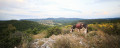
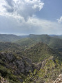
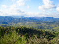
(8) Take in the magnificent, almost 360° view, which takes in the Aude plain, the Montagne d’Alaric, the vast, undulating and wooded expanses of the Corbières, and the Pyrenees. After reading the very informative information board, head north downhill to continue the mine route. Look out for a gate in the electric fence on the right, next to another information board.
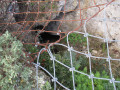
(9) Go through the gate, then turn right into a holm oak woodland, which you’ll descend through via several hairpin bends before emerging onto a track suitable for vehicles. Continue to the left, take a short detour to the entrance of the Trou de l’Aigue mine—now closed off for safety reasons—then rejoin the route for about fifty metres.
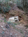
(10) Turn left onto the very narrow, steeply sloping path leading to the most evocative part of the mining site. Walk past several mining excavations on your right, some of which are very impressive and have had to be secured with steel nets. The view of the right-hand slope, riddled with mine shafts, gives you a sense of the intense activity that once took place here when the mine was in full operation.
Continue along the path to leave the woods and emerge onto the plateau. Head right and make your way to a junction with a signpost.
(11) Turn left, then right about twenty metres further on. Continue along the wide path leading to the old miners’ huts nestled in a wooded valley, where you’ll leave the markings for the Sentier des Mines, which would otherwise direct you to turn left.
No signposting
(12) Continue along the track, which winds gently up the hillside, to reach the Col d’en Paris.
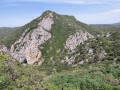
(13) Take the hairpin bend to the left and go round the Serre de l’Arbre Aspic to reach a large three-way junction. Turn right and follow the edge of the woodland on your left.
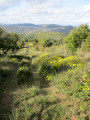
(14) Don’t miss this junction, located by a solitary tree which serves as a good landmark. Turn right onto a grassy double track, partially overgrown with young shoots and brambles. Head straight down the slope to reach the Tourens dairy farm and go round it on the left.
(15) Turn left and head for the junction where the route meets theGR®36Aat the end of a tarmac road.
GR® white and red markings
(16) Turn left. Carry on straight for about a hundred metres, then turn left at the next junction: the signposting is poor at this point. Head up a narrow valley, keeping in the same direction and ignoring the various, more or less clearly marked, off-track paths on the left.
(2) Turn right onto the outbound route.
(1) Continue to the right and head back to the car park (S/E).




 Visorando Member
 Difficult