Country:

 City:
City:


In Félines-Termenès, park in the shaded car park next to the tennis court on the edge of the D613.
(S/E) Leave the car park and head towards the village centre, taking the left-hand pavement after crossing at the pedestrian crossing.
YellowPR® signposting
(1) Turn left onto Chemin du Libre, then left again in front of the Foyer de Campagne. At the last house, the tarmac road turns into a wide, partly grassy track. At the first junction, keep left and continue uphill. At the next junction, leave the wide track and take a path on the right at a wooden post in poor condition marked ‘sentier touristique’.
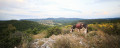
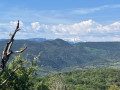
(2) At this point, the path splits in two, with a sign for “enceinte pastorale” on the right and “dolmens” on the left. Take the left-hand fork and head towards Pla de Ferriol. Go through a metal gate and cross a section where the path becomes less distinct, especially if the grass is tall. Avoid heading down towards the ruins of a building; instead, go round them on the left to find clearer signposting. On the left, enjoy the view of Mont Tauch, easily recognisable by its tabular silhouette. Go through a second gate and then turn right along the path to begin the winding descent leading to a junction with a wide cross-country path at a signpost.
No signposting
(3) Turn left and follow this path until you reach the D40 at a place called Moulintour.
YellowPR® signposting
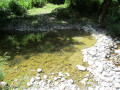
(4) Follow the road to the right for a few dozen metres, then turn left onto a stony track that leads into a pretty little valley. Cross the ford over the Sou using the concrete blocks if the stream is flowing, and continue to a right-hand bend, at the end of which there is a small riverbed.
(5) Do not cross the ford, but look out for the cairn on the right, which marks the start of a very faint track that climbs steeply through dense low vegetation and eventually joins a cross-country path.
Signposting:PR® yellow +GR® white and red
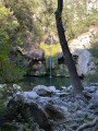
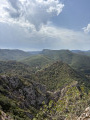
(6) Turn right and follow the path which runs alongside the Sou at varying distances depending on the section. Don’t hesitate to take short detours to the right to admire the Caune Pont Gorges, but do so with caution as these various viewpoints are not secured. You’ll reach a small picnic area with two tables situated near a concrete road that forms a very tempting pool of water in hot weather.
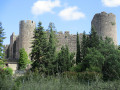
(7) Continue on to the village of Termes, which boasts the imposing ruins of its Cathar castle. Walk past the town hall, cross the footbridge and head left for about 40 metres.
GR® white and red markings
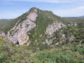
(8) Take the first alleyway on the right, continue up the steps opposite to reach a tarmac road, which you should follow to the left. At the last house, the tarmac gives way to a path that climbs up the hillside. When you have a clear view, do turn round to take in the scenery and the beautiful remains of Termes Castle, perched on a rocky outcrop. You’ll come to a junction.
(9) Ignore the path opposite (GR®36A) and turn right, following the sign for “Villerouge Termenès – Lagrasse” via theGR®36. Further on, you’ll reach a wide track suitable for vehicles; take this to the left, heading uphill, to reach the D40 at Col Caroun.
(10) Follow this road, turning left and keeping to the left-hand verge.
No signposting
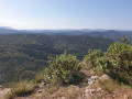
Let theGR® head off to the left and continue along the road to the Col de Termes, where there is a magnificent view of the Pyrenees and the Canigou.
(11) Retrace your steps for about fifty metres and turn right onto a wide path that runs along the southern flank of the Serre de Termes and, further on, rejoins theGR®36that you left earlier.
GR® red and white markings
(12) Carry on straight ahead. Pass a hunting post, then negotiate a hairpin bend to the right.
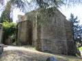
(13) Leave the wide path you have been following and take a narrow track that begins a long descent towards the Ruisseau du Bac valley. In its first section, this deeply incised and ravined track often requires you to walk along the left or right embankment. This is followed by a long, extremely stony stretch where you’ll need to be careful to protect your ankles. Once at the bottom, wade across the stream and continue along the valley floor to reach the lovely site of the Notre-Dame Chapel, which has been beautifully restored.
YellowPR® signposts
(14) Carry on straight ahead to reach Villerouge-Termenès, emerging near the castle.
(15) Turn right, then right again towards the castle. Follow the small street to cross the bridge and turn immediately left to head up the road that runs below Saint-Étienne Church and the cemetery. At the junction, head straight ahead to join the Route du Termenès (D613) and follow it to the right for about a hundred metres.
No signposting
(16) Turn right onto a track suitable for vehicles. When the track bends to the right (near a truck wreck), keep to the left. Cross a concrete slab, walk alongside a site used as a graveyard for old agricultural machinery, turn left at the junction and rejoin the D613. Follow it by turning left and cross the bridge: be careful, there is no footpath.
GR® signposting: white and red
(17) Follow the small tarmac road to the right until you reach a junction. Continue straight on along what has now become a wide dirt track. Stay on this track at the next junction.
No signposting
Let theGR® head off to the left and complete the bend to reach a disused stretch of road which you must take to the left to join the D613.
(18) Cross with extreme caution as the bend significantly obstructs drivers’ visibility, then turn left to walk alongside the road on the right-hand verge. Then take the first path on the right and, at the junction a few metres further on, keep left. Join the D613 one last time.
(19) Use the pavement on the right to return to the village and then to the car park (S/E).

 Visorando Member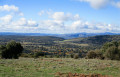
 Moderate