


 Country:

 City:
City:


Park in the dirt car park located on the outskirts of Coustouge, alongside the D323, heading towards Fontjoncouse. There is also a small car park on Rue de l’Église.
Yellow and green signposting
(S/E) Leave the car park by turning left onto the road (D323). Leave the return path on your right and cross the bridge.
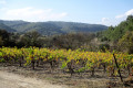
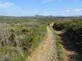
(1) Turn left onto a wide, stony track and stay on it, ignoring any offshoots to the right or left. The climb through the pine trees is gentle, allowing you to enjoy the scenery on the left, where vineyards and coniferous woodland share the landscape. Navigate a hairpin bend to the right and follow two closely spaced hairpin bends.
(2) Pass a partially grass-covered path on your right, which could serve as a shortcut at the start of the climb. Stay on the track, continuing straight ahead, and reach a three-way junction in a bend.
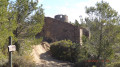
(3) Continue to the right, following the signposts. The track runs almost flat, passing several hunting posts, and leads to a junction situated a few metres before the ruins of the Poursan sheepfold.
(4) Turn left. Pass a junction marked by a signpost on a tree on the right and continue to the next one, marked by a directional post.
(5) Turn left, following the sign for “Thézan”, and head to a four-way junction: signpost.
No signposting
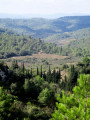
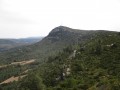
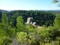
(6) Turn right (east), leaving the signposted route. The very stony path narrows and winds through heath to reach an unnamed pass overlooking the magnificent Pouzoles valley.
(7) Start on the right, descending a very steep and difficult slope on ground that is rutted in places: you’ll need to take care on this section of around 200 metres, where walking poles will be a real help. Enter the woodland and follow the edge of a vast clearing dotted with a few makeshift huts and caravans in a sorry state, which seem out of place here. You’ll reach a crossroads.
(8) Turn right to continue skirting the clearing. The path levels out before reaching a three-way junction near an information sign about how to behave around sheepdogs.
(9) Turn right. Cross an electric fence (make sure to close it properly) and carry on. The slope becomes very steep for about 200 m before levelling off as you emerge into the open. This is followed by a winding descent passing close to abandoned vineyards. At a three-way junction with beehives on the left, turn right up a slight incline, then head for the junction where you rejoin the path you left some time ago.
Yellow and green markings
(10) Turn left. Walk along the flat, past a fire-fighting water reservoir, and you’ll immediately come to a junction.
(11) Turn right. Walk past the Fontjoncouse Honey Farm and continue straight on until you reach the Stop sign on the D323.
(12) Go straight on to follow the D323 for just under a hundred metres, then leave it and turn left at the sign for the church.
No signposting
Walk up Rue du Marché, turn left after Rue des Pigeons, then take the sharp right-hand bend to follow Rue de l’Église, which leads to the 8th-century church, offering a lovely view of the village and the valley.
(13) Walk back a few metres, then follow the path on the left to quickly reach a concrete road. Follow it to the left, then turn right to take a moment to visit the ruins of the old Amarel mill.
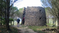
(14) Although it has lost its wings, the very well-preserved stone base is well worth a detour. Don’t hesitate to walk a few metres further to reach the edge of the woods and enjoy a stunning view over the Malpas Stream valley, where the vineyards, cypress trees and rolling hills are reminiscent of Tuscany!''
Head back the way you came, turn right onto the tarmac road, which turns into a wide dirt track at a three-way junction where you should keep to the right. Continue along the flat path, skirting a magnificent conifer plantation. Stay on the main track, ignoring other side tracks on the left, until you reach a junction situated in a small hollow. Don’t be tempted by the track heading downhill to the right; instead, carry on for a few metres until you spot an old wooden sign on the left indicating the old lime kiln: the sign and the start of the path are not easy to spot.
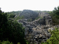
(15) Turn left onto a very narrow path, winding through the heath to the stone ruins of the old lime kiln: if you wish, you can climb over the low wall to reach the site, taking care not to trip over the numerous stones. Turn back.
(15) Head left, keep left at the junction that appears shortly afterwards, then keep right at the next one.
(16) Navigate the right-hand bend and continue through the heath, which unfortunately offers few views along this stretch. Reach the Col de la Louve.
(17) Carry on straight ahead, ignore a path on the left, then turn left at the next junction to reach a beautiful viewpoint at a junction not shown on the IGN map.
(18) Turn right. Take great care on the descent, which continues for about 300 m: the slope is very steep, the stony ground is unstable and rutted in places. Conditions improve once the path enters the woodland.
(19) Turn left onto a wide, partly tarmac-surfaced farm track and rejoin the D323. All that remains is to follow the road to the left to reach the car park (S/E).

 Visorando Member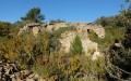
 Moderate
 Very difficult
