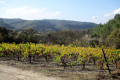
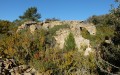
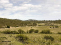
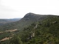
Vineyards and heath around Thézan-des-Corbières

Walk through the foothills of Thézan-des-Corbières, Caraguilhes-Poursan-Roques d’Agnel, amongst vineyards, heaths, plateaus and scenic viewpoints.

Details

n°4445033
Creation:
Last update:
Last review:
  • Walking
    Activity: Walking
  • ↔
    Distance: 6.50 mi
  • ◔
    Average duration: 3h 35 
  • ▲
    Difficulty: Moderate

  • ⚐
    Back to start: Yes
  • ↗
    Ascent: + 653 ft
  • ↘
    Descent: - 636 ft

  • ▲
    Highest point: 935 ft
  • ▼
    Lowest point: 371 ft

Description of the walk

Start from the car park on Place de la Gare (at the village entrance on the left when coming from Saint-Laurent or Lézignan).

(S/E) Cross Avenue de la Gare (D611) and take Rue René Cassin.

(1) At the junction, turn right onto Rue du Moulin à Vent. At thefirst junction, turn left, staying on the same street. Carry on straight ahead, ignoring the various turn-offs to the right or left. At the end, pass through the hamlet of La Grangette.

(2) Just past the houses, at the foot of a telephone pole, turn left and head up into the vineyard (do not enter the private residential property). Carry on straight ahead, skirting the vineyards on your right. At the corner of a vineyard plot, continue uphill in the same direction. Ignore a path branching off to the left, veer to the right and join a wide track near the Château de Caraguilhes.

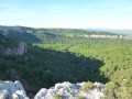
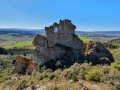
(3) Follow the path to the left. At a Fork in the road (elevation 199), keep to the right and arrive at the Rocher de l’Erle viewpoint (panoramic view of Villerouge-la-Crémade, the castle wall and, on the horizon, the Pic de Nore; to the left, a view of the Alaric and its watchtower).

(4) Continue along the path, which veers to the right to go round the Rocher de l’Erle. The path then becomes stony and runs straight ahead (south-east): ignore all side paths. Walk past the ruins of an old sheepfold and reach a crossroads.

(5) Then turn left (east). The path descends to join a wider track in the hollow of a small valley.

(6) Follow the path to the left. Ignore a path branching off to the right (fire marker) and head up the valley (yellow and green ‘Ronde des Corbières’ markings; follow these as far as the Poursan borehole). After just under a kilometre (elevation 263), turn left and you’ll immediately reach a T-junction.

(7) Turn left here. Stay on the main path, which soon heads north-north-west. Begin the descent and take a wide hairpin bend.

(8) At the crossroads, follow a wide track to the right. Head downhill and take in the view over the village. Pass a borehole and you’ll soon reach a junction.

(9) Turn left here (ignore the signposting which heads off to the right). After about 150 m, turn right. Walk alongside olive groves and fallow land. You’ll reach a crossroads at the edge of a solar farm.

(10) Turn right and walk alongside the fence of the solar farm.

(11) Turn right and follow a path that descends alongside a recently planted vineyard. A wire fence is in place to prevent vehicle access, but pedestrians are permitted to pass. You’ll reach the building of the former community of communes, emerge onto Rue du Moulin à Vent and follow it to the left.

(1) At the junction you passed on the way there, turn right onto Rue René Cassin, cross Avenue de la Gare and you will immediately come back to the car park where you started (S/E).

Waypoints

  1. S/E : mi 0 - alt. 374 ft - Place de la Gare car park
  2. 1 : mi 0.07 - alt. 381 ft - Crossroads at the end of the circular loop
  3. 2 : mi 1.07 - alt. 413 ft - La Grangette
  4. 3 : mi 1.63 - alt. 479 ft - Caraguilhes – Junction
  5. 4 : mi 2.06 - alt. 712 ft - Viewpoint at the - Rocher de l'Erle
  6. 5 : mi 3.03 - alt. 915 ft - Crossroads
  7. 6 : mi 3.54 - alt. 810 ft - Crossroads
  8. 7 : mi 4.12 - alt. 873 ft - T-junction
  9. 8 : mi 4.98 - alt. 738 ft - Crossroads
  10. 9 : mi 5.58 - alt. 469 ft - Borehole – Junction
  11. 10 : mi 6.01 - alt. 456 ft - Solar farm – Crossroads
  12. 11 : mi 6.2 - alt. 410 ft - Junction
  13. S/E : mi 6.5 - alt. 374 ft - Place de la Gare car park

Notes

A small fountain at the entrance to the Château de Caraguilhes estate on the left after point (3).
There may be sheep along the route.
Please respect any barriers you may encounter.

Worth a visit

Château de Caraguilhes for wine tasting and sales (3).

Reviews and comments

4.2 / 5
Based on 2 reviews

Reliability of the description
4 / 5
Ease of following the route
4.5 / 5
Route interest
4 / 5
HADELINE
HADELINE

Overall rating : 4.7 / 5

Date of your route : Nov 11, 2026
Reliability of the description : ★★★★★ Very good
Ease of following the route : ★★★★★ Very good
Route interest : ★★★★☆ Good
Very busy route : No

Unfortunately, 50 per cent of the walk is through an area burnt by wildfires. A bit too much tarmac for my liking at the start.
Overall, a good route, but it’s worth waiting a while for the vegetation to recover.
November 2026

Machine-translated

sogeco31
sogeco31

Overall rating : 3.7 / 5

Date of your route : May 28, 2021
Reliability of the description : ★★★☆☆ Average
Ease of following the route : ★★★★☆ Good
Route interest : ★★★★☆ Good
Very busy route : No

An interesting route, although there are a few inaccuracies in the directions provided; for example, at point 2, near the telephone exchange, there is a private property which we are asked to cross… unless it is actually the field right next to it, but the signposting directs us to carry on straight ahead! Then, on arriving at Caraguilhes Castle, if you follow the same signposting, you end up heading in the opposite direction to the route described in the guidebook… but you do rejoin the route starting from Saint-Laurent and heading to the Cirque de Viviès, which, incidentally, is well worth a detour; you can quite easily find the route described after climbing the steep slope leading up to the plateau from the bottom of the cirque. Finally, it’s easy to miss the detour via the solar power station if you’re not paying attention (you really must read the description carefully, which says to leave the signposted route – which I did… only afterwards!)

My report with a few photos: https://sogeco31.blogspot.com/2021/05/le...

Machine-translated

Other walks in the area

For more walks, use our search engine .

The GPS track and description are the property of this route's author. Please do not copy them without permission.