Country:

 City:
City:


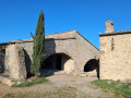
It can sometimes be difficult to find a parking space in the centre of Lagrasse. The easiest option is therefore to park in the large car park by the abbey and begin with a walk round the village of Lagrasse to start this third stage. For those who have completed the second stage of the Corbières circular route and are staying overnight in Lagrasse, set off directly from this point (2).
(S) Head towards the abbey, then turn right at the cemetery to go round it.
(1) Then turn left to cross the stone bridge over the Orbieu and head for the beautiful covered market hall after entering the village via the Porte de l’Eau.
(2) Walk past the post office, turn left to cross the second bridge, and turn right towards the D3. A few metres before the D3, follow the signpostedGR®36path to the left, which climbs above the village towards Mouthoumet and Tuchan. Once on the plateau, continue straight on along the path: there’s a lovely view of the Sou river on the right. At the T-junction, turn right onto the wide path towards Notre-Dame du Carla and continue for about 200 metres.
(3) Leave theGR® and follow the wide dirt track to the right. You will then begin a long descent to the banks of the Sou.
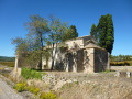
(4) About fifty metres before the D3, turn left onto the path towards Notre-Dame du Carla. Begin a steady climb along a lovely path that winds through the woodland and reach the chapel, which has a shelter in case of rain.
(5) Take the lovely path on the right: the one on the left leads, after 50 metres, to a beautiful cross and a lovely viewpoint. Join theGR®36at a white marker post: there’s a lovely view to the right of the chapel as you head uphill.
(6) Join theGR® again on the right. At the bend, leave the dirt track and continue to follow theGR® on the right. A little further on, ignore a path on the right and begin a short but steep climb.
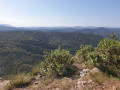
(7) Leave theGR®, which you’ll leave on your left, to take the lightly marked path on the right towards Rieux-en-Val and its Roman bridge: a Red Cross and White Cross marking the end ofthe GR® on a rock on the ground. You’ll then begin a long descent with a beautiful panoramic view of the surrounding valleys and villages. Halfway down the descent, ignore a path on the left: there is a lot of fallen branches on the ground towards the end of the path. Carry on straight ahead to join a better-marked cross-country path.
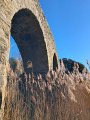
(8) Turn left. At the T-junction, take the wide dirt track on the right to continue the descent. Carry on to the right along the stony road – formerly tarmacked – until you reach the Roman bridge at the entrance to the village.
(9) Cross the bridge and take the path on the left along the River Sou towards the village. At the tarmac road, turn left, then left again onto the D42 to cross the more recent bridge. Once across, turn immediately right, then left towards La Métairie Neuve along an old tarmac road.
(10) Turn left again: there’s a lovely view of the village of Rieux-en-Val on your left. Continue along the road, which further on becomes a track and climbs gently in a straight line towards a pass: there’s a view of the Pech de la Fage on the right and, if you turn round, of Serviès-en-Val Castle in the distance.
(11) At the pass, the track turns into a road that was once tarmacked and is now fully asphalted. Ignore a road on the right and continue down the slope until you reach a dirt track on the left. Follow this, then turn sharply right to join the RD41.
(12) Take the road on the left, cross the bridge and, 50 metres beyond it, take the path on the right which descends towards the river to cross the ford (passable even in winter). Continue straight on along the path, keeping to the left at the Y-junction, and you’ll reach a ruined house where you’ll rejoin theGR®36.
(13) Continue along the dirt track to the right and walk for about 150 metres. Turn right again at a 90° angle, rejoin a section of the Sculpture Trail and carry on. The dirt track turns into a path that winds through the undergrowth before climbing more steeply. When you reach a level stretch, you’ll come to a wider dirt track; take this to the right: this is the continuation ofthe GR® + Sculpture Trail.
(14) At the Y-junction, leave the Sentier Sculpturel and keep to theGR® on the right: as you round the bend, you’ll see the village of Mayronnes and the finish car park on the right. Continue downhill, then leave theGR® to cross the bridge and reach the car park, marking the end of the third and final stage of this Corbières circular route (E).

 Association / Club / Walk leader
 Easy
Easy 
 Moderate
  Visorando Member