Country:

 City:
City:


Park in the car park in front of the church.
(S) Head towards the castle and cross the bridge on the right to enter the village. Turn immediately right onto Rue Blanche (Carriera Blanca), then take Rue des Moulins, following the red and white markings ofthe GR®®36. Leave the village via the tarmac road. Ignore the entrance to a house on the right, then keep left at the three-way junction.
(1) Keep to the right, continue for about 300 m, then turn left at a 90° angle to stay on theGR®® and continue climbing gradually up through the red earth: there’s a lovely view to the left of the village and Villerouge-Termenès Castle at the top of the hill.
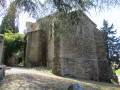
(2) At the small pass, leave the track and take a path on the right towards Chapelle Saint-Martin to begin the second part of the ascent.
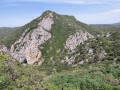
(3) Pass the chapel on your right and carry on straight ahead along theGR®® to follow the ridge path, which crosses aPR®®. Continue the climb to the Pech de Blanes.
(4) Continue along the ridge path (a slight descent followed by an ascent) towards Mont Major, ignoring aPR®® on your right at the foot of the mountain.
(5) At the summit, turn right, following theGR®® to begin the descent towards Saint-Pierre-des-Champs. You will soon reach a four-way junction.
(6) Ignore the first path on the left and take the next one, also on the left, continuing the descent. Ignore the side paths and carry on, following the GR®® markings.
(7) At the T-junction, turn right to continue the descent.
(8) At theGR®®36Amarker – Barcelona 291 km – take the now slightly tarmacked road on the right to continue the descent. Ignore the private tracks on either side and head for the junction with the quiet little road leading to Peyrens.
(9) Turn left to reach the hamlet of Les Joffres, which you’ll leave on your left, then the first houses of the village of Saint-Pierre-des-Champs. Walk past the castle ruins, then turn left onto Rue des Pins to reach the RD212.
(10) Cross the road carefully and head straight ahead to reach the bridge and cross the Orbieu. At the end of the bridge, continue straight on along the semi-tarmac path which passes close to several houses. At the top of the hill, take the path branching off to the left, leaving the vineyard and the dirt track on your right.
(11) When you reach the field, turn right to walk alongside a plot of vineyard, then turn left 100 metres further on towards the farmhouse. At the junction with the dirt track, continue straight on to join the tarmac road near Château Saint-Auriol.
(12) Head down the tarmac road to the right to rejoin theGR®® and carry on to the bridge, which you must cross.
(13) Turn left after the bridge, then immediately turn right onto a dirt track that climbs up the side of a hill planted with pine trees. Once at the top, the track continues mainly through woodland along a relatively flat stretch and leads to a junction with a wide, well-marked dirt track at a hairpin bend.
(14) Leave theGR®®36Aand turn right. Continue along the wide track, passing two tracks on the right and then one on the left. When you reach a Y-junction, leave the dirt track and turn right onto a wide stony track. After about 200 m, turn right onto a track that feels a bit like retracing your steps.
(15) Leave the track and take a stony path on the left which winds its way through the low trees. When you reach the ruins of an old farmhouse, leave the track on your left and continue straight on along the path. This turns into a wider track which gradually descends the hillside. Cross the wide dirt road and continue straight on along the path which runs alongside it and eventually joins it.
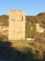
(16) Turn left: at the first bend, there is a lovely view of the village of Lagrasse and the tower of Sainte-Marie Abbey. Continue towards the village by taking the tarmac road on the left.
(17) Go round the abbey by turning right at the cemetery to head back towards the medieval town.
(18) Cross the bridge before heading upstream along the river to enter the village via the Porte de l’Eau. Continue straight on until you reach the Halle (E).
 Visorando Member
 Difficult
 Easy
Easy