Montpenery and La Roche Trouée

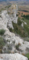
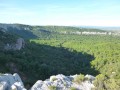
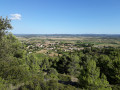
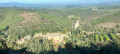
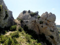
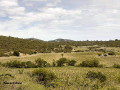
A lovely walk with the scent of the heath in the air. The walk starts at the recently rebuilt Boutenac washhouse, takes you past the church – which has also been renovated – and the remains of the tower. After a visit to the old village, head towards Mount Penery to enjoy a 360° view very close to the Roche Trouée, but be careful not to take any unnecessary risks: if you ask locals for directions, say ‘le Trou de la Lunette’.

Details

6833746
Creation:
Last update:
Last review:
  • Walking
    Activity: Walking
  • ↔
    Distance: 3.57 mi
  • ◔
    Average duration: 2h 00 
  • ▲
    Difficulty: Easy

  • ⚐
    Back to start: Yes
  • ↗
    Ascent: + 367 ft
  • ↘
    Descent: - 361 ft

  • ▲
    Highest point: 594 ft
  • ▼
    Lowest point: 249 ft
  • ⚐ Country: France
  • ⚐ City: Boutenac (11200)
  • ⚑
    Start/End: N 43.148518° / E 2.793909°
  • ❏
    IGN map(s): Ref. 2446E
  • Hour-by-hour weather

Photos

Description of the walk

Park in the car park by the old washhouse.

(S/E) Walk up Avenue des Corbières towards the village centre. After about 150 m, turn left up Rue du Foyer. You’ll arrive behind Saint-Mamès Church; go round it on the left.
With your back to the church entrance, take Rue du Centre opposite. Ignore all the adjacent streets and walk past the ruins of the old tower at No. 13. At the end, turn left into Rue de la Forge and immediately right into Boulevard de Ronde.

(1) At the end, turn 90° to the left and take Route de Ferrals. You will then walk alongside the gardens of the Joncasse stream on your right – so named because this area, where water was abundant, was once overgrown with ‘reeds’. After about 700 m, turn 90° to the right and leave the road. At the Fork in the road, head slightly to the left. Note on your left the reservoir that supplies the village with drinking water, followed by the municipal rubble tip, recognisable by its barrier. This is where the tarmac road ends.

(2) Ignore the path on the right and head north. After a right-hand bend, you’ll reach a junction on the edge of a vineyard. Turn left here. Follow the path as it bends to the right until you reach another junction. Turn left and you’ll reach another junction after about sixty metres.

(3) Then turn left. After 200 m, facing a dry-stone wall, turn right at a 90° angle to take the path leading uphill.

(4) Turn left and climb to the highest point of the walk. Head off to the right (north-north-west) and descend to reach the Roche Trouée.
To return, retrace your steps, pass the highest point again and head down to the left (due east) until you reach the junction you passed earlier.

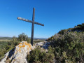
(4) Turn left, heading due north, and follow a rocky, barely visible, descending path for about 230 m until you reach the iron cross.

(5) About ten metres further down is a track that is more or less passable by vehicle; turn right and follow it, ignoring the adjacent paths. At the end of this track, you’ll come to the tarmac road known as the “Ancien Chemin de Luc”. Turn right and follow this road due south; it’s partially shaded in the late afternoon. The heath is on your right and the vineyards on your left, all the way to the village.

(6) After fording the Joncasse stream, take the short, charming climb straight ahead – a narrow, shaded path between two gardens. You’ll emerge onto the Route de Ferrals; turn left and head straight down, ignoring the side streets, until you reach Avenue des Corbières. Follow this road to the car park. (S/E).

Waypoints

  1. S/E : mi 0 - alt. 253 ft - Former wash house at Boutenac
  2. 1 : mi 0.41 - alt. 282 ft - Route de Ferrals
  3. 2 : mi 1.06 - alt. 433 ft - End of the tarmac road
  4. 3 : mi 1.35 - alt. 430 ft - Junction
  5. 4 : mi 1.69 - alt. 554 ft - Access to La Roche Trouée
  6. 5 : mi 2.25 - alt. 427 ft - Iron cross
  7. 6 : mi 3.19 - alt. 276 ft - In the village, the path opposite
  8. S/E : mi 3.57 - alt. 253 ft - Former wash house at Boutenac

Notes

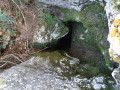
(4) You will pass 10 metres from a chasm with a very narrow entrance that drops vertically to a depth of 25 metres.
Keep your dogs on a lead, as anyone who were to fall in would not only sustain injuries but would also be unable to get out without the use of roping equipment.

Worth a visit

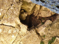
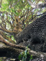
At the highest point, between the ‘4 ’ and the ‘Roche Trouée’, when the summer sky would turn threatening, the Boutenac council worker ‘Petit Paul’ would set off explosive flares to disperse the clouds and protect the vineyard from hailstorms. You can see the base of the cannon, which has been reinforced to accommodate the explosive charge, and on the side, the tube for the fuse and the firing mechanism. (see photo)

Reviews and comments

3.8 / 5
Based on 5 reviews

Reliability of the description
3.6 / 5
Ease of following the route
3.4 / 5
Route interest
4.4 / 5
MI.L
MI.L

Yes, JPP34, the appeal of my route is that it takes you along the ridge via the Chemin des Chasseurs; if I’d been looking for the easy option, I’d have suggested driving straight up to ‘La Lunette’. Some people do just that!

Machine-translated

jpp34
jpp34

Overall rating : 4 / 5

Date of your route : Jan 07, 2025
Reliability of the description : ★★★★☆ Good
Ease of following the route : ★★★☆☆ Average
Route interest : ★★★★★ Very good
Very busy route : No

A very difficult stretch up to the wayside cross – there’s no proper path, it’s very rocky and even quite dangerous.
There is an easier route. When you head down towards the stone with a hole in it, just carry on a little further and take the first path on the right.

Machine-translated

mojga
mojga
• Edited:

Overall rating : 3 / 5

Date of your route : Aug 01, 2023
Reliability of the description : ★★★☆☆ Average
Ease of following the route : ★★★☆☆ Average
Route interest : ★★★☆☆ Average
Very busy route : No

This walk is best done in spring or winter as the terrain is clear throughout the route. There’s no need to go through the village; simply head up Avenue des Corbières to the crossroads and take the Route de Ferrals opposite. There’s a lovely panoramic view at the top.

Machine-translated

MI.L
MI.L
• Edited:

Overall rating : 5 / 5

Date of your route : Jun 05, 2021
Reliability of the description : ★★★★★ Very good
Ease of following the route : ★★★★★ Very good
Route interest : ★★★★★ Very good
Very busy route : No

Hi Sylviequeval,
The path between WP4 and WP5 does indeed exist; you must have missed it right from the start. It’s a path used by hunters to get into position for wild boar. It’s quite rocky and the tracks aren’t clearly marked on the ground, but it’s there. I can’t understand how the vegetation could have overgrown it in such a short time.
However, routes are often altered by moderators who aren’t familiar with the terrain (they’re just looking at a map on a screen).
Sorry.
Best regards and enjoy your summer hikes.

Machine-translated

sylviequeval
sylviequeval

Overall rating : 3 / 5

Date of your route : Jun 05, 2021
Reliability of the description : ★★☆☆☆ Disappointing
Ease of following the route : ★★☆☆☆ Disappointing
Route interest : ★★★★★ Very good
Very busy route : No

Hello
At point 4 in the description, we ran into a problem after taking a detour to see the rock with the hole in it (a lovely view). The path leading from 4 to 5 doesn’t exist. The description mentions a ‘hard-to-spot’ path, but it’s more than just hard to spot – the vegetation is dense and thorny, making it impenetrable.
We had to improvise a way back using the IGN map.
Thanks anyway for the walk, as the view from the hollow rock is well worth the detour!!

Machine-translated

Tenzig11250
Tenzig11250

Hello, next hike.

Machine-translated

LorMer
LorMer

Overall rating : 4 / 5

Date of your route : May 29, 2021
Reliability of the description : ★★★★☆ Good
Ease of following the route : ★★★★☆ Good
Route interest : ★★★★☆ Good
Very busy route : No

A very enjoyable walk
I used the Visorando app
The view from the rock with the hole in it is lovely

Machine-translated

Other walks in the area

For more walks, use our search engine .

The GPS track and description are the property of this route's author. Please do not copy them without permission.