


Refine your search for walks in Saint-Flavy
Saint-Flavy walks
 Ferreux circular route via Saint-Loup-de-Buffigny
 Visorando Member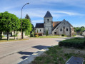
 5.54 mi
 +223 ft
 -230 ft
 2h 45
2h 45
 Easy
Easy
 Departure from Ferreux-Quincey (Aube)
A short walk through the villages of Ferreux and Saint-Loup-de-Buffigny and the countryside around the River Ardusson.
Views of the villages to the north, seasonal flora and wildlife!
Be warned – it’s a bit of a climb!
Discovering Trois Saints from Vallant-Saint-Georges
9.99 mi
+13 ft
-13 ft
4h 35
 Moderate
Departure from Vallant-Saint-Georges (Aube)
Moderate
Departure from Vallant-Saint-Georges (Aube)
A pleasant walk along the “Discovering the Three Saints” route: Vallant-Saint-Georges, Droupt-Sainte-Marie and Droupt-Saint-Balse. The route allows you to discover the rich cultural, wildlife and plant heritage of this area. A very flat route along the Haute Seine Canal, the River Seine and the ponds, including the Brun.
The hills above Saint-Hilaire and Crancey
 5.72 mi
+174 ft
-167 ft
2h 45
Moderate
Departure from Saint-Hilaire-sous-Romilly (Aube)
5.72 mi
+174 ft
-167 ft
2h 45
Moderate
Departure from Saint-Hilaire-sous-Romilly (Aube)
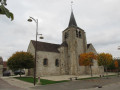
Get out into the fresh air and open spaces; here’s a scenic walk through the villages of Saint-Hilaire and Crancey, with views over the Seine valley, the hills of Champagne and the grain-growing plains to the east towards Troyes.
The former Paraclet Abbey, the village of Quincey and its mill
 6.84 mi
+269 ft
-262 ft
3h 25
Moderate
Departure from Saint-Aubin (Aube) (Aube)
6.84 mi
+269 ft
-262 ft
3h 25
Moderate
Departure from Saint-Aubin (Aube) (Aube)
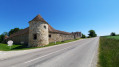
A relatively easy walk, starting from the former Abbey of Le Paraclet in Saint-Aubin (Aube), passing through the small village of Quincey where, after seeing the old mill on the River Ardusson, you enter the village and head towards the church, leaving the restored washhouse on your left.
Retrace your steps back to Rue du Mazot, then head up to the right towards the hills, where you’ll enjoy views of the power station, the village and the abbey.
Macey Forest
 4.72 mi
+285 ft
-269 ft
2h 25
Easy
Departure from Macey (Aube)
4.72 mi
+285 ft
-269 ft
2h 25
Easy
Departure from Macey (Aube)
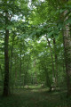
In the beautiful Macey State Forest, a walk along forest roads and well-maintained paths, with a few lovely viewpoints.
Circular Vaulonnais route from Montgueux
4.75 mi
+456 ft
-446 ft
2h 35
Easy
Departure from Montgueux (Aube)
A short walk to get a breath of fresh air, either on your own or with the family, amongst fields and woodland. An easy route suitable for everyone: wide farm tracks.
Vineyards, fields and woods, ridges and valleys of Montgueux and Macey
 6.93 mi
+591 ft
-594 ft
3h 40
Moderate
Departure from Montgueux (Aube)
6.93 mi
+591 ft
-594 ft
3h 40
Moderate
Departure from Montgueux (Aube)
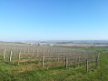
Hike from the heights of Montgueux on the ridges overlooking Mesnil Vallon, crossing Macey and its national forest, then returning along the vineyards overlooking La Grange au Rez with a bird's eye view of Troyes.
Around Courgenay
5.32 mi
+308 ft
-322 ft
2h 45
Easy
Departure from Courgenay (Yonne)
Listening to the Cistercian Abbey of Vauluisant, discover the monks’ irrigation system, the old flour mill, the Saint-Thomas gate, the old farms of Vauluisant, La Singerie and the Vauluisant State Forest.
Montbernange Wood
 2.35 mi
+246 ft
-236 ft
1h 20
Easy
Departure from Torvilliers (Aube)
2.35 mi
+246 ft
-236 ft
1h 20
Easy
Departure from Torvilliers (Aube)
The Montbernange Forest from Torvilliers.
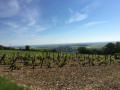
A walk through the woods on a hill near Troyes, offering a panoramic view of the surrounding plains and villages.
The Bezeaux Spring and Les Hauts de Flacy
6.28 mi
+397 ft
-397 ft
3h 15
Moderate
Departure from Flacy (Yonne)
After admiring the church dedicated to Saint-Loup and the wash house dating from 1877, head towards the Hauts de Flacy via the Source Bézeaux and the Flacy forest.
Mont Martin and the Laines Valley
 5.81 mi
+738 ft
-738 ft
3h 20
Moderate
Departure from Saint-Germain (Aube) (Aube)
5.81 mi
+738 ft
-738 ft
3h 20
Moderate
Departure from Saint-Germain (Aube) (Aube)
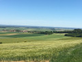
From the Chemin de la Grande Voie in the hamlet of Lépine (Saint-Germain), head towards Les Hauts des Forges and Mont Martin, then return along the Laines valley via theGR® de Pays ‘Plaines et Collines’ trail around Troyes.
The Vauchassis Forest via the Belle Fayte ridge
 5.01 mi
+394 ft
-384 ft
2h 40
Easy
Departure from Vauchassis (Aube)
5.01 mi
+394 ft
-384 ft
2h 40
Easy
Departure from Vauchassis (Aube)
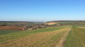
Walk in the forest east of Vauchassis and return via the Crête de la Belle Fayte
From Bercenay to Vauchassis
 7.08 mi
+548 ft
-522 ft
3h 45
Moderate
Departure from Bercenay-en-Othe (Aube)
7.08 mi
+548 ft
-522 ft
3h 45
Moderate
Departure from Bercenay-en-Othe (Aube)
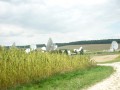
A short walk overlooking the villages of Bercenay and Vauchassis.
From the washhouse to the Sources de l’Ancre via the Bois de la Garenne in Bercenay
 5.67 mi
+305 ft
-302 ft
2h 50
Easy
Departure from Bercenay-en-Othe (Aube)
5.67 mi
+305 ft
-302 ft
2h 50
Easy
Departure from Bercenay-en-Othe (Aube)
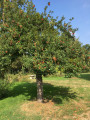
From the wash house opposite the church, then via the Fond de la Garenne, up through the Bercenay-en-Othe Communal Forest, then down towards the Sources de l’Ancre and back along the River Ancre.
Montaigu via Les Grandes Vallées
 4.31 mi
+463 ft
-472 ft
2h 25
Easy
Departure from Laines-aux-Bois (Aube)
4.31 mi
+463 ft
-472 ft
2h 25
Easy
Departure from Laines-aux-Bois (Aube)
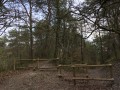
From the heights of Laines-aux-Bois, descend to the plain, visit the Fontaine site, the remains of the Gallo-Roman oppidum and the traces of the castle at the Montaigu nature site, then return via the Sentier des Moutons trail, ending with a walk through the charming hamlet of Les Grandes Vallées.
This route avoids the steepest paths.
More walks in Saint-Flavy
Select a point of interest below: