The former Paraclet Abbey, the village of Quincey and its mill

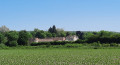
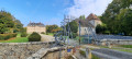
A relatively easy walk, starting from the former Abbey of Le Paraclet in Saint-Aubin (Aube), passing through the small village of Quincey where, after seeing the old mill on the River Ardusson, you enter the village and head towards the church, leaving the restored washhouse on your left.
Retrace your steps back to Rue du Mazot, then head up to the right towards the hills, where you’ll enjoy views of the power station, the village and the abbey.

Details

10024318
Creation:
Last update:
Last review:
  • Walking
    Activity: Walking
  • ↔
    Distance: 6.84 mi
  • ◔
    Average duration: 3h 25 
  • ▲
    Difficulty: Moderate

  • ⚐
    Back to start: Yes
  • ↗
    Ascent: + 269 ft
  • ↘
    Descent: - 262 ft

  • ▲
    Highest point: 390 ft
  • ▼
    Lowest point: 240 ft

Photos

Description of the walk

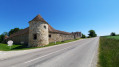
Whether arriving from Nogent-sur-Seine or Ferreux-Quincey, park alongside the high walls and towers of the former abbey.

(S/E) Walk along the cobbled path for 200 metres, then turn right.

(1) Shortly afterwards, turn left to head up towards the forest, then turn right and continue in the same direction for about 3 km, passing under some power lines.

(2) Before reaching the D51, turn right towards the village of Quincey, skirting a horse paddock, then turn right and then left to join a tarmac road leading into the village.

(3) Follow it to the left. After 300 m, turn right onto Rue du Mazot until you reach the old watermill, which you’ll leave on your left, and carry on until you reach the path on the right.

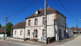
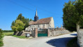
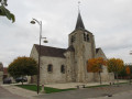
(4) Follow this track for about 800 m, turn right, pass the wash house on your left, and at the end of the street turn left towards Saint-Matin Church.

(5) Retrace your steps back to the junction with Rue du Mazot.

(4) Turn right onto Rue du Mazot, cross the D442 (taking care) and continue straight on for 900 m, passing under the high-voltage power line.

(6) Turn right, cross a road and carry on straight ahead for 2 km.

(7) Turn right and carry on for about 1 km. At the end of the track, turn right, then left, cross the D442 again (taking care), and you’ll be back at the old abbey (S/E).


Waypoints

  1. S/E : mi 0 - alt. 253 ft - Along the abbey’s surrounding walls
  2. 1 : mi 0.22 - alt. 256 ft - Towards the forest. After the - Ardusson (rivière) - Affluent de la Seine
  3. 2 : mi 1.77 - alt. 312 ft - Turn right towards the village
  4. 3 : mi 2.14 - alt. 269 ft - Turn left
  5. 4 : mi 2.7 - alt. 259 ft - Out and back; turn right after the mill
  6. 5 : mi 3.33 - alt. 289 ft - Saint-Matin Church
  7. 6 : mi 4.62 - alt. 390 ft - Path on the right
  8. 7 : mi 5.93 - alt. 282 ft - Path on the right
  9. S/E : mi 6.84 - alt. 253 ft - Along the abbey’s surrounding walls

Notes

No special equipment required, but bring rainwear as there is little shelter outside the village of Quincey; there is a water point at the cemetery surrounding Quincey Church. Mosquito repellent is recommended in summer.

Worth a visit

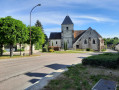
An interesting walk due to the history of the Paraclet Abbey site, its affiliated church of Saint-Martin in Quincey, the old watermill on Rue du Mazot in Quincey and the village washhouse on the banks of the River Ardusson.

Reviews and comments

4.7 / 5
Based on 2 reviews

Reliability of the description
5 / 5
Ease of following the route
5 / 5
Route interest
4 / 5
lebelarbre
lebelarbre

We only did half the walk because the southern section, which mainly crosses fields, seemed a bit monotonous to us. So we set off from Quincey straight towards Le Paraclet, visited it, then returned to Quincey via the northern circular route; we walked a circular route as far as Ferreux, along the southern and then northern banks of the Ardusson. A pleasant walk.

Machine-translated

Roger Flao
Roger Flao

Hello, thank you for dropping by and for taking this walk. During our walk, there was nothing to suggest that this section of the route was private; it’s true that we walk alongside the stud farm, but this path is clearly marked on the IGN map. Yes, your suggestion makes sense, and why not extend it? Kind regards.

Machine-translated

Anne Laure B
Anne Laure B

Hello

I’d just like to make a quick comment on your route. Between points 2 and 3, there’s a path and some private property.
I suggest you carry on straight ahead (at no. 2), cross the road and turn onto the next path between the places known as ‘Le Fourneau’ and ‘La Côte’; this does make the route a bit longer, but the return to the village along the path that runs alongside the river is very pleasant.

Many thanks in advance
To Laure

Machine-translated

Roger Flao
Roger Flao

We’re delighted that you enjoyed this route...

Machine-translated

marieodile
marieodile

Overall rating : 4.7 / 5

Date of your route : Jan 23, 2022
Reliability of the description : ★★★★★ Very good
Ease of following the route : ★★★★★ Very good
Route interest : ★★★★☆ Good
Very busy route : No

We’re delighted to have discovered this new route not far from home
The second section, on the other side of the road, is a bit more monotonous than the first.
Best avoided during heatwaves as there is little shade

Machine-translated

Baboune77650//
Baboune77650//

Overall rating : 4.7 / 5

Date of your route : Nov 24, 2021
Reliability of the description : ★★★★★ Very good
Ease of following the route : ★★★★★ Very good
Route interest : ★★★★☆ Good
Very busy route : No

A walk in the great outdoors – a brilliant way to recharge your batteries.

Machine-translated

Other walks in the area

For more walks, use our search engine .

The GPS track and description are the property of this route's author. Please do not copy them without permission.