The hills above Saint-Hilaire and Crancey

Get out into the fresh air and open spaces; here’s a scenic walk through the villages of Saint-Hilaire and Crancey, with views over the Seine valley, the hills of Champagne and the grain-growing plains to the east towards Troyes.

Details

n°4398209
Creation:
Last update:
Last review:
  • Walking
    Activity: Walking
  • ↔
    Distance: 5.72 mi
  • ◔
    Average duration: 2h 45 
  • ▲
    Difficulty: Moderate

  • ⚐
    Back to start: Yes
  • ↗
    Ascent: + 174 ft
  • ↘
    Descent: - 167 ft

  • ▲
    Highest point: 410 ft
  • ▼
    Lowest point: 220 ft

Photos

Description of the walk

Park at the side of the road, in one of the marked spaces, on Allée des Cerisiers.

(S/E) Take the Allée des Cerisiers eastwards until you reach the Rue du Petit Fayet, which you turn right into.

(1) When the street turns left at a 90° angle, carry on straight ahead along the grassy track. Follow this track for approximately 1.2 km, ignoring all side paths.

(2) At the junction after the wooded section, turn right. You’ll come out onto the D96; follow it to the left. After 100 m, take the unpaved track on the right. Carry on straight ahead and pass under a high-voltage power line. At the T-junction, turn right towards the mast and pass under the high-voltage power line again.

(3) Once you reach the mast, turn right. Take thethird track on the left, before the farm.

(4) After about 400 m, take thefirst track on the right. You’ll come out onto the D96 again; follow it to the left towards the village of Crancey.

(5) At the entrance to the village, turn left onto Chemin de la Voie Romaine. Cross the D51 and then take thefirst right, onto Chemin des Yattes. Turn right onto the path before the entrance to the cemetery.

(6) At the corner by the cemetery, turn left onto the Route de Longueperte (D51). Cross the D619 (formerly the N19) at the pedestrian crossing, then cross the railway line at the level crossing. Continue straight ahead. Pass the Rue des Adams on your right, then turn slightly right into the Place du Guevet.

(7) Cross the Guevet bridge, then follow the Ruisseau de Faverolles on your right. The path then veers away from the stream and passes between some ponds.

(8) At the junction (farmhouse), turn right onto Chemin de Mouille Cul, between two bodies of water.

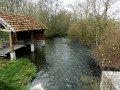
(9) At the next junction, veer to the right and walk past the wash house and the old mill house. Cross Rue des Tilleuls on the right-hand side and take the bridge over the railway line. You’ll reach the D619; follow it to the right towards the town hall and school.

(10) Just before the town hall, turn left onto Rue de l’Église. Then take thefirst left, Allée des Cerisiers, to return to the car park (S/E).


Waypoints

  1. S/E : mi 0 - alt. 299 ft - Allée des Cerisiers
  2. 1 : mi 0.24 - alt. 282 ft - Go straight on at the bend
  3. 2 : mi 0.92 - alt. 407 ft - Crossroads
  4. 3 : mi 1.97 - alt. 387 ft - A guyed metal aerial.
  5. 4 : mi 2.62 - alt. 331 ft - Junction
  6. 5 : mi 3.21 - alt. 246 ft - Entrance to Crancey – Chemin de la Voie Romaine.
  7. 6 : mi 3.6 - alt. 253 ft - Crancey Cemetery – D51 road
  8. 7 : mi 4.02 - alt. 223 ft - Place du Guevet
  9. 8 : mi 4.79 - alt. 223 ft - Crossroads – Farmhouse
  10. 9 : mi 5.1 - alt. 223 ft - Junction
  11. 10 : mi 5.43 - alt. 262 ft - D619 road
  12. S/E : mi 5.72 - alt. 302 ft - Allée des Cerisiers

Notes

No special equipment required; the route mainly follows farm tracks with a water point at Crancey cemetery. No shelter, except in the villages.

Worth a visit

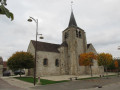
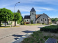
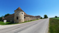
Churches and wash houses in Saint-Hilaire and Crancey.

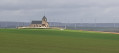
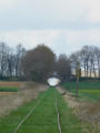
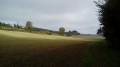
Beautiful panoramic views of the church at Saint-Hilaire, the Seine valley and the hills of Champagne, the Aube grain-growing plain and the numerous wind turbines, as well as a view of the Nogent-sur-Seine nuclear power station.

Reviews and comments

4.3 / 5
Based on 2 reviews

Reliability of the description
4.5 / 5
Ease of following the route
4.5 / 5
Route interest
4 / 5
Roger Flao
Roger Flao

Thank you for your feedback!

Machine-translated

MARTDomi
MARTDomi

Overall rating : 4 / 5

Date of your route : Jul 22, 2025
Reliability of the description : ★★★★☆ Good
Ease of following the route : ★★★★☆ Good
Route interest : ★★★★☆ Good
Very busy route : No

Pretty country loop. Pas-de-Calais, no particular difficulties

Machine-translated

Roger Flao
Roger Flao

Thank you for your comment – a lovely route with some beautiful views!

Machine-translated

Luc Horrenberger
Luc Horrenberger

Overall rating : 4.7 / 5

Date of your route : Feb 03, 2025
Reliability of the description : ★★★★★ Very good
Ease of following the route : ★★★★★ Very good
Route interest : ★★★★☆ Good
Very busy route : No

A perfect walk in the sunshine, not too challenging, with a climb at the start and well signposted throughout the route – I’d recommend it…

Machine-translated

Other walks in the area

For more walks, use our search engine .

The GPS track and description are the property of this route's author. Please do not copy them without permission.