Macey Forest

In the beautiful Macey State Forest, a walk along forest roads and well-maintained paths, with a few lovely viewpoints.

Details

3415316
Creation:
Last update:
Last review:
  • Walking
    Activity: Walking
  • ↔
    Distance: 4.72 mi
  • ◔
    Average duration: 2h 25 
  • ▲
    Difficulty: Easy

  • ⚐
    Back to start: Yes
  • ↗
    Ascent: + 285 ft
  • ↘
    Descent: - 269 ft

  • ▲
    Highest point: 823 ft
  • ▼
    Lowest point: 610 ft

Photos

Description of the walk

Park in the car park by the town hall and the school.

(S/E) Head up the path that runs alongside the town hall and then the school. When you come out onto Rue Turvenelle, turn right and then left into Rue Jean-Jacques Rousseau.

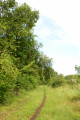
(1) Leave the street by turning left onto a grassy path which narrows as it enters the woodland. After about 250 metres, take the small path on the left (not shown on the map). Follow it for one kilometre on almost flat ground.

(2) Turn right to pass between plots 9 and 11. At the junction with the forest track, turn right and follow it for 1.5 km, up to the 238-metre mark.

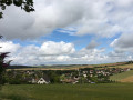
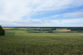
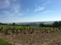
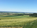
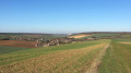
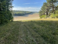
(3) Turn left between plots 19 and 21. Follow the path down to the edge of the woodland, then turn right and walk along the edge of the woodland. Enjoy a lovely view of the plain and the village of Messon as you head towards the 219-metre mark.

(4) When this path turns left, carry on in the same direction (westwards), entering the woods via a mountain bike trail. This trail then descends for a few dozen metres to the left before climbing again to the right, heading north.
Carry on along this mountain bike track and follow the forest track visible on your right for 300 metres.

(5) Turn sharply left, still on this mountain bike track.
Go round the nature reserve, following this track first northwards and then eastwards. Continue along this track, which runs along the northern edge of the woodland.

(6) Carry on along this path as it climbs to the right, leaves the edge of the woodland and enters the forest again. Further up, the path turns left before reaching the Gallets fields. You’ll come to a junction.

(7) Leave the woods and take the path leading down to the left, ignoring the one that veers sharply to the left. Then walk down Rue Jean-Jacques Rousseau.

(1) Carry on straight ahead until you reach Rue René Cassin. Turn right to reach the town hall and the car park (S/E).

Waypoints

  1. S/E : mi 0 - alt. 610 ft - Town Hall
  2. 1 : mi 0.34 - alt. 673 ft - Junction of road and grassy path
  3. 2 : mi 0.89 - alt. 801 ft - Passage between plots 9 and 11
  4. 3 : mi 1.82 - alt. 791 ft - Junction (elevation 238)
  5. 4 : mi 2.22 - alt. 748 ft - Trail junction (elevation 219)
  6. 5 : mi 2.82 - alt. 719 ft - At the end of the forest track: the Reserve
  7. 6 : mi 3.76 - alt. 699 ft - Junction. Due south
  8. 7 : mi 4.2 - alt. 774 ft - At the junction, turn left
  9. S/E : mi 4.72 - alt. 610 ft - Town Hall

Notes

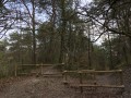
The Macey State Forest consists mainly of beech, oak, wild cherry, maple and hornbeam trees.
It was already used during the construction of Troyes Cathedral and continues to be maintained.
The varied route partly follows a blue/white-marked trail, as well as a forest road and well-maintained paths also used by mountain bikers.

Reviews and comments

4.1 / 5
Based on 3 reviews

Reliability of the description
4.3 / 5
Ease of following the route
4 / 5
Route interest
4 / 5
Richard Jean-Louis
Richard Jean-Louis

Overall rating : 4 / 5

Date of your route : Mar 02, 2026
Reliability of the description : ★★★★☆ Good
Ease of following the route : ★★★★☆ Good
Route interest : ★★★★☆ Good
Very busy route : Yes

I am looking for routes based on your components to draw routes.

Machine-translated

Océane .10
Océane .10

Overall rating : 4.3 / 5

Date of your route : Aug 20, 2024
Reliability of the description : ★★★★★ Very good
Ease of following the route : ★★★★☆ Good
Route interest : ★★★★☆ Good
Very busy route : No

A very pleasant site; it’s shaded, so it’s fine when it’s hot.

Machine-translated

mamandesmarcheuses
mamandesmarcheuses

Overall rating : 4 / 5

Date of your route : Oct 19, 2020
Reliability of the description : ★★★★☆ Good
Ease of following the route : ★★★★☆ Good
Route interest : ★★★★☆ Good
Very busy route : No

A lovely walk in the woods with some lovely views

Machine-translated

Other walks in the area

For more walks, use our search engine .

The GPS track and description are the property of this route's author. Please do not copy them without permission.