Circular Vaulonnais route from Montgueux

A short walk to get a breath of fresh air, either on your own or with the family, amongst fields and woodland. An easy route suitable for everyone: wide farm tracks.

Details

106231196
Creation:
Last update:
Last review:
  • Walking
    Activity: Walking
  • ↔
    Distance: 4.75 mi
  • ◔
    Average duration: 2h 35 
  • ▲
    Difficulty: Easy

  • ⚐
    Back to start: Yes
  • ↗
    Ascent: + 456 ft
  • ↘
    Descent: - 446 ft

  • ▲
    Highest point: 876 ft
  • ▼
    Lowest point: 604 ft
  • ⚐ Country: France
  • ⚐ City: Montgueux (10300)
  • ⚑
    Start/End: N 48.305943° / E 3.953947°
  • ❏
    IGN map(s): Ref. 2817SB
  • Hour-by-hour weather

Description of the walk

Start and finish at Montgueux Stadium – car access and car park.

(S/E) Start gently with a downhill stretch along the Bois du Château on your right; in the dip, turn left onto a straight, almost flat section – an ideal start for a gentle warm-up.

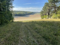
(1) Turn right towards the Bois Grosmont; there’s a short climb, ideal for your thighs and calves, then turn left onto the ridge to reach a viewpoint on the heights of Mesnil Vallon.

(2) Continue along the path opposite, which joins and then runs alongside the Bois de Vaulonnais before entering it.

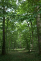
(3) Take a narrow single track (MTB trail) on the left, enter the woods and cross through them.

(4) On emerging, turn right and follow the path alongside the field to the Bois Beauregard – Bois Brûlé. Turn left as you head downhill alongside the woods and arrive at the D91.

(5) Follow the path on the left, running alongside this road, until you reach the sewage treatment works.

(6) Leave the departmental road, turn left, pass the sewage treatment plant and reach a fork in the road.

(7) Turn right onto a small, very pleasant path that climbs towards Montgueux. At the top, turn left to go round the Bois Chanais on the left-hand side.

(8) Those who enjoy walking through woodland can take a shortcut to the right through the woods. Otherwise, continue round the edge of the woods until you reach the stadium (S/E).

Waypoints

  1. S/E : mi 0 - alt. 860 ft - Montgueux Stadium
  2. 1 : mi 0.59 - alt. 755 ft - Junction
  3. 2 : mi 1.2 - alt. 840 ft - Viewpoint
  4. 3 : mi 1.6 - alt. 827 ft - Entrance to the woods
  5. 4 : mi 1.89 - alt. 712 ft - Entrance to the woods
  6. 5 : mi 2.72 - alt. 610 ft - D91
  7. 6 : mi 3.25 - alt. 679 ft - Junction at the sewage treatment works
  8. 7 : mi 3.51 - alt. 669 ft - Junction
  9. 8 : mi 4.16 - alt. 817 ft - Entrance to the Bois de Chanais
  10. S/E : mi 4.75 - alt. 863 ft - Montgueux Stadium

Notes

Easy parking and access by car. No water points along the route and no shelter.

Worth a visit

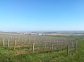
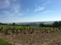
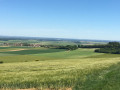
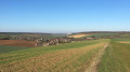
360° panoramic view; you can see quite far on a clear day (2).

Other walks in the area

For more walks, use our search engine .

The GPS track and description are the property of this route's author. Please do not copy them without permission.