Ferreux circular route via Saint-Loup-de-Buffigny

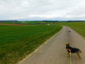
A short walk through the villages of Ferreux and Saint-Loup-de-Buffigny and the countryside around the River Ardusson.
Views of the villages to the north, seasonal flora and wildlife!
Be warned – it’s a bit of a climb!

Details

21942291
Creation:
Last update:
Last review:
  • Walking
    Activity: Walking
  • ↔
    Distance: 5.54 mi
  • ◔
    Average duration: 2h 45 
  • ▲
    Difficulty: Easy

  • ⚐
    Back to start: Yes
  • ↗
    Ascent: + 223 ft
  • ↘
    Descent: - 230 ft

  • ▲
    Highest point: 436 ft
  • ▼
    Lowest point: 272 ft

Photos

Description of the walk

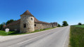
Park near the wash house on Route de Longueperte (D52).

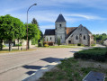
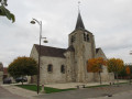
(S/E) Take Rue du Pont Robin and turn right towards the D442; cross the road carefully to reach the town hall and Place de l’Église.

(1) Return to the D442 and follow it to the right until you reach a bend. Continue straight on along the D52 until you come to a path on the left

(2) Turn left onto the field track and follow it for about 900 metres. At the end, first turn left then right as you skirt a woodland, then continue left until you reach the D442 again near the village of Saint-Loup-de-Buffigny. Follow it to the right for about 400 metres.

(3) Turn left onto a small road, pass through a farm and, at the end, turn right to walk through the village of Saint-Loup-de-Buffigny to the village hall/school and the church. Continue for a further hundred metres or so until you reach a small path on the left.

(4) Take this path, which joins Rue de Belle Fille, and follow it to the left back towards the village.

(5) Just before a junction, turn right onto a grassy path that climbs for 400 metres and, at the end, first turn left then right for about 150 metres.

(6) On the hills above the villages, before the power lines, turn left and walk 1 km to a mast.

(7) Turn left onto the path and follow it for 600 m before turning right onto the grassy path which will take you past the cemetery and onto the D52 (Route de Longueperte); follow this to the left for 50 m, then turn right onto a path through tall grass for 80 m.

(8) Turn right onto the path that runs alongside the copses.

(9) Just after passing under an EDF high-voltage power line, take the path on the left, cross the Ruisseau l’Ardusson and, shortly afterwards, turn left, following the copses back towards the village of Ferreux-Quincey, eventually rejoining the D52, Route de Longueperte.
Turn left and you’ll find the wash house at your starting point (S/E).


Waypoints

  1. S/E : mi 0 - alt. 279 ft - Route de Longueperte (D52). Cross the - Ardusson (rivière) - Affluent de la Seine
  2. 1 : mi 0.22 - alt. 308 ft - Town Hall - Église Saint-Loup (Ferreux)
  3. 2 : mi 0.51 - alt. 344 ft - Path leading up towards the woods
  4. 3 : mi 1.69 - alt. 302 ft - Junction
  5. 4 : mi 2.31 - alt. 295 ft - Junction - Église Saint-Loup (Saint-Loup-de-Buffigny)
  6. 5 : mi 2.74 - alt. 295 ft - Junction – Grass-covered path
  7. 6 : mi 3.1 - alt. 331 ft - Elevation of the two villages
  8. 7 : mi 3.6 - alt. 436 ft - Branch
  9. 8 : mi 4.32 - alt. 289 ft - Path alongside a copse
  10. 9 : mi 4.75 - alt. 285 ft - Junction
  11. S/E : mi 5.54 - alt. 279 ft - Route de Longueperte (D52)

Notes

No special equipment is required other than good walking shoes, a bottle of water and rainwear.

Worth a visit

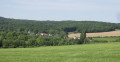
The restored wash house at the starting point, the churches of Ferreux-Quincey and Saint-Loup-de-Buffigny, and a beautiful panoramic view of the hills to the north of the villages.
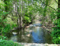
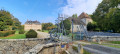
The lovely Ardusson stream.
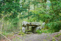
Seasonal flora and wildlife.

Reviews and comments

4.7 / 5
Based on 2 reviews

Reliability of the description
5 / 5
Ease of following the route
5 / 5
Route interest
4 / 5
verosano
verosano
• Edited:

Overall rating : 4.7 / 5

Date of your route : Feb 09, 2025
Reliability of the description : ★★★★★ Very good
Ease of following the route : ★★★★★ Very good
Route interest : ★★★★☆ Good
Very busy route : No

A very pleasant route, particularly from 7) to the finish, apart from the 400 metres before 3), where cars drive fast.
After number 9), the path is a bit waterlogged up to the bridge.
I did an extra circular route via Rue du Moulin: a magnificent stretch alongside the stream that feeds into the Ardusson.
I set off a bit late and the sky was grey, but I’ll come back to do it again with my walking group in the spring.
Thank you for this lovely, detailed discovery.

Machine-translated

Roger Flao
Roger Flao

Thank you for taking a look at our walking suggestions; you’ve adapted them to suit your own preferences...

Machine-translated

lebelarbre
lebelarbre

We combined two half-hikes into one: we did the Quicey–Paraclet hike, but only half of it, as the southern section – which mainly crosses fields – seemed a bit monotonous to us. So, we set off from Quincey straight towards the Paraclet, visited it, then returned to Quincey via the northern circular loop; we then walked a circular route as far as Ferreux, along the southern and then northern banks of the Ardusson. A pleasant walk.

Machine-translated

Roger Flao
Roger Flao

Thank you for your comment! Enjoy your walks...

Machine-translated

erictual
erictual

Overall rating : 4.7 / 5

Date of your route : Sep 11, 2022
Reliability of the description : ★★★★★ Very good
Ease of following the route : ★★★★★ Very good
Route interest : ★★★★☆ Good
Very busy route : No

A route that presents no particular difficulties or points of interest, other than a pleasant stroll through a flat landscape.

Machine-translated

Other walks in the area

For more walks, use our search engine .

The GPS track and description are the property of this route's author. Please do not copy them without permission.