


Refine your search for walks in Saint-Baldoph
Saint-Baldoph walks


 Mont Charvais, Croix de la Coche and Bec du Corbeau
 Visorando Member
 5.41 mi
 +1,890 ft
 -1,883 ft
 4h 10
4h 10
 Moderate
 Departure from Saint-Baldoph (Savoie)
This circular route on the outskirts of Chambéry takes you to three vantage points offering panoramic views of the Belledonne mountain range, Les Bauges and La Chartreuse. On the outskirts of Mont Charvais, surrounded by pine trees, you can almost feel the Mediterranean atmosphere – all that's missing are the cicadas.
La Madeleine and Haut Mollard via the Butte de l’Échaud
 3.48 mi
+295 ft
-282 ft
1h 50
3.48 mi
+295 ft
-282 ft
1h 50
 Easy
Departure from La Ravoire (Savoie)
Easy
Departure from La Ravoire (Savoie)
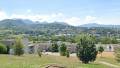
A circular loop in the heart of the Chambéry conurbation which, starting from the small car park at La Peysse near the Voie Verte, takes you on a walk in La Ravoire over the green hill of L’Échaud and the Haut-Mollard, and allows you to visit the Madeleine neighbourhood below. Perfect for a short family stroll on a Sunday.
:!: 21/02/2025: Route amended between (5) and (7).
The Marais des Chassettes
 3.73 mi
+105 ft
-108 ft
1h 50
Easy
Departure from La Ravoire (Savoie)
3.73 mi
+105 ft
-108 ft
1h 50
Easy
Departure from La Ravoire (Savoie)
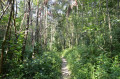
A walk around La Ravoire and Challes-les-Eaux in the Chambéry metropolitan area, passing through the Marais des Chassettes. This is a protected natural site that is home to several species of local flora and fauna. Here you’ll find the biome that once existed here: the marshes of the Alpine valley floors. It’s also an opportunity to explore the Challes-les-Eaux leisure centre, as well as the hill where the church stands and the new quarter of La Ravoire.
Croix de la Coche loop
4.21 mi
+1,204 ft
-1,175 ft
3h 00
Easy
Departure from Barberaz (Savoie)
Coche or Cochette means a passage. The ancestral passage between the villages of Montagnole and Saint-Baldoph is marked by a solid, massive stone cross. Information panels along the way. Panoramic views at the summit and on the descent along the ridge.
Circular in the heart of La Ravoire
 6.04 mi
+322 ft
-322 ft
3h 05
Easy
Departure from La Ravoire (Savoie)
6.04 mi
+322 ft
-322 ft
3h 05
Easy
Departure from La Ravoire (Savoie)
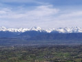
A lovely, fairly flat semi-urban walk in La Ravoire, perfect for exploring this pretty, leafy suburb of Chambéry. Ideal for families looking for a short walk that combines urban and green surroundings. This walk takes you through the Valmar town centre, offers magnificent views of Belledonne from the Parc de l’Echaud, takes you through a few residential neighbourhoods, leads to the Boige plains and then returns via the sports facilities, Le Pré Joli and then Champ Clavier.
Towards Les Hauts de Chanaz
 4.23 mi
+942 ft
-935 ft
2h 45
Easy
Departure from Barberaz (Savoie)
4.23 mi
+942 ft
-935 ft
2h 45
Easy
Departure from Barberaz (Savoie)
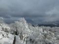
This is a simple circular walk for a half-day excursion. It takes place in the foothills of the Chartreuse Mountains. Beautiful views of Les Bauges, Chartreuse, L'Épine and Lac du Bourget.
Pichut waterfall circuit
 3.28 mi
+797 ft
-801 ft
2h 10
Easy
Departure from Apremont (Savoie) (Savoie)
3.28 mi
+797 ft
-801 ft
2h 10
Easy
Departure from Apremont (Savoie) (Savoie)
This circuit runs along the foothills of the Chartreuse mountains at the foot of Mont Granier. Discover the vineyards, a pretty waterfall and views of the Belledonne and Bauges mountains. A few information boards add to the interest of this easy walk.
Yellow and occasional white and red markings forthe GR® 965.
Boucle panoramique au dessus de Challes-les-Eaux
 4.02 mi
+246 ft
-259 ft
2h 05
Easy
Departure from Challes-les-Eaux (Savoie)
4.02 mi
+246 ft
-259 ft
2h 05
Easy
Departure from Challes-les-Eaux (Savoie)
Comment en quelques minutes à peine découvrir des panoramas et endroits à voir absolument à Challes-les-Eaux.
Resistance Fighters’ Farm and Maquis memorial from Challes-les-Eaux
6.69 mi
+1,598 ft
-1,572 ft
4h 30
Moderate
Departure from Challes-les-Eaux (Savoie)
During the heat of summer, this route allows you to enjoy the coolness of the woodland whilst exploring this important site of the Resistance on the heights of the Bois de Barby, below the hamlet of Curienne. This farm, now in ruins, was home to one of the very first maquis groups in the region in August 1942.
From Saint-Jeoire to Montmélian through the vineyards
8.38 mi
+1,115 ft
-1,115 ft
4h 50
Easy
Departure from Saint-Jeoire-Prieuré (Savoie)
In December, a good idea for a sunny walk is to go hiking in the vineyards.
The walk described below is just one of many possible routes through the Chignin vineyards.
There are endless variations possible.
Around Mont Ronjou
 3.30 mi
+620 ft
-620 ft
2h 05
Easy
Departure from Saint-Jeoire-Prieuré (Savoie)
3.30 mi
+620 ft
-620 ft
2h 05
Easy
Departure from Saint-Jeoire-Prieuré (Savoie)
This is an easy hike to a small grassy peak overlooking the vineyards of Saint-Jeoire-Prieuré. Enjoy beautiful views of the Belledonne mountain range, the Chartreuse mountains and the Chambéry cluse. There are markings and even directional signs, but not along the entire route described.
From Montagnole to Pas de la Fosse
 6.85 mi
+1,017 ft
-1,001 ft
4h 00
Moderate
Departure from Montagnole (Savoie)
6.85 mi
+1,017 ft
-1,001 ft
4h 00
Moderate
Departure from Montagnole (Savoie)
This varied route, set in a picturesque countryside, offers magnificent views of the Montagne de l’Épine, Lac du Bourget (and the Dent du Chat), as well as the foothills of the Massif des Bauges, not to mention, to the south, the view towards the Pointe de la Gorgeat, the gateway to the Chartreuse.
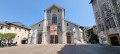
Loop through historic Chambéry
 1.93 mi
+13 ft
-13 ft
0h 55
Easy
Departure from Chambéry (Savoie)
1.93 mi
+13 ft
-13 ft
0h 55
Easy
Departure from Chambéry (Savoie)
Visit the historic centre of Chambéry, passing by the Château des Ducs de Savoie, the Town Hall, Saint-François de Salles Cathedral, the Museum of Fine Arts... and charming little pedestrian passages. A very pleasant route.
From Jacob to Montagnole
4.57 mi
+856 ft
-833 ft
2h 50
Easy
Departure from Jacob-Bellecombette (Savoie)
A short, easy walk on the outskirts of the town and at the foot of the Chartreuse Mountains. Panoramic views over the Chambéry Basin.
From Jean-Jacques Rousseau’s house to the Jacob and Grobelle waterfalls
 6.41 mi
+1,329 ft
-1,352 ft
4h 05
Moderate
Departure from Jacob-Bellecombette (Savoie)
6.41 mi
+1,329 ft
-1,352 ft
4h 05
Moderate
Departure from Jacob-Bellecombette (Savoie)
A pleasant green walk in the hills, very close to the very centre of the Chambéry conurbation, allowing you to visit the home of the illustrious Jean-Jacques Rousseau and explore the Nant du Pontet streams. This walk takes you through the areas of Jacob-Bellecombette, Chambéry and Barberaz, and past the boundary of the municipality of Montagnole. Despite its proximity to the city, most of the route is through woods or across meadows.
La Grande Montagne
7.50 mi
+2,182 ft
-2,051 ft
5h 20
Moderate
Departure from Chambéry (Savoie)
This walk combines a variety of points of interest, starting from Les Éléphants, Chambéry’s iconic monument, before heading towards the Charmettes neighbourhood, dear to Jean-Jacques Rousseau. Further up lies the Grande Montagne, which, whilst nothing like high mountains, nevertheless offers panoramic views of distant mountain ranges.
The first section follows theGR®96route.
The Jacob-Bellecombette Waterfalls
 4.42 mi
+869 ft
-883 ft
2h 45
Moderate
Departure from Jacob-Bellecombette (Savoie)
4.42 mi
+869 ft
-883 ft
2h 45
Moderate
Departure from Jacob-Bellecombette (Savoie)
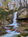
On the outskirts of Chambéry, the Nant du Ruisseau du Pontet retains a wild course, hemmed in by urban development, with its waterfalls and gorges offering an interesting hike that continues up the Grobelle hillside for views over the Chambéry Basin. The return route naturally involves some sections along roads that are fairly unavoidable given the layout of the area.
La Fejaz de la Ravoire, Barby and the Château de la Bâtie
 4.09 mi
+787 ft
-758 ft
2h 35
Easy
Departure from La Ravoire (Savoie)
4.09 mi
+787 ft
-758 ft
2h 35
Easy
Departure from La Ravoire (Savoie)
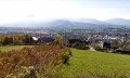
A short, easy and pleasant circular route to the east of the Chambéry gorge, combining urban and natural scenery; Starting from La Fejaz (La Ravoire), it allows you to explore the centre of the pretty village of Barby before gently making your way up into the foothills of the Bauges massif via Les Chavonnes and the Château de la Bâtie, until you reach the heights overlooking the ‘end of the world’ (Saint-Alban-Leysse) and the River Leysse.
Chapelle Saint-Michel via Bellevarde and the Stèle
 6.75 mi
+2,231 ft
-2,231 ft
5h 05
Easy
Departure from Barby (Savoie) (Savoie)
6.75 mi
+2,231 ft
-2,231 ft
5h 05
Easy
Departure from Barby (Savoie) (Savoie)
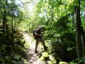
The Mont Saint-Michel Chapel, which is clearly visible from the Chambéry basin, is often the destination for a Sunday afternoon walk starting from Montmerlet above Curienne. There is only a hundred metres or so of elevation gain.
The trail is very well marked.
A lovely tour of Chignin among the vineyards.
 4.39 mi
+741 ft
-725 ft
2h 40
Easy
Departure from Chignin (Savoie)
4.39 mi
+741 ft
-725 ft
2h 40
Easy
Departure from Chignin (Savoie)
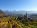
A very pretty circular for a long walk among the vineyards of Chignin. Very pleasant in the foothills of Les Bauges. A beautiful getaway among medieval towers and cellars, with magnificent views of the Chambéry valley and the Belledonne mountain range. It is even more beautiful in the middle of autumn, just after the grape harvest.
The Roc de Torméry via the ladders, the Tapin, the Grotte de l’Ermite
6.88 mi
+3,166 ft
-3,169 ft
5h 55
 Difficult
Departure from Chignin (Savoie)
Difficult
Departure from Chignin (Savoie)
From the Chignin vineyard, it takes a good two hours to reach the foot of the ladders that allow you to overcome the final obstacle. This structure was built in response to the threat posed by the Roc de Tormery to the village below. The view, already visible during the ascent, opens up as soon as you set foot on the ridge.
Chignin - Torméry themed walk
4.36 mi
+518 ft
-515 ft
2h 25
Easy
Departure from Chignin (Savoie)
A short walk for an afternoon in the sunshine in the vineyard. The route described is largely based on a local circular loop called: The winegrower's year.
In addition to the directional signs, there are yellow markings and pictograms (a winegrower working in the vineyard).
The route is marked at intervals by seven information panels.
Montbasin Razerel Monterminod
7.19 mi
+2,306 ft
-2,297 ft
5h 20
Easy
Departure from Saint-Alban-Leysse (Savoie)
A walk to revisit the classics near Chambéry.
Leysse and Ternèze, gorges and canyons
 11.02 mi
+2,733 ft
-2,740 ft
7h 25
Moderate
Departure from Saint-Alban-Leysse (Savoie)
11.02 mi
+2,733 ft
-2,740 ft
7h 25
Moderate
Departure from Saint-Alban-Leysse (Savoie)
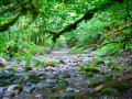
A long route following the Leysse and then the Ruisseau de Ternèze along the right bank, before descending via the left bank, allowing you to explore places that are by turns wild and marked by past human activity. The presence of water makes these sections pleasant in summer. The route is long as it covers the entire length; it is possible to shorten it at any point where you can cross from one bank to the other.
In the Monts de Bassens
4.82 mi
+1,060 ft
-1,060 ft
3h 10
Moderate
Departure from Bassens (Savoie) (Savoie)
A walk to discover the heritage around Bassens.
Just a stone’s throw from Chambéry, in the heart of the Alps, you can enjoy a half-day outing taking in a succession of panoramic views and insights into local history.
Les Hauts de Chamoux
6.13 mi
+679 ft
-679 ft
3h 25
Moderate
Departure from Cognin (Savoie)
A walk above Bissy, towards the Côte de Chamoux, through forests and meadows offering lovely views of the Épine mountain range, the southern tip of Lake Bourget and La Motte Servolex, as well as the Chambéry conurbation and the iconic summit of the Croix du Nivolet.
From Bout du Monde to Trou de l’Enfer via the shortest route
 4.55 mi
+1,093 ft
-1,079 ft
3h 05
Moderate
Departure from Saint-Alban-Leysse (Savoie)
4.55 mi
+1,093 ft
-1,079 ft
3h 05
Moderate
Departure from Saint-Alban-Leysse (Savoie)
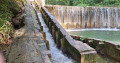
A rather daunting name for a gentle stroll. Le Bout du Monde is the remote, secluded corner of a Savoyard village, whilst the Trou de l’Enfer marks the source of a mid-mountain torrent, the Leysse. In this heatwave, stay in the shade and walk alongside the torrent. Enjoy the cool, damp microclimate. To avoid getting lost, follow the riverbed.
Chemin des Vignes from Bout du Monde to Passerelle du Trou de l'Enfer
 5.42 mi
+1,476 ft
-1,450 ft
3h 45
Moderate
Departure from Saint-Alban-Leysse (Savoie)
5.42 mi
+1,476 ft
-1,450 ft
3h 45
Moderate
Departure from Saint-Alban-Leysse (Savoie)
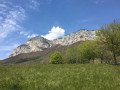
A beautiful walk along the Leysse gorges and through the old vineyards of Saint-Jean-d'Arvey.
The trail, while not particularly difficult, can be a little steep and slippery.
It offers superb views of the Leysse and the cliffs of Mont Peney.
From Saint-André to Lac Noir
 8.04 mi
+1,394 ft
-1,388 ft
4h 55
Moderate
Departure from Les Marches (Savoie)
8.04 mi
+1,394 ft
-1,388 ft
4h 55
Moderate
Departure from Les Marches (Savoie)
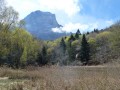
At the foot of the largest cliff in the French Alps, autumn hike from the village of Saint-André to Lac Noir.From Atrus (village of Bellecombette) to Lac Noir, then from Lac Noir to the village of Lachat, the route follows a section of the Sentier des HuguenotsGR®®965.
Circular Mont Saint-Michel from Curienne
 5.09 mi
+1,253 ft
-1,250 ft
3h 25
Moderate
Departure from Curienne (Savoie)
5.09 mi
+1,253 ft
-1,250 ft
3h 25
Moderate
Departure from Curienne (Savoie)
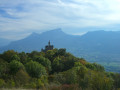
This circular offers beautiful views and allows you to visit Mont St-Michel, which dominates the Cluse de Chambéry, the Motte castrale de la Bognette and, if you wish, the Grotte des Fées.
Mont Saint-Michel Chapel loop, starting from Curienne
 4.95 mi
+764 ft
-771 ft
2h 55
Moderate
Departure from Curienne (Savoie)
4.95 mi
+764 ft
-771 ft
2h 55
Moderate
Departure from Curienne (Savoie)
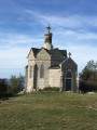
Admittedly, starting from Curienne, this route is not the shortest way to reach the Mont Saint-Michel Chapel! However, it offers the chance to (re)discover the very pleasant Chemin de la Paraie, the memorial stone and the Maquisards’ farm, as well as superb views over Chambéry and the surrounding mountains.Although technically straightforward and with little elevation gain, this hike is nevertheless classified as ‘moderate’ due to its length.
Tour of Lake Saint-André
0.84 mi
+7 ft
-7 ft
0h 25
Easy
Departure from Les Marches (Savoie)
A Sunday stroll to aid digestion… or a circular loop to run several times for a workout!
A walk to Les Marches
 4.30 mi
+771 ft
-741 ft
2h 40
Easy
Departure from Les Marches (Savoie)
4.30 mi
+771 ft
-741 ft
2h 40
Easy
Departure from Les Marches (Savoie)
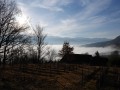
A lovely little walk through the Savoyard vineyards in the commune of Les Marches.
It is possible to add other itineraries to this description, as there are so many paths and trails. The proposed route takes in the typical landscapes of the Abymes vineyards, formed by the collapse of the Granier in 1248.
Through the vineyards and the Marches plain
6.15 mi
+476 ft
-492 ft
3h 15
Moderate
Departure from Les Marches (Savoie)
An easy walk through the vineyards in search of sunshine, ending on the plain. Beautiful views of the region’s mountain ranges.
The Ternèze Canyon and the Bognette viewpoint
5.15 mi
+860 ft
-840 ft
3h 05
Moderate
Departure from Curienne (Savoie)
This hike allows you to discover the magnificent site of the Ternèze Canyon and then, in the village of Curienne, to enjoy information about the Motte Castrale. Next, reach the Sommet de la Bognette for a 360° viewpoint, and on the way back, pass by the Stèle des Résistants.
La Plaine des Marches
 8.83 mi
+509 ft
-492 ft
4h 30
Moderate
Departure from Les Marches (Savoie)
8.83 mi
+509 ft
-492 ft
4h 30
Moderate
Departure from Les Marches (Savoie)
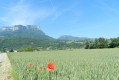
An easy hike offering views of the landscapes from Les Bauges to La Chartreuse, passing by Mont Blanc and Les Belledonnes.
From the Plaine des Marches to Lac Noir
 11.53 mi
+1,614 ft
-1,598 ft
6h 40
Difficult
Departure from Les Marches (Savoie)
11.53 mi
+1,614 ft
-1,598 ft
6h 40
Difficult
Departure from Les Marches (Savoie)
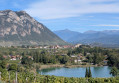
La Plaine des Marches: a classic route. I suggest continuing on to the heights of Chapareillan and heading to the famous Lac Noir below the Col du Granier to enjoy the breathtaking views over the valleys and the surrounding mountain ranges: Chartreuse, Bauges and Belledonne.The return route via Lac de Saint André, off the beaten track, adds an extra dimension to this beautiful hike, apart from the section passing under the high-voltage power line.
Footbridge circuit from Saint-Jean-d'Arvey
 7.21 mi
+1,594 ft
-1,594 ft
4h 40
Moderate
Departure from Saint-Jean-d'Arvey (Savoie)
7.21 mi
+1,594 ft
-1,594 ft
4h 40
Moderate
Departure from Saint-Jean-d'Arvey (Savoie)
This is a pleasant route to walk at any time of year, particularly in late autumn as it enjoys plenty of sunshine.
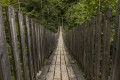
The route of the Himalayan footbridge at Trou de l'Enfer allows you to discover the curious meanders of the Leysse.
More walks in Saint-Baldoph
Select a point of interest below: