From Bout du Monde to Trou de l’Enfer via the shortest route

A rather daunting name for a gentle stroll. Le Bout du Monde is the remote, secluded corner of a Savoyard village, whilst the Trou de l’Enfer marks the source of a mid-mountain torrent, the Leysse. In this heatwave, stay in the shade and walk alongside the torrent. Enjoy the cool, damp microclimate. To avoid getting lost, follow the riverbed.

Details

102532595
Creation:
Last update:
Last review:
  • Walking
    Activity: Walking
  • ↔
    Distance: 4.55 mi
  • ◔
    Average duration: 3h 05 
  • ▲
    Difficulty: Moderate

  • ⚐
    Back to start: Yes
  • ↗
    Ascent: + 1,093 ft
  • ↘
    Descent: - 1,079 ft

  • ▲
    Highest point: 1,440 ft
  • ▼
    Lowest point: 1,066 ft

Photos

Description of the walk

There are several parking spaces on the right-hand side by the stream after La Guillotière.

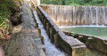
(S/E) Follow the stream along this dirt track, which is passable by vehicles but closed to traffic. Walk for about 900 m until you reach a weir.

(1) At this point, the vegetation makes the banks inaccessible. Take the path leading uphill to the left, reach a ruined hut and go round it on the right to reach a Fork in the road about twenty metres further on.

(2) Ignore the path that continues uphill and turn immediately downhill to the right to reach another Fork in the road.

(3) Turn off to your right. The path descends steeply towards the banks of the stream.

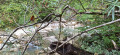
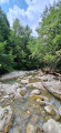
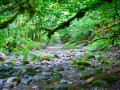
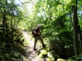
(4) Turn left to follow the banks of the Leysse for about 1,700 metres. This section is very damp, shaded and mossy. A few slippery patches might just give you a dip along the way.

(5) Continue to the left and climb for about a hundred metres until you reach the sign pointing towards the footbridge.

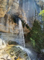
(6) Turn right to reach the Trou de l’Enfer footbridge, which is about 200 m away: take the time to go down and have a splash under the footbridge.

(7) To return, follow the same path back to the car park (S/E).

Waypoints

  1. S/E : mi 0 - alt. 1,066 ft - Car park on the right, on the torrent side - Leysse (rivière)
  2. 1 : mi 0.59 - alt. 1,158 ft - Dam
  3. 2 : mi 0.77 - alt. 1,404 ft - Ruined hut
  4. 3 : mi 1 - alt. 1,430 ft - Junction
  5. 4 : mi 1.09 - alt. 1,168 ft - Back to the bank of the stream
  6. 5 : mi 2.07 - alt. 1,309 ft - Junction - Ternèze (cours d'eau) - Affluent de la Leysse
  7. 6 : mi 2.13 - alt. 1,401 ft - Signpost for the footbridge
  8. 7 : mi 2.27 - alt. 1,358 ft - Trou de l’Enfer footbridge
  9. S/E : mi 4.55 - alt. 1,066 ft - Car park on the right, on the torrent side - Leysse (rivière)

Notes

(1) The fish ladder allows trout to swim upstream when the water level is too high.

Other walks in the area

For more walks, use our search engine .

The GPS track and description are the property of this route's author. Please do not copy them without permission.