


 Country:

 City:
City:



Park in the free municipal car park, Le Silo, in the new Valmar neighbourhood.
(S/E) Head towards the Place de la Mairie via the Villard Valmar promenade, running alongside the newer blocks of flats (La Chèneraie, Le Symphonie). Cross the central square in its entirety to reach the small pedestrian path on Rue de la Poste. Head towards the complex of orange-coloured blocks of flats dating from the 1980s. Walk past the Charles Emmanuel III de Savoie, Les Nénuphars and then Les Soldanettes residential blocks. Turn off onto the shaded path that runs alongside the elevated car park. Continue along the tree-lined paths. Walk past the first building in the Pré Hibou complex (light blue) and you’ll arrive at the Val Fleuri roundabout on Avenue du Pré Renaud.
(1) Walk along the avenue for a few minutes towards the woods. Pass by and go round the local shop, La Ravoire Paysanne. Enter the small wood opposite the shop and the car park. A path runs through it, with the occasional flight of steps here and there. On leaving the woods, you’ll find yourself in the new La Peyrouse neighbourhood, opposite the beautiful Château des Charmilles. Walk right up to it, then take the street to the left. At the junction at the entrance to the Sycomore centre, take the footpath within the walled grounds of the Pré du Haut Mollard. Walk halfway along it, then turn onto Rue du Galibier. Continue along the footpath at the end of the street. Walk through the wooded area until you reach the large meadow at Chevron.
(2) Take the path on the left towards the Sommet de la Trousse.
You can take the other path opposite, through the woods, which leads a little further on if you’d like to extend this circular route by a few minutes.
Reach the junction at Sommet de la Trousse, then continue along Chemin des Châtaigniers to reach the road leading to the Échaud neighbourhood. Walk down the streets between the houses in this former hamlet of Le Mollard until you reach the École Privée de Sainte-Lucie. From there, take the tarmac footpath which leads back up towards Parc de l’Échaud. Turn left once you’ve passed the large building, then walk up through the park, past the small football pitch and the children’s playground, to the viewpoint at the top. Head back down via the zigzagging footpath opposite, which features fitness equipment, to return to Avenue du Pré Renaud. Walk along this avenue in the opposite direction to before, via the quiet street reserved for pedestrians and cyclists, Rue Hector Berlioz. Cross the Belledonne junction to reach the Petite Croix de La Ravoire.
(3) Continue for a few minutes along the pavement on Route des Belledonne, then take the pretty little path running alongside the La Mère stream, heading towards Parc du Gallaz. Walk right through this green park. Reach Avenue de la Liberté, then take Avenue de Maistre opposite. Just before reaching the Municipal Tennis Club, take the small path on the left which joins Rue des Barreaux. Continue along the path and then the cycle path on this street to reach the hamlet of Le Joigny, next to Saint-Gras.
(4) Cross the main road through Joigny, then head into the Carpinelles neighbourhood. Continue to the junction with Rue Marcoz.
(5) Turn right onto it, heading towards the large houses set amongst the meadows. Once you’ve reached the end of Rue Marcoz, turn left onto the small Rue de Bel-Air towards the Sommet de Boige. Carry on straight ahead between the houses until you reach the last one, then continue straight on along the path between the meadows. Keep going straight ahead until you reach the ‘Sommet de Boige’ sign amongst the meadows. At the top of the hill, take the path on the left towards the marsh below. You’ll reach the Marais de Montagnole.
(6) Take the very narrow path straight ahead that runs alongside it through the meadows, then follow the farm tracks until you reach the Chemin des Drouilles at the foot of the Médipôle de Savoie medical centre. Follow this Route des Drouilles, which runs alongside the entire medical centre, up to the new Marcel Basset Municipal Football Ground and the new Masettes Municipal Rugby Ground. Continue straight on towards Les Carpinelles, where you’ll rejoin the junction with Rue Marcoz that you passed earlier.
(5) Turn right onto the small farm track running alongside the meadow and the houses, which leads to the new Allée Jean-Louis Chanéac (a brand-new neighbourhood). Head up through this neighbourhood to the left towards the Lycée du Granier, then take the cycle path leading to the Pré Joli neighbourhood. Turn right twice until you reach the small footpath on the left.
(7) Continue along the Pré Joli footpath between the houses until you reach the end at Avenue de Joigny. Head to the Carrefour de la Biche, cross it in its entirety, reach the small Richelieu shopping centre, then head towards the Vallon Fleuri Primary School. There, take the small footpath on the left which goes round the entire school complex. Once in the large green park of Champ Clavier, walk all the way up to the children’s playground.
(8) Continue past the playground on the hill, then cross the lawn opposite the youth centre to reach Rue Richelieu and the small flight of steps leading down to the Puits d’Ordet. Take these steps, cross this small neighbourhood to reach the Marais des Puits d’Ordets cycle path. Do not take the cycle path, but carry on straight along the street that passes in front of the recent developments at the Domaine du Parc (Le 360 buildings). When you reach the new Ravoire cemetery, continue towards the old cemetery, then carry on to the left until you can see the Le Silo Municipal Car Park (S/E).

 Visorando Member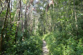



 Moderate
