


 Country:

 City:
City:


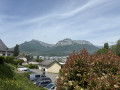
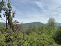
Set off from the free “Le Silo” car park in the centre of La Ravoire.
(S/E) Head south, passing the municipal rugby pitch and the village cemetery. Turn left onto Rue de la Concorde and walk past the entrance to the old cemetery. Carry on straight ahead, then turn right to walk past the new cemetery. Continue straight on past the homes of the Domaine du Parc, then, almost at the end of Rue des Puits d’Ordet, you’ll reach the cycle path that runs between the meadows.
(1) Turn left and carry on straight ahead along the cycle path beside the Mère stream for a good kilometre until you reach the road on the other side. This is the N6 (Italy – Savoie – Rhône). At the roundabout at the entrance to Challes-les-Eaux, cross the road carefully to reach the opposite side, then head for Chambéry Aerodrome.
(2) Once you reach the car park for the aerodrome and the leisure centre, turn right onto the cycle path (Voie Verte des Planeurs), then right again to enter the Challes-les-Eaux leisure centre. Go round the pretty pond, pass the open-air café and head towards the tennis courts. Follow the sports grounds until you reach the car park at one of the entrances.
(3) Return to the N6, then cross it – taking care at all times – to reach the houses opposite. Turn back for about a hundred metres, then head up to the left through the trees along the winding footpath provided for this purpose. At the houses, turn right, then right again at the next junction. In the Chassettes residential area, turn left onto the footpath, then left again until you reach the woods.
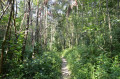
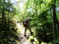
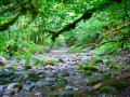
(4) Follow the signposted footpath that runs the length of the woodland heading south. On this path, after passing a good dozen houses, you will reach the ‘official’ entrance to the marsh.
(5) Enter the marsh via the main path. Carry on straight ahead through the woodland, following the information boards (three or four, I believe). Keep going straight ahead. After about ten minutes, you’ll come to a junction: do not turn left or right, but carry on straight ahead. After a while, you’ll emerge from the woodland. Carry on straight ahead towards the houses. Follow the path that runs alongside all the houses on your left. After passing about fifteen detached houses, you’ll reach the tarmac road again, near Rue des Puits d’Ordets, where we had taken the cycle path.
(6) Do not take this road but turn immediately left towards the housing estate via Allée de Chassettes. At the far end of the estate, on the right, there is a flight of steps leading up to Champ Clavier: take these (they are not very visible from the entrance to the square, so walk a little further in). Once you reach Rue Richelieu and the green park, head uphill towards the church. Take the service access road through Champ Clavier Park, then take the small flight of steps next to the local youth centre. You will arrive at the forecourt of Saint-Étienne Church.
(7) Visit the church grounds, then turn left, walking alongside the parish hall and the church. Take the path behind the church which leads back to the road. Then walk down Rue de l’Église until you reach the new Valmar neighbourhood on your right at the junction with Rue de la Concorde. Head towards the Valmar neighbourhood, cross the road, then walk through the neighbourhood until you reach the central square in front of the Town Hall. Then continue eastwards along the Promenade Villard Valmar, between the new blocks of flats, until you reach the small square and then the car park where you started (S/E).



 Visorando Member

 Moderate
