


Refine your search for walks in Roisey
Roisey walks


 Margarat Plateau, Roisey Forest
 Visorando Member

 6.10 mi
 +1,319 ft
 -1,332 ft
 3h 55
 Moderate
 Departure from Roisey (Loire)
A lovely walk through the forest on the hills above Roisey, suitable for all seasons. A slight climb to enjoy some beautiful views. After the Margarat plateau, the route crosses the northern slope of Pélussin whilst remaining within the municipality of Roisey.
From Véranne to Saint-Julien-Molin-Molette
 11.44 mi
+1,883 ft
-1,909 ft
6h 55
 Difficult
Departure from Véranne (Loire)
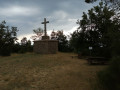
A route through the Pilat mountains that takes you along a short stretch of the Way of St James and offers beautiful views of the Rhône valley in places. You can also visit the villages of Véranne and Saint-Julien-Molin-Molette along the way.
From Véranne to Sainte-Blandine
 7.67 mi
+1,375 ft
-1,378 ft
4h 45
Moderate
Departure from Véranne (Loire)
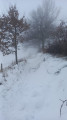
From the village of Véranne, shaded paths will take you through the hills of the Pilat Natural Park to the Croix de Sainte-Blandine, which overlooks the Rhône valley, offering a beautiful view of the Alps on a clear day.
The return journey is via theGR®65, which is also part of the Way of St James from Geneva.
Les Trois Dents from Véranne
 8.75 mi
+2,323 ft
-2,339 ft
6h 05
Moderate
Departure from Véranne (Loire)
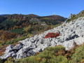
This hike allows you to discover the Trois Dents rocks, which give this area of Pilat an alpine character and offer magnificent views. As an option, the Saint-Sabin chapel offers a beautiful view of the Véranne area. The Pilat Natural Park's signposts and directional signs will be a great help in following the route.
Circular from Véranne to the Saint-Sabin Chapel
 7.90 mi
+2,064 ft
-2,077 ft
5h 25
Moderate
Departure from Véranne (Loire)
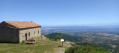
A very pleasant hike. It offers varied landscapes, on ancient mossy paths, dotted with houses typical of the Pilat region. You will have beautiful views of the surrounding and even distant peaks on numerous occasions.
Crest de L'Oeillon from Veranne
10.07 mi
+2,746 ft
-2,753 ft
7h 00
Moderate
Departure from Véranne (Loire)
This hike takes you through several different landscapes in Pilat. It starts at the foot of the hills, rich in orchards, and reaches the highest point of the massif, where the view is spectacular.
Circular walk in Véranne through woods and apple orchards
 4.16 mi
+538 ft
-538 ft
2h 25
 Easy
Departure from Véranne (Loire)
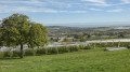
An easy walk to get some fresh air along small tarmac roads and wooded paths. The route passes through the Bois de Couroules and apple orchards. There are sweeping views of the Alps, from Mont Blanc to the Grand Veymont, the highest peak in the Vercors.
This walk is fully signposted in yellow and is known as “Véranne 2”.
From Véranne, Chapelle Saint-Sabin and the traverse of the Trois Dents ridge
 10.54 mi
+3,117 ft
-3,087 ft
7h 35
Difficult
Departure from Véranne (Loire)
A hike with a tourist attraction, featuring the Saint-Sabin Chapel and its remarkable view of the Alps. This medieval chapel is not the original building; an earlier chapel dating from the 4th century is thought to have stood on a prehistoric site, the ramparts of which, built from large blocks of rock, bear witness to this presence and to the site’s significance since time immemorial. There is also a fun aspect to the easy traverse of the ridges of the Trois Dents.
The Maclas hills
 8.33 mi
+1,453 ft
-1,421 ft
5h 05
Moderate
Departure from Maclas (Loire)
A route between hills and foothills, between forests and orchards.
Some sections are on roads, which are unavoidable but not very busy.
The Bessey Plateau and the Batalon
 8.16 mi
+1,050 ft
-1,070 ft
4h 40
Moderate
Departure from Maclas (Loire)
A lovely circular route that takes you from Maclas to the beautiful medieval village of Malleval via the Bessey Plateau and the Épervier river valley, then back up the Batalon river.
No particular difficulty (apart from the length of the route); the paths are mostly easy and gently sloping.
The second half of the route (from the River Épervier to Maclas) is mostly cool and shaded.
The hillsides of Maclas
 8.41 mi
+909 ft
-889 ft
4h 40
Easy
Departure from Maclas (Loire)
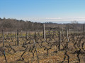
fairly easy hike on the foothills of Mont Pilat, facing it and the Rhône plain
Bessey and its mysteries
 5.48 mi
+469 ft
-440 ft
2h 55
Easy
Departure from Bessey (Loire)
An easy route to discover some of the attractions of the commune of Bessey in the Pilat Regional Nature Park.
Historic Pélussin and the Scie valley
 6.42 mi
+1,211 ft
-1,204 ft
4h 00
Moderate
Departure from Pélussin (Loire)
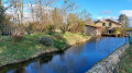
This easy walk allows you to stroll around the beautiful village of Pélussin before plunging into the wooded valley of the Scie stream.It partly follows the Priel trail (Pelussin 1, yellow/white markings).
The Dentillon hut from Pelussin
 7.32 mi
+2,018 ft
-2,024 ft
5h 05
Moderate
Departure from Pélussin (Loire)
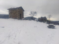
This walk starts from Pelussin (in the heart of Pilat) and involves a slight climb (just under 600 m) to keep you in shape, which rises continuously. You will arrive at the Dentillon hut, with its arboretum and orientation table. You can then continue on to the 3 dents, which will add another 45 minutes and 250m of elevation gain.
The Chemin du Tacot to the east of Pélussin
 9.15 mi
+1,647 ft
-1,650 ft
5h 40
Difficult
Departure from Pélussin (Loire)
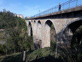
At the start and end of the route, this circuit follows the Tacot, a local railway line that connected the two sides of the Pilat Massif, the Loire and the Rhône, until 1930. Magnificent views of the Pilat Massif, but above all of the Rhône Valley and the Alps, with Mont Blanc visible on the left when the sky is clear. Most of the circuit is in the forest.
Malleval and the Rhône hillsides
 3.38 mi
+719 ft
-689 ft
2h 10
Moderate
Departure from Malleval (Loire)
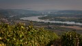
This short walk will allow you to enjoy the beautiful medieval village of Malleval (in the golden light of early morning if you set off at sunrise, which is recommended) before venturing into the wine-growing hillsides.
The distance is moderate, but expect some elevation gain (a fairly steep descent followed by a climb) during the first half of the route, as you make your way down to Saint-Pierre-de-Boeuf from the top of the hills, before climbing back up through the vineyards.
From the village of Malleval to the village of Roisey
 8.81 mi
+1,066 ft
-1,053 ft
5h 00
Moderate
Departure from Malleval (Loire)
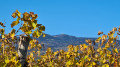
An easy walk between the village of Roisey and Malleval. At the start of the walk, you can see the Cascade du Saut de Lorette when there is water in winter and, on the way back, before reaching Malleval, you will pass through woodland along the Ruisseau de l’Épervier, which will provide a pleasant coolness if you are doing this walk in summer.
⚠️Access along the Ruisseau de l’Épervier is prohibited from the hamlet of Le Pont Jacquet (9) by municipal order following rockfalls caused by heavy flooding. Reported on 31 July 2025.
The northern balconies of Pélussin
 5.30 mi
+623 ft
-607 ft
3h 00
Moderate
Departure from Pélussin (Loire)
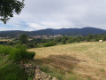
This short hike is an opportunity to discover the valleys north of the commune of Pélussin, while enjoying numerous views of this beautiful little village (two churches and a castle!), stretching along a ridge that slopes gently down towards the Rhône valley.
You can also enjoy beautiful views of the Pilat peaks (Les Trois Dents, Le Crêt de l'Oeillon).
Circular between La Ribaudy and Pélussin
 7.35 mi
+1,273 ft
-1,270 ft
4h 30
Moderate
Departure from Chavanay (Loire)
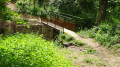
The route of this hike will take you from the hamlet of La Ribaudy to the village of Pélussin. Sometimes along wooded paths, sometimes across fields, you will reach the valley of the Rivière du Régrillon. You will cross the Pélussin Viaduct, the former Tacot railway line.
The medieval village of Malleval and the diversity of its surroundings
 4.59 mi
+965 ft
-965 ft
2h 55
Moderate
Departure from Malleval (Loire)
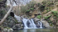
Start by exploring a botanical cactus trail, then climb up to the cemetery and enjoy the view.
Follow the cool Épervier stream upstream.
Discover wooded paths followed by sunny trails with superb 360° views, then descend through the vineyards.
Finish by discovering the Saut de Laurette.
Return via the old village (church, salt storehouse, former commandery) and the trails.
Col du Gratteau - Crêt de l'Œillon - Trêve du Loup circular
 7.39 mi
+1,411 ft
-1,385 ft
4h 40
Moderate
Departure from Pélussin (Loire)
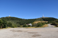
A short hike in the Pilat Massif with plenty of shade. The route is not too difficult and offers beautiful views of the Rhône Valley, the Vercors and the Alps, weather permitting, as well as the Monts du Lyonnais in some places and the Gier Valley.
Crêt de l’Œillon circular loop
 7.20 mi
+1,381 ft
-1,378 ft
4h 30
Moderate
Departure from Pélussin (Loire)
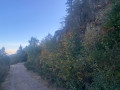
From the village of Pelussin, take the Col de l’Oeillon road to the Restaurant de la Magdalene and continue along the road until the next large bend, where there is an open car park on the left, surrounded by fir trees. On foot, the path is directly opposite, heading towards the Col du Gratteau. It begins with a gentle downhill slope which then climbs again to skirt around the three ridges. Further up, the path leads to the radio mast, which ends at a large pile of rocks and offers a 360-degree view. The descent from the summit on the north side leads to the edge of a forest, then follows a path that opens out onto a clearing. You then reach the undergrowth, and the path widens after a gentle climb overlooking the car park. Follow the path carefully to the right at the junction to end up beneath the fir trees and reach the car park via a fairly direct track.
The Saint-Sabin chapel from Saint-Appolinard
 7.61 mi
+2,182 ft
-2,182 ft
5h 25
Moderate
Departure from Saint-Appolinard (Loire) (Loire)
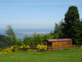
Another original way to get to this beautiful viewpoint that is the Saint-Sabin chapel on a small bluff in the heart of the Pilat Park, pouring into the Rhône Valley, with some of the best views of the Alps and pre-Alps (especially across the south). At the chapel, many signs and indications tell the story of the place and its flora.
A short walk towards Saint-Jacques d’Atticieux
 2.89 mi
+538 ft
-541 ft
1h 50
Easy
Departure from Saint-Jacques-d'Atticieux (Ardèche)
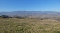
A lovely circular walk offering sweeping views of Mont Pilat. This walk is not recommended for very young children as 500 m of the route follows the D242 departmental road and you will need to wade across the Ruisseau de la Chaudière.
The Saint-Sabin Chapel from the cross
 1.35 mi
+226 ft
-226 ft
0h 50
Easy
Departure from Véranne (Loire)
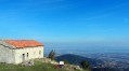
A very short, easy stroll (apart from the rocky path).
At the chapel, you can enjoy an exceptional view of:
- the Rhône Valley,
- the Pre-Alps (Chartreuse & Vercors),
- the Alps (on a clear day, you can even see Mont Blanc...)
... and when you turn around, you'll see the peaks of Pilat: Les 3 Dents, Crêt de l'Oeillon, etc.
Crêt de l'Œillon from Saint-Sabin
 6.74 mi
+1,309 ft
-1,280 ft
4h 15
Moderate
Departure from Véranne (Loire)
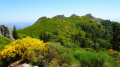
This route, consisting of three circular loops, is one of the most beautiful hikes in Pilat.
You will discover the Chapelle Saint-Sabin, a viewpoint over the Rhône valley, the Pic des Trois Dents and the Crêt de l'Œillon, dominated by its television transmitter.
Crêt de l'Oeillon from Saint-Sabin
 6.71 mi
+1,378 ft
-1,358 ft
4h 15
Moderate
Departure from Véranne (Loire)
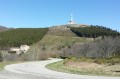
A lovely hike in the Pilat hills offering 360° views of Pilat, the Alps, the Monts du Lyonnais and the Monts du Forez.
The Pilat circular: Chapelle Saint-Sabin, Trois Dents and Route des Crêtes
 11.83 mi
+2,326 ft
-2,300 ft
7h 30
Difficult
Departure from Véranne (Loire)
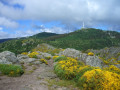
The Mont Pilat massif is very popular and criss-crossed by numerous trails. This circular loop combines several of them to pass by the site of the Chapelle St Sabin, then climb up to cross the Trois Dents on a fun route, before reaching the ridge and following it through the various crests stretching from the Œillon to the Perdrix. The return journey is via a descent that favours paths through the woods.
Chavanay - Bourg-Argental
 14.77 mi
+2,707 ft
-1,558 ft
9h 10
Difficult
Departure from Chavanay (Loire)
Eleventh stage of the Way of St James. This stage is the first in the Massif Central and crosses the Pilat Regional Nature Park. In the foothills of the Rhône Valley, it allows you to gain some altitude.
From Chavanay to Malleval
 9.20 mi
+1,371 ft
-1,388 ft
5h 25
Moderate
Departure from Chavanay (Loire)
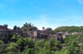
Walk through the orchards of Chavanay. Best done in April when the fruit trees are in bloom. As a bonus, you'll see the charming village of Malleval and the Epervier valley.
Please note: read carefully at marker No. 8
Chavanay to Crêt de la Perdrix circular loop
 23.87 mi
+4,426 ft
-4,416 ft
10 hrs
 Very difficult
Departure from Chavanay (Loire)
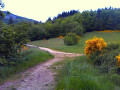
This long circular path starts in Chavanay, a village on the banks of the Rhône, and heads towards the highest point of the Pilat. The path begins by climbing through the vineyard-covered slopes of the Rhône valley, then crosses a plateau used for livestock farming and crops between the hamlets of La Ribaudy and Beautin, before crossing the foothills of the Pilat to the hamlet of Pataud. From there, the route climbs the wooded slope of the Crêts du Pilat and reaches the Col du Gratteau, then the Col de l’Œillon, from where it follows the Crêts ridge to reach the Col de la Perdrix. On the return journey, it descends through the woods on the southern slope and, via Chaumienne, reaches Saint-Sabin, then Véranne. It crosses the fields and orchards of the plateau, passing through Goëly and Bessey, before descending into the Rhône valley at the Grande Gorge and, via the Petite Gorge, returns to Chavanay.
Numerous signposts mark the route.IBP 140: estimated duration 13 hours for a hiker of average fitness.
A round trip to Le Crêt de l’Œillon from Chavanay
 16.74 mi
+4,137 ft
-4,114 ft
11h 20
Difficult
Departure from Chavanay (Loire)
This round-trip walk starts in Chavanay, a village on the banks of the Rhône, and ends at the Crêt de L’Œillon. The path climbs through the vineyard-covered slopes of the Rhône Valley, then crosses a plateau used for livestock farming and crops between the hamlets of La Ribaudy and Beautin, before crossing the foothills of the Pilat to reach the hamlet of Pataud. From there, the route climbs the wooded slope of the Crêts du Pilat, runs alongside the Trois Dents peak and, after a rocky outcrop, reaches the Col de l’Œillon and then the Crêt de l’Œillon.
Route in the Pilat Park starting from Saint-Appolinard
 6.14 mi
+863 ft
-856 ft
3h 35
Moderate
Departure from Saint-Appolinard (Loire) (Loire)
An easy walk to explore the cultivated plain and then the wooded hills, with magnificent views over the Rhône valley and the Alps.
In the Pilat mountains around the small pass of Doizieux
 7.16 mi
+1,335 ft
-1,312 ft
4h 25
Moderate
Departure from Doizieux (Loire)
A circular walk through forests of tall trees. During this hike, walkers will be treated to numerous views stretching from the Rhône Valley to the Alps, as well as over the valleys and peaks of the Pilat massif.
More walks in Roisey
Select a point of interest below: