


 Country:

 City:
City:


By car: Coming from Maclas, at the entrance to the village of Véranne, a sign points to the car park on the right.
(S/E) From the car park, walk back up the road you took by car. At the junction, turn right towards the church.
(1) Take the Route de Colombier (D34) on the left and follow it, ignoring the streets on your left. Continue for 100 metres past the junction with a central traffic island. Turn right towards Cabusson and follow this road for 30 metres. Continue by turning left. Pass through the hamlets of Le Tout and La Grange and arrive at Tronchiat.
(2) Turn left towards La Camière (signposted). The small, descending road crosses the Ruisseau du Fayon, then climbs up to La Camière.
(3) Go round the large building at La Camière and, at the rear, follow the path on the left (unmarked) at the edge of a wood. After 100 metres, you’ll come to a track on the left; ignore it and head uphill opposite for about 600 metres. You’ll reach a wide, level track (Chemin de la Croix de la Selle).
(4) Ignore the path straight ahead crossing a field. Follow the track to the left for 150 m until you reach a junction.
(5) Leave this and head up a stony path to the right. After 50 m, turn left, ignoring the path on the right and then the ones off to the side. Pass Michodon (a small house on the left) and, further up at around 970 m, leave the path straight ahead and continue along the track which curves to the right. Another 150 m further on, you’ll come to the long, narrow farmstead known as La Ligue.
(6) At the signpost (unmarked), leave the path straight ahead – heading towards the farm – and take the path furthest to the left towards Saint-Sabin. After 600 m, you’ll reach the Vert Ânes inn in Saint-Sabin.
(7) At the signpost, continue along the tree-lined path straight ahead, towards the Saint-Sabin Chapel, and arrive at a junction in a bend.
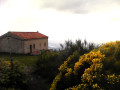
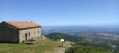
(8) Turn left to reach the chapel, from where you can enjoy a magnificent panoramic view of the Alps. The chapel is closed, except during the pilgrimage on Whit Monday. It stands in the middle of a megalithic rampart where a pagan ritual is thought to have been held, as evidenced by the presence of an altar and a cup-marked stone. There are information boards nearby explaining this prehistoric heritage.
(9) Head back down the same path to the previous junction.
(8) Turn left onto a path marked with white-and-yellow and white-and-brown crosses. You’ll come out onto the road to Saint-Sabin. Follow it straight ahead and cross the road leading to the Vert Ânes inn.
(10) At the signpost at the junction marked by the Croix de Saint-Sabin, head straight on towards the Col du Gratteau and Col de l’Œillon along a path that climbs northwards until you reach a junction.
(11) Ignore the level path on the right and continue climbing straight ahead for about 100 m. Take the right-hand Fork in the road and, at the junction 250 m further on – marked by a ‘No Motorised Vehicles’ sign – turn left. After about 700 m, you’ll reach the Col du Gratteau.
(12) At the sign for Col du Gratteau, climb the embankment leading to the D63 and follow it to the right, heading north, until you reach the start of a right-hand bend. Cut across it via a path on the right and rejoin the road to reach the Col de l’Œillon. Ignore the road on the left leading to the Crêt de l’Œillon (Pilat TV relay station). Continue for 40 m, straight ahead towards the north, until you see, on the right, next to the road sign for Pélussin, a junction with a footpath.
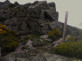
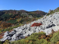
(13) At the signpost, turn right towards Les Trois Dents (Blanc-Marron). After 30 m, ignore the path on the left and continue in the same direction. Cross a pile of boulders before descending steeply through the rocks, where the path is not always visible, but you will find it again further down on a flat section.
(14) At the sign for Les Trois Dents (alt. 1194 m), take the path straight ahead uphill for 200 m until you reach a square signpost marking a fork in the path.
(15) At the foot of the first peak, leave the marked path and take the clearly visible track to the left which climbs to its summit. Follow the ridge along a well-defined track. Once you reach the final peak, the Pic du Midi, look out for the path running southwards along the foot of the Trois Dents. Descend via the left-hand side.
(16) At the bottom, do not follow the markings (white and brown) on a square post indicating a bend straight ahead (east), but go round the Pic du Midi to the right along a path marked by signposts. This path climbs westwards to reach a high point marked by a signpost. Just before this, take a path leading down to the left.
(17) This path passes through scrub, then through woodland, and joins a track (alt. 1100 m). Cross the track and continue the descent along the path opposite. You will emerge onto a track (elevation 1045).
(18) At the unmarked signpost (alt. 1,050 m), leave the track and continue to the right towards the Cévennes to come out onto a third track (alt. 1,005). Take this to the left and join a road.
(19) At the ‘Les Cévennes’ sign, follow signs for Sagne Morte (Sagnemorte on the IGN map). About a hundred metres further on, at a wide right-hand bend, ignore the signposted path to the left. Continue straight down the slope. In the hamlet of Sagnemorte, you’ll reach a junction.
(20) At the ‘Sagne Morte’ sign, leave the road and head left towards Ollagnières, emerging into the bend of a road.
(21) At the Ollagnières sign (altitude 692) at the end of the bend, turn right and follow the signs for Caillat. In the hamlet of Caillat, take the street on the left and, 50 metres further on, join the Caillat road.
(22) Follow it to the right (south) towards the hamlet of Pinois. 50 metres before this hamlet, leave the road to the right onto a steep climb which joins the Route de Sagnemorte. Follow it down to the left for 300 metres until you reach a white-and-yellow signposted path (elevation 594).
(23) Head up this path to the right until you reach a bend to the right. Ignore the path straight ahead and continue uphill until you reach a track. Follow this to the left for 100 m until you reach a junction (elevation 731).
(24) At the ‘Les Bessières’ sign, take the descent straight ahead towards Véranne for about 600 m until you reach a junction (elevation 663). Turn left and join a road that curves to the left.
(25) At the ‘Le Combeau’ sign (alt. 625 m), in the bend, leave the road and follow the path towards Véranne.
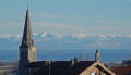
(26) At the sign for Véranne, turn right onto the Chemin du Repos and, 60 m further on, at the junction, head down to the left along the Rue de la Fontaine, which passes in front of the town hall and the church.
(1) Return to the car park via the same route you took on the way there (S/E).

 Visorando Member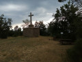

 Moderate
 Easy
Easy 
