


 Country:

 City:
City:



There is a car park next to the school below Saint-Appolinard Town Hall. From the D503 county road, this car park is signposted; a narrow street descends steeply to this spot, which is equipped with benches.
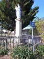
(S/E) The walk begins with the flight of steps leading up to the front of the town hall. Next, head down the street towards the church. Be sure to visit it – it is very beautiful both inside and out, with its glazed tiles. Continue down the street until you reach the junction marked by a stone cross.
(1) Turn right, continue along the main road, passing the campsite, until you reach an organic farmer’s estate. The tarmac ends and a dirt track takes over. Carry on straight ahead until you reach a junction marked by a Parc du Pilat signpost.
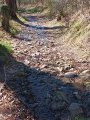
(2) Turn left and follow the track until you reach a stream crossing; see Practical Information. The ford is easily crossed unless there has been heavy rain. Follow the track uphill to another junction marked by a Parc du Pilat signpost. Turn left and continue to a Fork in the road.
(3) Take the left-hand branch and follow this flat path as it curves to the right, ignoring the first path you come to on the right and taking the second one on the right. Head up to the village of Choron along a small street which ends at a Stop sign at the junction with the D503.
(4) Cross the main road carefully, then take the lane opposite which climbs steeply to the left. At the junction, turn right onto the unpaved GR®65. Pass two paths on your right, continue straight on along the path that runs behind the Justin Bridou company, and turn left at the fork until you reach a junction.
(5) Leave the GR®—which continues straight on—and turn left towards Le Paradis. Walk up the tarmac road, passing the horse paddocks, until you reach a crossroads.
(6) Be careful not to follow the signposts heading towards Veranne, but instead follow the ones turning left, signposted ‘Appolinard 3’. The road passes in front of a large stone house and heads towards another group of houses. A signpost indicates to turn right before this group of houses.
(7) Follow this dirt track as it climbs into the woodland. Ignore all the side paths. The gradient levels off as you emerge from the woodland; there is a poultry farm on the left. Continue straight on until you reach a crossroads.
(8) Turn right, then immediately left after about twenty metres. The path joins a tarmac road. Carry on straight ahead to the junction.
(9) Cross the road, turn left and, after a few dozen metres, turn right onto a dirt track. Continue straight on until you reach the crossroads, marked by a signpost labelled ‘Maison Sabot’.
(10) Head down to the left. The slope is quite steep and the path can be very wet. The path heads south. Carry on to the hamlet of Le Courtil, at the junction with a tarmac road.
(11) Cross it, turn right onto Route de Pourzin and cross the bridge. Read the information sign explaining that the bridge is a bat roost. Continue downhill to the D503 after the entrance to Saint-Appolinard.
(12) Turn right, pass a narrow lane on your left, cross at the pedestrian crossing and take the next street (Rue de la Forge) on your left, which leads to the Town Hall after the bend to the right. Go down the steps you took at the start to return to the car park (S/E).


 Visorando Member


 Easy
Easy 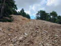

 Difficult
