Country:

 City:


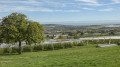
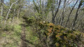
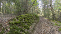
The village of Véranne has provided walkers with a large car park called “Drevet”. It is equipped with picnic tables and a boules court.
(S/E) Walk up towards the church, then take Rue de la Fontaine between the church and the town hall.
(1) Turn right onto Chemin du Repos and follow it straight on, walking alongside the cemetery. At the junction with Rue du Priaux, carry on straight ahead, cross the junction and continue to the bend just before you reach the property.
(2) Leave the tarmac road and head straight on along the unpaved track. Follow this track down through the Bois de Couroules until you reach the junction with the Route de Roisey (D34).
(3) Cross carefully and take the path opposite, which continues downhill. Stay on the main path, which will soon turn right onto a track.
(4) Turn right onto this almost level track. On your left, you’ll notice a wooden post with a QR code explaining the purpose of the wash house in front of you: see the ‘Practical information’ section below. Continue along the track, which offers a sweeping view of the Alps near the superb property known as ‘Chez Rambert’. You’ll come to tarmac roads that climb gently towards Le Buisson. Carry on in the same direction, passing between some beautiful stone houses. At the crossroads, carry straight on until you reach the first road leading down to the left, Rue du Buisson.
(5) Take care to turn left: the signs for the Parc du Pilat direct you to follow the sign for “Véranne 2” on the left. The road turns into an unpaved track that descends through the apple orchards to join the Chemin de Chez Gorand further down, which you take to the right.
(6) Cross the Route de Maclas with care , continue straight on along the flat track and pass through the industrial estate.
(7) Turn right and head up the dirt track which runs alongside the motocross route, curving to the left. You’ll rejoin the tarmac of the Chemin de Paradis, which continues to climb, passes some stables and then reaches the stone bridge over the Fayen.
(8) Just after the bridge, leave the tarmac road and turn left onto the uphill dirt track. Cross the Route du Viallon to rejoin the path, which is tarmac again, and continue uphill to cross the Route de Maclas with care. Opposite, take the unpaved Vieille Route, which continues uphill to the Chemin du Moura. Follow this to the left for a few dozen metres.
(9) Take care not to miss the small path on the right, which starts near the letterbox of a house alongside a wall. A steep climb then leads directly back to the Drevet car park (S/E).
 Visorando Member
 Difficult

 Moderate