Crêt de l’Œillon circular loop

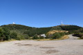
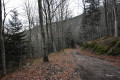
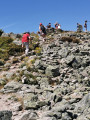
From the village of Pelussin, take the Col de l’Oeillon road to the Restaurant de la Magdalene and continue along the road until the next large bend, where there is an open car park on the left, surrounded by fir trees. On foot, the path is directly opposite, heading towards the Col du Gratteau. It begins with a gentle downhill slope which then climbs again to skirt around the three ridges. Further up, the path leads to the radio mast, which ends at a large pile of rocks and offers a 360-degree view. The descent from the summit on the north side leads to the edge of a forest, then follows a path that opens out onto a clearing. You then reach the undergrowth, and the path widens after a gentle climb overlooking the car park. Follow the path carefully to the right at the junction to end up beneath the fir trees and reach the car park via a fairly direct track.

Details

n°109389836
Creation:
Last update:
Last review:
–
  • Walking
    Activity: Walking
  • ↔
    Distance: 7.20 mi
  • ◔
    Average duration: 4h 30 
  • ▲
    Difficulty: Moderate

  • ⚐
    Back to start: Yes
  • ↗
    Ascent: + 1,381 ft
  • ↘
    Descent: - 1,378 ft

  • ▲
    Highest point: 4,465 ft
  • ▼
    Lowest point: 3,264 ft

Description of the walk

From Pélussin, take the Route du Col de l’Oeillon to the Restaurant de la Madeleine. Carry on to the next large bend: there is a large, open car park on the left, surrounded by fir trees. Park there.

(S/E) Take the track straight ahead, heading towards the Col du Gratteau, and you’ll reach a crossroads just before the Chapelle de la Magdelaine.

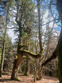
(1) Keep to the left and continue down a gentle slope along a dirt track lined with dry grass and young shoots, before heading into the shade of the tall fir trees. You’ll reach a crossroads at a hairpin bend.

(2) Carry on straight ahead along this forest track. Begin an easy climb; further on, at the edge of the woodland, you’ll come to a scree slope.

(3) Carry on straight ahead and then go round the Trois Dents. The terrain becomes rockier in places, with low vegetation (broom, heather) on either side, before you reach a wider track.

(4) Take this track to the right until you reach the Col du Gratteau junction.

(5) Turn right, taking care, at a 90° angle onto the D63, and head for the Col de l’Œillon.

(6) Take the D63.1 to the left, then follow the paths that cut across the hairpin bends to reach the Crêt de l’Œillon.

(7) Descend from the summit via the northern slope. The path leads to the edge of the forest, where the trees offer glimpses of the landscapes below. You’ll arrive at the paragliding launch site.

(8) Continue due north until you reach the Col de la Trève du Loup.

(9) Turn right, then immediately left onto the descending path, and continue until you reach a hairpin bend.

(10) Carry on to the right, stay on the path past the next two hairpin bends, then you’ll reach the D63 car park (S/E).

Waypoints

  1. S/E : mi 0 - alt. 3,438 ft - La Chapelle car park
  2. 1 : mi 0.13 - alt. 3,399 ft - La Chapelle
  3. 2 : mi 0.55 - alt. 3,264 ft - Path to the Col du Gratteau
  4. 3 : mi 1.82 - alt. 3,599 ft - Circuit of the Trois Crêts
  5. 4 : mi 3 - alt. 3,579 ft - Trail junction
  6. 5 : mi 3.47 - alt. 3,885 ft - Col du Gratteau (1204m)
  7. 6 : mi 3.87 - alt. 4,062 ft - Col de l'Œillon (1235m)
  8. 7 : mi 4.33 - alt. 4,373 ft - Crêt de l'Œillon (1364 m)
  9. 8 : mi 4.57 - alt. 4,350 ft - Take-off track
  10. 9 : mi 5.54 - alt. 3,983 ft - Col de la Trève du Loup (1219m)
  11. 10 : mi 6.24 - alt. 4,022 ft - Hairpin bend
  12. S/E : mi 7.2 - alt. 3,438 ft - La Chapelle car park

Notes

A very shaded walk. Paths are sometimes lined with tall grass and very sharp stones. There are no water sources, so you’ll need to bring something to drink along the way.

Worth a visit

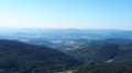
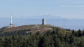
(7) Crêt de l’Œillon: seethe various facilities, particularly the telecommunications equipment, as well as its orientation table. Ona clear day, enjoy theview of the Northern Alps, clearly visible from Mont Blanc to the Vercors in the distance. And in front of you, the Rhône Valley and the Pays du Gier.

Other walks in the area

For more walks, use our search engine .

The GPS track and description are the property of this route's author. Please do not copy them without permission.