A short walk towards Saint-Jacques d’Atticieux

A lovely circular walk offering sweeping views of Mont Pilat. This walk is not recommended for very young children as 500 m of the route follows the D242 departmental road and you will need to wade across the Ruisseau de la Chaudière.

Details

n°18783670
Creation:
Last update:
Last review:
  • Walking
    Activity: Walking
  • ↔
    Distance: 2.89 mi
  • ◔
    Average duration: 1h 50 
  • ▲
    Difficulty: Easy

  • ⚐
    Back to start: Yes
  • ↗
    Ascent: + 538 ft
  • ↘
    Descent: - 541 ft

  • ▲
    Highest point: 1,526 ft
  • ▼
    Lowest point: 1,201 ft

Photos

Description of the walk

Car park along the D242 next to the bridge, just in front of the blue sign saying ‘Ardèche à bientôt’.

(S/E) Drive carefully up the D242 until you reach the junction with the road to Saint-Jacques d’Atticieux, where you turn right.

(1) After a climb of about a hundred metres, the road takes a gentle, slight bend. Then take the dirt track that branches off to the left, heading downhill at the edge of an orchard; further along the road, you can see an old building. The track narrows to a narrow path and descends towards the stream you can hear. It then widens again before reaching the stream.

(2) The crossing used to be different, but a flood destroyed everything. Look about twenty metres further on; there is a possible ford here as the stream is narrower. Frequent use by walkers and hunters has created a relatively easy crossing. Once you have crossed the stream, head back up the wide path which leads out into cultivated fields. Continue until you reach the small road.

(3) Turn right onto it to head back down towards the stream, where you cross via a proper bridge.

(4) At the three-way junction just after the bridge, take the path on the left which climbs back up to the road; follow this to the left towards Saint-Jacques d’Atticieux.

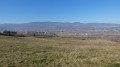
(5) At the first junction, take the dirt track on the right. Enjoy the magnificent view of Mont Pilat before joining the D242. Turn right to reach the car park straight away (S/E).


Waypoints

  1. S/E : mi 0 - alt. 1,247 ft - Car park along the D242
  2. 1 : mi 0.48 - alt. 1,316 ft - Leaving the tarmac road
  3. 2 : mi 0.77 - alt. 1,240 ft - Fording
  4. 3 : mi 1.14 - alt. 1,401 ft - Crossroads
  5. 4 : mi 1.39 - alt. 1,283 ft - Three-way junction
  6. 5 : mi 1.86 - alt. 1,526 ft - Crossroads
  7. S/E : mi 2.89 - alt. 1,243 ft - Car park along the D242

Reviews and comments

4.3 / 5
Based on 2 reviews

Reliability of the description
3 / 5
Ease of following the route
5 / 5
Route interest
5 / 5
Azimut71
Azimut71

Overall rating : 5 / 5

Date of your route : May 16, 2025
Reliability of the description : ★★★★★ Very good
Ease of following the route : ★★★★★ Very good
Route interest : ★★★★★ Very good
Very busy route : No

A storm was brewing. At the stone bridge (4), I took the path on the right, which joins the ridge road (with a view of Pilat). Then, 30 metres to the right, a path begins on the left that leads directly back to the starting point.
I didn't regret my choice, as this path is moderately sloped, well maintained and very pleasant.
The section between (1) and (2) is very narrow and overgrown, and is not suitable for mountain bikes.

Machine-translated

POULIN Gérard
POULIN Gérard ★

Good evening,
The starting point was situated right on the boundary between the municipalities and departments of Maclas (42) and Saint-Jacques d’Atticieux (07). I’ve moved it a few metres south, and the starting point is now correctly situated within the desired municipality and department.
Perhaps it would be better to:

  • Avoid a title that refers to a village you don’t pass through.
  • Set the starting point in the main village of the municipality, or otherwise specify the nearest hamlet.
  • Please also note that to reach the starting point easily from the app, you need to click on the ‘Go to start’ tab.

Machine-translated

dougere
dougere
• Edited:

Sorry, but it’s Visiorando that automatically mentions the commune of Maclas; I don’t know why, as the entire walk is in the Ardèche (see map)

Machine-translated

38Christian
38Christian

OK, but on Visorando, the starting point is set as the commune of Maclas, which is in the Loire (42). When you’re supposed to park near a sign saying ‘See you soon in Ardèche’, coming from the Loire, it’s not clear – at least not to me.

Machine-translated

dougere
dougere

As you have to park in front of the ‘See you soon in Ardèche’ sign, the departmental road is called the D242. After this sign, the departmental road on the Loire side is called the D19. This departmental road is clearly marked on the map.
I don’t understand why the instructions for getting to the car park’s starting point are missing. Why mention ‘Maclas village centre’ as the starting point when the start is actually on the Loire/Ardèche border, which has nothing to do with the centre of Maclas?

Machine-translated

38Christian
38Christian

Overall rating : 1 / 5

Date of your route : Feb 10, 2022
Reliability of the description : ★☆☆☆☆ Very disappointing
Ease of following the route : Not used / Not applicable
Route interest : Not used / Not applicable
Very busy route : No

The start point on the D242 is impossible to find. This road isn’t marked on the Visorando map. Nor is Maclas, for that matter. We waste time trying to find the start point and, by the time we set off, there’s no time left to do the walk. There are no directions on how to get to the start point from the centre of Maclas village.

Machine-translated

Other walks in the area

For more walks, use our search engine .

The GPS track and description are the property of this route's author. Please do not copy them without permission.