


Refine your search for walks in Rivières-le-Bois
Rivières-le-Bois walks
 Villegusien to Domarien circular loop
 Visorando Member
 10.51 mi
 +541 ft
 -545 ft
 5h 20
5h 20
 Moderate
 Departure from Villegusien-le-Lac (Haute-Marne)
An idyllic walk through the woods and countryside of southern Haute-Marne.
With a bit of exploration to discover the paths through the woods.
Tour of Lake Vingeanne
 5.31 mi
+23 ft
-23 ft
2h 30
5.31 mi
+23 ft
-23 ft
2h 30
 Easy
Departure from Villegusien-le-Lac (Haute-Marne)
Easy
Departure from Villegusien-le-Lac (Haute-Marne)
Discover the wild flora and fauna in the heart of the Pays des 4 Lacs.
Le Creux de la Chaudière depuis Dommarien
9.20 mi
+574 ft
-568 ft
4h 45
Moderate
Departure from Dommarien (Haute-Marne)
This route invites you to discover the heritage of the village of Dommarien. You will then continue through the Bois de la Côte Aubert to return to your starting point, crossing the plain and passing close to the village of Chassigny.Along the way, you’ll discover Dommarien’s bridge, wash houses and ‘patouillets’.
Route de découverte de Fayl-Billot
3.34 mi
+200 ft
-207 ft
1h 45
Easy
Departure from Fayl-Billot (Haute-Marne)
Fayl-Billot is a village of 1,300 inhabitants located in the Haute-Marne department. It is best known as the capital of basketry. There are many artisans practising this craft in the village. At the end of this walk, do not hesitate to take home a souvenir. This walk takes in the village’s main tourist and cultural attractions, such as the National School of Osier Cultivation and Basketry, Notre-Dame Church, as well as all the village’s wash houses and fountains.
The three communes of the Montsaugeonnais
 10.47 mi
+797 ft
-804 ft
5h 30
Moderate
Departure from Montsaugeon (Haute-Marne)
10.47 mi
+797 ft
-804 ft
5h 30
Moderate
Departure from Montsaugeon (Haute-Marne)
The Montsaugeonnais Community of Communes. Established by a prefectural decree of 19 November 2015, it was formed from the merger of the three communes of Montsaugeon, Prauthoy and Vaux-sous-Aubigny, which became delegated communes. Its administrative centre is in Prauthoy.
The route of the three municipalities will take you through the Montanson woods, which are very popular when the daffodils are in bloom from March to the end of April. You will also be able to explore the vineyards of the Montsaugeonnais.
La Pâturie, Le Prélot and the “Sentier des Pierres sèches” in Champlitte
 6.79 mi
+413 ft
-390 ft
3h 30
Moderate
Departure from Champlitte (Haute-Saône)
6.79 mi
+413 ft
-390 ft
3h 30
Moderate
Departure from Champlitte (Haute-Saône)
A pleasant little walk through the vineyards and the heritage of Franche-Comté.
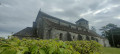
The Prauthoy Massif
 3.59 mi
+315 ft
-246 ft
1h 55
Easy
Departure from Vaux-sous-Aubigny (Haute-Marne)
3.59 mi
+315 ft
-246 ft
1h 55
Easy
Departure from Vaux-sous-Aubigny (Haute-Marne)
The walk starts not far from Aubigny Church and takes you on a lovely, easy circular route entirely through the Prauthoy Forest. Ideal for hot days. At the start or finish, enjoy the view from Aubigny Church of Mont Poupet and Mont Blanc, weather permitting.
The short circular loop of the Grandes Charmes
4.30 mi
+535 ft
-528 ft
2h 25
Moderate
Departure from Vaux-sous-Aubigny (Haute-Marne)
A lovely walk offering superb panoramic views, leafy arches and, depending on the season, birdsong.
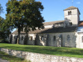
A walk in the Montsaugeonnais at the crossroads of three provinces
 11.02 mi
+804 ft
-814 ft
5h 45
Moderate
Departure from Vaux-sous-Aubigny (Haute-Marne)
11.02 mi
+804 ft
-814 ft
5h 45
Moderate
Departure from Vaux-sous-Aubigny (Haute-Marne)
On the borders of Champagne, Burgundy and Franche-Comté, the Domaine du Muid Montsaugeonnais covers 13 hectares, spread across the territories of four communes: Chatoillenot, Montsaugeon, Rivière-les-Fosses and Vaux-sous-Aubigny.
Abandoned since the outbreak of phylloxera in the late 19th century, the vineyard was revived in 1988 thanks to the Chevaliers du Montsaugeonnais.
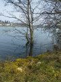
Tour of Lake Liez near Langres
 9.47 mi
+49 ft
-49 ft
4h 25
Moderate
Departure from Chatenay-Mâcheron (Haute-Marne)
9.47 mi
+49 ft
-49 ft
4h 25
Moderate
Departure from Chatenay-Mâcheron (Haute-Marne)
This route takes you around Lac de la Liez along a path in the heart of unspoilt countryside. The lake is very busy in season and is the perfect place to relax, either on the beach or by taking part in the various activities on offer (sailing, water skiing, tubing, etc.). But nature lovers can also enjoy themselves away from the area near the Liez Reservoir dam and Langres Plage.
A lovely, rural circular loop from Pierrecourt to Champlitte
9.28 mi
+505 ft
-531 ft
4h 45
Moderate
Departure from Pierrecourt (Haute-Saône)
This short circular loop of around fifteen kilometres, which presents no particular difficulty, allows you to discover beautiful, peaceful and serene countryside and, if you’re as lucky as we were, to spot some roe deer in the woodland.
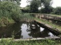
Pierrecourt and its points of interest
 4.32 mi
+223 ft
-230 ft
2h 10
Easy
Departure from Pierrecourt (Haute-Saône)
4.32 mi
+223 ft
-230 ft
2h 10
Easy
Departure from Pierrecourt (Haute-Saône)
Nestled in lush green surroundings, 8 km from Champlitte, the village of Pierrecourt boasts:a washhouse, ‘Le Magny’a covered fountain, “Coulvot”, just outside the village.
From the Liez Dam to Perrancey-les-Vieux-Moulins, taking a stroll through Langres
7.53 mi
+722 ft
-696 ft
4h 05
Moderate
Departure from Peigney (Haute-Marne)
This stage takes place in the Marne catchment area, whose waters flow into the English Channel. Perched on a high hill detached from the plateau, Langres invites us to stroll along its ramparts. Opt for its restaurants rather than the usual picnic.
Route de découverte de Langres
4.96 mi
+118 ft
-105 ft
2h 25
Easy
Departure from Langres (Haute-Marne)
Langres is one of the sub-prefectures of Haute-Marne. The town is unique in being completely surrounded by ramparts, making it the town with the longest fortified wall in Europe. This section takes you on a tour of Langres’ historic centre and along the 3-kilometre-long walkway of the medieval fortifications. The route through the town itself is equally charming, featuring a number of historic monuments, including Saint-Mammès Cathedral, and for those wishing to extend their visit to Langres, there is also the town museum to explore.
 From the Citadel of Langres to Dijon
56.59 mi
+771 ft
-1,476 ft
8 hrs
 Difficult
Departure from Langres (Haute-Marne)
Difficult
Departure from Langres (Haute-Marne)
This route, initially designed to connect to the Culmont-Chalindrey railway junction, has been extended to Dijon due to the cancellation of the train service! It crosses the mustard fields of the Côte-d'Or and the former sand pits of La Tille, which have been converted into ponds that are more popular with fishermen than tourists.
Views of Langres between Arbigny-sous-Varennes and the Liez Dam
19.00 mi
+1,112 ft
-768 ft
9h 40
Difficult
Departure from Arbigny-sous-Varennes (Haute-Marne)
From Arbigny-sous-Varennes, the waters of the Presle stream flow into the Mediterranean, whilst from Orbigny-au-Mont those of the Liez flow into the English Channel. Perched on its hilltop, Langres serves as our landmark.
From Sacquenay to the Canal between Champagne and Burgundy
 10.04 mi
+312 ft
-312 ft
4h 55
Moderate
Departure from Sacquenay (Côte-d'Or)
10.04 mi
+312 ft
-312 ft
4h 55
Moderate
Departure from Sacquenay (Côte-d'Or)
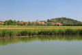
A walk in the Vingeanne area that will take you to discover the 15th-century fountains in Sacquenay as well as the canal between Champagne and Burgundy. Diverse landscapes and a well-preserved environment.
Through the Auberive State Forest from Perrancey-les-Vieux-Moulins
18.45 mi
+1,083 ft
-1,184 ft
9h 25
Difficult
Departure from Perrancey-les-Vieux-Moulins (Haute-Marne)
This stage offers the chance to discover some of the springs of the Langres Plateau, whose waters feed into the English Channel. After skirting the marshes, you enter the Auberive State Forest, in the heart of the Forêts National Park. The abbey founded by Saint Bernard in 1132 reveals its secrets. But why Auberive, exactly?