A lovely, rural circular loop from Pierrecourt to Champlitte

This short circular loop of around fifteen kilometres, which presents no particular difficulty, allows you to discover beautiful, peaceful and serene countryside and, if you’re as lucky as we were, to spot some roe deer in the woodland.

Details

1152143
Creation:
Last update:
Last review:
  • Walking
    Activity: Walking
  • ↔
    Distance: 9.28 mi
  • ◔
    Average duration: 4h 45 
  • ▲
    Difficulty: Moderate

  • ⚐
    Back to start: Yes
  • ↗
    Ascent: + 505 ft
  • ↘
    Descent: - 531 ft

  • ▲
    Highest point: 1,027 ft
  • ▼
    Lowest point: 728 ft
  • ⚐ Country: France
  • ⚐ City: Pierrecourt (70600)
  • ⚑
    Start/End: N 47.64387° / E 5.589304°
  • Accessible from the train station Gare de Champlitte.
  • ❏
    IGN map(s): Ref. 3221SB
  • Hour-by-hour weather

Description of the walk

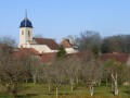
Start from the ‘centre’ of Pierrecourt, or perhaps from the church, which has plenty of charm.

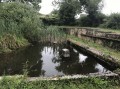
(S/E) Head towards Rue de Champlitte via the D17 local road, but just as you leave Pierrecourt, turn right just before the two septic tanks (not very glamorous, but discreet).

(1) Take the new path, ignoring Rue Nouvelle on the right. Ignore the path branching off to the right.
Carry on straight ahead along the main stone track, running alongside a woodland on the left.

(2) Carry on straight ahead, ignoring the small path on the left. You can’t go wrong as there’s only one path until you reach the Ferme des Champs Bois.

(3) Pass the next farm, Le Rhône, where the track becomes tarmac and joins the D460.

(4) Follow this road to the left: watch out for cars – there aren’t many, but they always go too fast.

(5) Join the Via Francigena, which comes in from the right, and continue on to Champlitte via Rue des Casernes. Turn left onto Rue de Champlitte-la Ville (D17).

(6) Take the first street on the left (still on the Via Francigena), which continues as a track on the right. At the crossroads with a cross, carry on straight ahead.

(7) Leave the Via Francigena and take a path up to the left.

(8) Be careful not to take the path that goes straight up (it’s a dead end anyway). Carry on to the right until you reach a crossroads.

(9) Cross a small road coming from the right which branches off to the left at a three-way junction. Carry on straight ahead until you reach the D17.

(10) Follow this road for 200 metres to the right, then leave it to go up the first steep slope on the left.

(11) Turn onto the first path on the left, which is signposted for Pierrecourt, and carry on straight ahead.

(12) Enter the Bois de la Coupotte, ignoring the cross marked on a tree which indicates that the signposted path does not enter the woods (it turns left, but you no longer follow it from this point). At first, it is a very well-marked path, but afterwards you walk through the undergrowth without any risk of getting lost.

(13) Turn left to walk alongside a field and stay at the edge of the woodland.

(14) You’ll come out onto a stony path which you follow until you reach the starting point at Pierrecourt via a small road (S/E).

Waypoints

  1. S/E : mi 0 - alt. 925 ft - Pierrecourt “town centre” car park
  2. 1 : mi 0.12 - alt. 906 ft - Chemin Neuf
  3. 2 : mi 0.86 - alt. 919 ft - Straight on
  4. 3 : mi 1.85 - alt. 991 ft - “Les Champs Bois” farm
  5. 4 : mi 2.91 - alt. 820 ft - Junction with the D460
  6. 5 : mi 4.02 - alt. 764 ft - Via Francigena. Near the - Salon (rivière)
  7. 6 : mi 4.78 - alt. 735 ft - Street on the left
  8. 7 : mi 5.23 - alt. 728 ft - Path on the left
  9. 8 : mi 5.42 - alt. 774 ft - Slightly to the right
  10. 9 : mi 5.75 - alt. 869 ft - Go straight on at the crossroads
  11. 10 : mi 6.17 - alt. 817 ft - Junction with the D17
  12. 11 : mi 6.58 - alt. 942 ft - First signposted path on the left
  13. 12 : mi 7.61 - alt. 951 ft - Entrance to the Bois de la Coupotte
  14. 13 : mi 7.88 - alt. 902 ft - Field on the edge of the woodland
  15. 14 : mi 8.55 - alt. 846 ft - Junction with the stone path
  16. S/E : mi 9.28 - alt. 925 ft - Pierrecourt “town centre” car park

Worth a visit

Champlitte and its Museum of Folk Arts and Traditions.

Reviews and comments

3.9 / 5
Based on 3 reviews

Reliability of the description
3.7 / 5
Ease of following the route
4.3 / 5
Route interest
3.7 / 5
poucito
poucito

Overall rating : 4.7 / 5

Date of your route : Mar 04, 2023
Reliability of the description : ★★★★★ Very good
Ease of following the route : ★★★★★ Very good
Route interest : ★★★★☆ Good
Very busy route : No

Hello,

a route through the countryside; it’s best to avoid the road section by taking the longer route via Montarlot
Fine weather but misty / saw a hare / a roe deer
A pleasant route

Machine-translated

Nanard 21
Nanard 21

Overall rating : 4 / 5

Date of your route : Mar 16, 2020
Reliability of the description : ★★★★☆ Good
Ease of following the route : ★★★★☆ Good
Route interest : ★★★★☆ Good

We took a detour along the towpath to Montarlot Lés Champlitte to avoid the main road for about 2.5 km
A lovely walk for the end of winter, with sightings of wildlife (roe deer, hares, a fox and a doe)

Machine-translated

louploup
louploup

Overall rating : 3 / 5

Date of your route : Apr 22, 2019
Reliability of the description : ★★☆☆☆ Disappointing
Ease of following the route : ★★★★☆ Good
Route interest : ★★★☆☆ Average

Hello,

We were disappointed that this walk didn’t go through Champlitte… Too much road (D460); it might have been nice to include the short circular loop via Pierrecour in the walk!!!!
Kind regards

Machine-translated

Other walks in the area

For more walks, use our search engine .

The GPS track and description are the property of this route's author. Please do not copy them without permission.