Pierrecourt and its points of interest

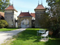
Nestled in lush green surroundings, 8 km from Champlitte, the village of Pierrecourt boasts:

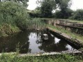
  • a washhouse, ‘Le Magny’
  • a covered fountain, “Coulvot”, just outside the village.

Details

844495
Creation:
Last update:
Last review:
  • Walking
    Activity: Walking
  • ↔
    Distance: 4.32 mi
  • ◔
    Average duration: 2h 10 
  • ▲
    Difficulty: Easy

  • ⚐
    Back to start: Yes
  • ↗
    Ascent: + 223 ft
  • ↘
    Descent: - 230 ft

  • ▲
    Highest point: 1,083 ft
  • ▼
    Lowest point: 909 ft
  • ⚐ Country: France
  • ⚐ City: Pierrecourt (70600)
  • ⚑
    Start/End: N 47.644209° / E 5.591075°
  • ❏
    IGN map(s): Ref. 3221SB
  • Hour-by-hour weather

Photos

Description of the walk

Park in the car park next to the town hall in Pierrecourt.

(S/E) Head up to the top of the village via the main road (D5).

(1) As you leave the village, before the second-hand shop, turn left onto the road leading to a pond, which you’ll leave on your right.
After the pond, take the grassy path on the left and follow it straight on until you reach the departmental road.

(2) Turn right, walk carefully along this road and turn off again onto a grassy path on the left which runs along the edge of the woods and passes through thickets of brambles.

(3) At a crossroads, turn left, then turn right to come out onto a stony track.

(4) Take this path on the left and walk gently downhill to the village.

(5) Pass the wash house and the Magny cross on your left.

(6) Cross the county road and take Rue Nouvelle opposite. Turn left, then right onto the Route de Champlitte.
A little further on, take a stony path on your left which passes in front of a shed.

(7) Then turn left, then left again to pass close to the Croix de Coulvot and the covered spring.
Return to the starting point via Rue de l’Ormeau, then turn left onto Rue de Juchaud. Turn right onto Rue de Champlitte and then right again onto Grande Rue to return to the car park (S/E).


Waypoints

  1. S/E : mi 0 - alt. 965 ft - Car park near the town hall
  2. 1 : mi 0.14 - alt. 988 ft - Turn left towards the pond
  3. 2 : mi 0.65 - alt. 988 ft - Pierrecourt–Argillières road, on the right
  4. 3 : mi 1.58 - alt. 1,083 ft - At the junction, turn left
  5. 4 : mi 1.81 - alt. 1,017 ft - Gravel track, on the left
  6. 5 : mi 2.88 - alt. 932 ft - Magny Cross
  7. 6 : mi 3.15 - alt. 912 ft - D5, opposite
  8. 7 : mi 3.59 - alt. 922 ft - On the left after a shed
  9. S/E : mi 4.32 - alt. 965 ft - Car park near the town hall

Worth a visit

Originally, there was only a chapel in Pierrecourt, served by the monks of Aumonières, whose church was
a parish church. After the departure of the last monks, followed by the sale of the church as national property in 1793, the chapel became a church, dedicated to Saint Martin.

Don’t miss: the hamlet of Aumonières.

Since 2012, six information panels have been installed in Pierrecourt. Here you will find information on the
local heritage.

Reviews and comments

4.7 / 5
Based on 3 reviews

Reliability of the description
5 / 5
Ease of following the route
5 / 5
Route interest
4 / 5
GRIGRI25
GRIGRI25

Overall rating : 4.7 / 5

Date of your route : Jul 20, 2026
Reliability of the description : ★★★★★ Very good
Ease of following the route : ★★★★★ Very good
Route interest : ★★★★☆ Good
Very busy route : No

A lovely circular walk to do with the family. Beautiful views and picnic spots near the crosses and wash houses, or pleasant springs.
No difficulty at all.
The route is half in the shade, half in the sun
We did it on 19 July and didn’t see a single soul, just two fawns as we rounded the edge of a maize field. Peace and quiet guaranteed

Machine-translated

ChristianNant70
ChristianNant70

Overall rating : 4.7 / 5

Date of your route : Feb 19, 2022
Reliability of the description : ★★★★★ Very good
Ease of following the route : ★★★★★ Very good
Route interest : ★★★★☆ Good
Very busy route : No

A pleasant circular route. Interesting views of the countryside and a walk through the village.
Thank you for this route.

Machine-translated

Nanard 21
Nanard 21

Overall rating : 4.7 / 5

Date of your route : Feb 24, 2020
Reliability of the description : ★★★★★ Very good
Ease of following the route : ★★★★★ Very good
Route interest : ★★★★☆ Good

We took a detour via Montarlot-lès-Champlitte to avoid walking along the towpath of the RD 460
An interesting detour, but it adds a good 2 km to the route

Machine-translated

Other walks in the area

For more walks, use our search engine .

The GPS track and description are the property of this route's author. Please do not copy them without permission.