


Refine your search for walks in Nieul-sur-l'Autise
Nieul-sur-l'Autise walks


 The banks of the Autise between Nieul and Xanton
 Association / Club / Walk leader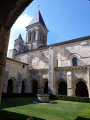
 6.73 mi
 +115 ft
 -105 ft
 3h 10
3h 10
 Moderate
 Departure from Nieul-sur-l'Autise (Vendée)
This route links the two villages, both home to listed historic monuments and a heritage of remarkable architecture, via paths and small roads. It never strays far from the River Autise, offering a mix of shaded and sunny stretches amidst vast, bucolic landscapes.
To make the most of your day, you could start or finish this walk with a visit to Nieul Abbey and/or the Maison de la Meunerie, followed by a picnic in the Parc du Vignaud (S/E) or at Xanton Church (4)
The Autise and the Xanton dolmens
 6.49 mi
+217 ft
-187 ft
3h 10
Moderate
Departure from Xanton-Chassenon (Vendée)
6.49 mi
+217 ft
-187 ft
3h 10
Moderate
Departure from Xanton-Chassenon (Vendée)
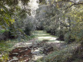
This route offers a wide variety of landscapes. A circular route through the fields on the heights of Xanton, with a 360° panoramic view, joins theGRP® Tour du Pays de Mélusine, which runs alongside rolling meadows before descending back towards the valley. It then joins the signposted Vallée de l’Autise route.
La vallée de l'Autise à Xanton
 3.20 mi
+33 ft
-33 ft
1h 30
3.20 mi
+33 ft
-33 ft
1h 30
 Easy
Departure from Xanton-Chassenon (Vendée)
Easy
Departure from Xanton-Chassenon (Vendée)
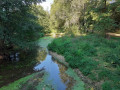
Une petite boucle sans difficulté avec des sentiers et des chemins qui traversent des prairies en longeant l'Autise jusqu'à Denant puis retour par une piste cyclable à travers les champs.
The Bois Riveau and Grands Bois route
 Visorando Member
 3.83 mi
+16 ft
-16 ft
1h 45
Easy
Departure from Bouillé-Courdault (Vendée)
3.83 mi
+16 ft
-16 ft
1h 45
Easy
Departure from Bouillé-Courdault (Vendée)
Merger of two very well-marked routes, marked in two colours: yellow-orange and yellow-blue.
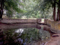
The route is mostly shaded and very pleasant in the Poitevin marshes!
La Vergne Trail
 4.71 mi
+236 ft
-236 ft
2h 20
Easy
Departure from Saint-Hilaire-des-Loges (Vendée)
4.71 mi
+236 ft
-236 ft
2h 20
Easy
Departure from Saint-Hilaire-des-Loges (Vendée)
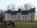
A walk that follows theGR® de Pays de Mélusine and theGR® de Pays Sud Gâtine to the Bois de la Vergne and returns to Saint-Hilaire-des-Loges, offering unobstructed panoramic views.
Please note that this route has been altered and shortened via the D3 following a ban on access to the Bois de la Vergne
Around the Autize via Les Moulières and Tourteron
 6.67 mi
+390 ft
-413 ft
3h 25
Moderate
Departure from Saint-Pompain (Deux-Sèvres)
6.67 mi
+390 ft
-413 ft
3h 25
Moderate
Departure from Saint-Pompain (Deux-Sèvres)
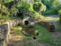
A route that follows the River Autize, passes near Château des Moulières, then takes a footpath and reaches the village of Tourteron via agricultural tracks. After a detour to the fountain and wash house in Tourteron, the walk continues across the plain dotted with wind turbines, then follows or runs alongside an old railway line, passes under a viaduct and returns along the meadows bordering the Autize to the Moulin de Dray before climbing back up to Saint-Pompain.
Meilleraie loop to Saint-Michel-le-Cloucq
 4.65 mi
+177 ft
-148 ft
2h 15
Easy
Departure from Saint-Michel-le-Cloucq (Vendée)
4.65 mi
+177 ft
-148 ft
2h 15
Easy
Departure from Saint-Michel-le-Cloucq (Vendée)
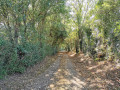
Hike around La Meilleraie with a mostly shaded first section and some unpaved paths, forming a pleasant green tunnel in summer. The second part of the circuit is more open, with a section on the plain. This second part can be avoided by going directly from point (6) to point (9).
La Garenne - Courdault in the wild marshlands
 5.24 mi
+13 ft
-10 ft
2h 25
Easy
Departure from Benet (Vendée)
5.24 mi
+13 ft
-10 ft
2h 25
Easy
Departure from Benet (Vendée)
A short route through the wild marshes of Courdault.
Walk at Port d'Aziré
 1.29 mi
+7 ft
-7 ft
0h 35
Easy
Departure from Benet (Vendée)
1.29 mi
+7 ft
-7 ft
0h 35
Easy
Departure from Benet (Vendée)
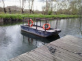
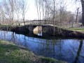
This is an easy, short walk that allows you to discover the wild side of the Green Venice. In the heart of nature, you will always be close to the water, in the shade of pollarded ash trees and poplars. And you may even be lucky enough to spot some nutria or deer.
From Port d'Aziré to Marais des Nattes
 5.89 mi
+7 ft
-7 ft
2h 45
Moderate
Departure from Benet (Vendée)
5.89 mi
+7 ft
-7 ft
2h 45
Moderate
Departure from Benet (Vendée)
Walking along the Rigole d'Aziré to the Courdault canal, then returning via the Marais des Nattes, you may spot some nutria, purple herons or lapwings, and perhaps even a deer or two.
Between the plains and the forest at La Meilleraie and Saint-Michel-le-Cloucq
 10.36 mi
+522 ft
-492 ft
5h 15
Moderate
Departure from Saint-Michel-le-Cloucq (Vendée)
10.36 mi
+522 ft
-492 ft
5h 15
Moderate
Departure from Saint-Michel-le-Cloucq (Vendée)
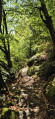
Set between the plains and the forest, this walk should appeal to keen walkers, both for its length and the variety of terrain it covers. It should also appeal to nature lovers thanks to the different landscapes encountered: plains, hedgerows, forest… The first half of the route is relatively easy (with little elevation gain); the section running alongside the river is a little more technical but doesn’t last very long; and the final section presents no particular difficulties.
 From Sainte-Christine to Coulon along the banks of the Sèvre
 18.03 mi
+16 ft
-16 ft
4 hrs
Moderate
Departure from Benet (Vendée)
18.03 mi
+16 ft
-16 ft
4 hrs
Moderate
Departure from Benet (Vendée)
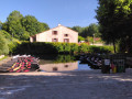
During your stay at La Ferme du Marais Poitevin, discover the traditional villages nestled between the plains and the marshes.
Follow the Sèvre Niortaise river to the village of Coulon, listed as one of the most beautiful villages in France.
Around the Jeune Autise in Maillezais
 6.94 mi
+46 ft
-46 ft
3h 15
Moderate
Departure from Maillezais (Vendée)
6.94 mi
+46 ft
-46 ft
3h 15
Moderate
Departure from Maillezais (Vendée)
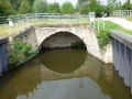
This path between the "wet" and "dry" marshes, passing by a characteristic feature of the marsh (the Aqueduct), will take you from the Romanesque church to the majestic Abbey of Saint-Pierre de Maillezais.
Route des Vals d'Autise
22.13 mi
+43 ft
-43 ft
3 hrs
Easy
Departure from Maillezais (Vendée)
An easy route offering a chance to explore different aspects of the Poitevin Marshes: town, farmland, meadows and its famous canals. You can stop to visit the Abbey of Saint-Pierre in Maillezais.
From Benet to Port d’Aziré
 5.60 mi
+138 ft
-138 ft
2h 40
Easy
Departure from Benet (Vendée)
5.60 mi
+138 ft
-138 ft
2h 40
Easy
Departure from Benet (Vendée)
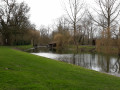
Starting from the Champ de Foire car park, near the Salle Polyvalente, you’ll climb up to the heights of Benet before reaching Port d’Aziré via a small road offering panoramic views over the cereal fields, then return via the Plaine de Pierre Plate and the hamlet of Villeneuve.
Les Peux and the Chemin du Lisier
 3.48 mi
+115 ft
-115 ft
1h 40
Easy
Departure from Benet (Vendée)
3.48 mi
+115 ft
-115 ft
1h 40
Easy
Departure from Benet (Vendée)
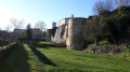
From the ruins of the old fortified castle, passing by the Church of Sainte-Eulalie (a listed historic monument), follow the Peux, a network of small footpaths with evocative names: Peu des Demoiselles, Peu des Ânesses, Peu de chez Gognar, Peu de Gâte-Bourse… you will discover the village of Benet, which stretches across two hills crossed by Rue de la Combe, beneath which flows the Vrizon.
On the edge of the Gâtine region in Coulonges-sur-l'Aurize
7.25 mi
+207 ft
-226 ft
3h 30
Moderate
Departure from Coulonges-sur-l'Autize (Deux-Sèvres)
South-west of the Gâtine Parthenaise, starting from Coulonges-sur-l'Autize, this hike takes you from the plains of southern Vendée to the more hilly Gâtine Parthenaise, from farmland to bocage.
Architectural heritage in Coulonges-sur-l’Autize
 6.76 mi
+144 ft
-154 ft
3h 15
Moderate
Departure from Coulonges-sur-l'Autize (Deux-Sèvres)
6.76 mi
+144 ft
-154 ft
3h 15
Moderate
Departure from Coulonges-sur-l'Autize (Deux-Sèvres)
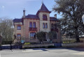
During this walk, you’ll discover the Renaissance castle of Coulonges and its grounds. You’ll pass the old railway station (now privately owned). After a stroll through the countryside, you’ll come across the Logis de Magné and the wash house, as well as the chimney of the old lime kiln. Return to the village of Coulonges via the church, a former washhouse (Rue de l’Épargne), a small square built on the site of a former restaurant, and then the town’s covered market.
Le Gué Verdon
 6.95 mi
+240 ft
-230 ft
3h 25
Moderate
Departure from Saint-Michel-le-Cloucq (Vendée)
6.95 mi
+240 ft
-230 ft
3h 25
Moderate
Departure from Saint-Michel-le-Cloucq (Vendée)
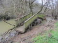
At the start, quiet country lanes with panoramic views of Fontenay-le-Comte and the surrounding countryside; then, after passing through the village of Meilleraie, shaded paths and tracks running alongside the Vendée river not far from the Albert dam, before climbing up to Saint-Michel-le-Cloucq.
Jean dôs Bois Trail
 7.45 mi
+535 ft
-554 ft
3h 55
Moderate
Departure from Saint-Michel-le-Cloucq (Vendée)
7.45 mi
+535 ft
-554 ft
3h 55
Moderate
Departure from Saint-Michel-le-Cloucq (Vendée)
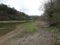
Starting from Saint-Michel-le-Cloucq, 5 km north of Fontenay-le-Comte, you will first walk along shaded paths around the Vendée and its tributary, the Ruisseau de la Cornelière. (difficult section, uneven path) then, passing by the Fontaine à l'Ermite, you will cross part of the Mervent forest and reach Saint-Michel via quiet paths and small roads, with beautiful panoramic views.
The Marais du Mazeau and the banks of the Sèvre
 5.56 mi
+23 ft
-23 ft
2h 35
Easy
Departure from Le Mazeau (Vendée)
5.56 mi
+23 ft
-23 ft
2h 35
Easy
Departure from Le Mazeau (Vendée)
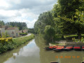
Circular route along footpaths and small tarmac roads through the Marais du Mazeau and along the Sèvre Niortaise.
Urban circular in Fontenay le Comte
 6.93 mi
+112 ft
-131 ft
3h 15
Moderate
Departure from Fontenay-le-Comte (Vendée)
6.93 mi
+112 ft
-131 ft
3h 15
Moderate
Departure from Fontenay-le-Comte (Vendée)
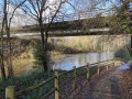
A superb hike that allows you to discover some of the town centre's attractions and trails, mostly along the Vendée, before returning along a small stream and then an old railway line. There is little elevation gain, making it a very easy route.
Chemin des lavoirs in Coulonges-sur-l'Autize
9.58 mi
+200 ft
-200 ft
4h 35
Moderate
Departure from Coulonges-sur-l'Autize (Deux-Sèvres)
This route will take you past six wash houses located in the towns of Coulonges-sur-l'Autize and Ardin. You will also discover an old kiln, a marble quarry and the large chimney (a remnant of the lime kilns) in Coulonges-sur-l'Autize.
From the Balingue water tower to the Mervent Dam
 8.21 mi
+807 ft
-830 ft
4h 30
Moderate
Departure from L'Orbrie (Vendée)
8.21 mi
+807 ft
-830 ft
4h 30
Moderate
Departure from L'Orbrie (Vendée)
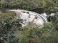
A walk connecting the Balingue water tower to the Mervent Dam. Most of this route runs through woodland on well-marked paths, but also includes trails not necessarily shown on maps. The first few kilometres are on very easy terrain, followed by steeper sections through the woodland. Perfect for walkers who enjoy off-the-beaten-track routes.
The wild marshes of Le Mazeau
5.36 mi
+7 ft
-7 ft
2h 30
Easy
Departure from Le Mazeau (Vendée)
A walk in the wild marshes of Le Mazeau, criss-crossed by a multitude of canals and ditches. Here, summer and winter alike, the light is always beautiful through the poplar plantations!
From Orbrie along the Vendée
 6.96 mi
+577 ft
-597 ft
3h 40
Moderate
Departure from L'Orbrie (Vendée)
6.96 mi
+577 ft
-597 ft
3h 40
Moderate
Departure from L'Orbrie (Vendée)
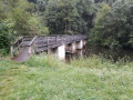
A lovely circular walk along the River Vendée and through the Mervent Forest. This circular walk will take you to the Mervent Dam, following part of the Mélusine GRP®.
The Mervent Dam
 6.78 mi
+486 ft
-476 ft
3h 30
Moderate
Departure from L'Orbrie (Vendée)
6.78 mi
+486 ft
-476 ft
3h 30
Moderate
Departure from L'Orbrie (Vendée)
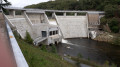
Circular route through the forest, passing through rolling meadows, then along the Vendée to the dam and the lake shore, on paths and trails that are sometimes a little steep but pleasant in all seasons.
Le Jaulard and La Fontaine à l'Ermite in the Mervent Forest
5.89 mi
+459 ft
-453 ft
3h 05
Moderate
Departure from L'Orbrie (Vendée)
A circular route that takes you off the beaten track in the heart of the Mervent State Forest, suitable for all seasons. Shortcuts are possible. The GPX track can be very useful.
The Hermit's Fountain Trail
 3.67 mi
+184 ft
-180 ft
1h 50
3.67 mi
+184 ft
-180 ft
1h 50
 Difficult
Departure from L'Orbrie (Vendée)
Difficult
Departure from L'Orbrie (Vendée)
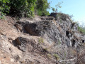
Starting from the Fontaine-à-l’Ermite roundabout, the path leads to the lakeshore and then follows the course of the Vendée river along the left bank as far as the Perrure bridge, before climbing up to the Allée de la Fontaine à l’Ermite, which will take you back to the starting point.Please note: this is a rugged trail involving rock climbing along the entire stretch of the Vendée.
Around Pissotte
 6.83 mi
+413 ft
-410 ft
3h 30
Moderate
Departure from Pissotte (Vendée)
6.83 mi
+413 ft
-410 ft
3h 30
Moderate
Departure from Pissotte (Vendée)
A relatively easy hike with an initial open section along the Vendée towards Fontenay-le-Comte, then back along an old disused railway line. The second section begins with a crossing of vineyards, then immediately enters the forest with paths and trails.
The Père de Montfort Cave in the Mervent Forest
 6.25 mi
+554 ft
-558 ft
3h 20
Moderate
Departure from Pissotte (Vendée)
6.25 mi
+554 ft
-558 ft
3h 20
Moderate
Departure from Pissotte (Vendée)
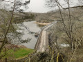
From the Saint-Luc roundabout, you will walk along long forest paths to a trail overlooking the Vergnes stream and leading to the Pierre Brune dam. You will then climb stone steps to the Grotte du Père de Montfort and finish the ascent via a wooden staircase. You will then walk along the Mère to the Diet Bridge and join theGR® de Pays de Mélusine, which will take you back to your starting point.
In the Mervent forest along the Vendée
 9.89 mi
+643 ft
-617 ft
5h 05
Moderate
Departure from Pissotte (Vendée)
9.89 mi
+643 ft
-617 ft
5h 05
Moderate
Departure from Pissotte (Vendée)
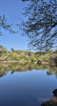
After exploring the Mervent National Forest, a lesser-known but slightly wilder route along the Mervent dam reservoir. Let's set off to explore the banks of the Vendée, passing by the Fontaine à l'Ermite, the Balingue and the Sauvaget site. Quite a programme.
Discovering the Mervent State Forest
 10.23 mi
+883 ft
-883 ft
5h 30
Moderate
Departure from Pissotte (Vendée)
10.23 mi
+883 ft
-883 ft
5h 30
Moderate
Departure from Pissotte (Vendée)
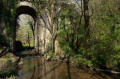
A superb hike through the largest forest in the Vendée. The terrain is varied but not particularly difficult, making it a hiker's paradise. Beautiful paths, a dam lake, a climbing site, a leisure park, a hidden cave, remarkable bridges and trees, and a forest that has been explored for many years: this is what I invite you to discover.